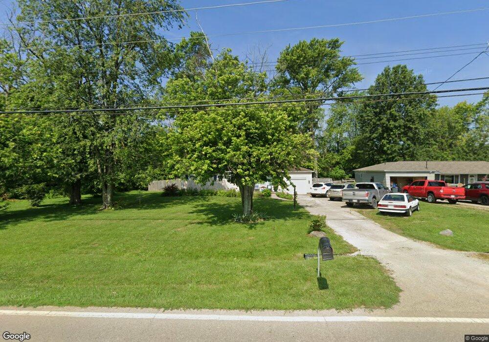
9463 McCauly Rd Cincinnati, OH 45241
West Chester Township NeighborhoodEstimated Value: $267,000 - $322,000
3
Beds
2
Baths
1,440
Sq Ft
$201/Sq Ft
Est. Value
About This Home
This home is located at 9463 McCauly Rd, Cincinnati, OH 45241 and is currently estimated at $289,250, approximately $200 per square foot. 9463 McCauly Rd is a home located in Butler County with nearby schools including Adena Elementary School, Lakota Ridge Junior School, and Lakota West High School.
Ownership History
Date
Name
Owned For
Owner Type
Purchase Details
Closed on
Oct 22, 2004
Sold by
Hayes Michelle R and Brunner Michelle
Bought by
Hayes Phillip J and Hayes Michelle R
Current Estimated Value
Home Financials for this Owner
Home Financials are based on the most recent Mortgage that was taken out on this home.
Original Mortgage
$95,650
Outstanding Balance
$44,723
Interest Rate
5.25%
Mortgage Type
Stand Alone Refi Refinance Of Original Loan
Estimated Equity
$244,527
Purchase Details
Closed on
May 30, 2003
Sold by
Mccollum Stephen W and Mccollum Teresa M
Bought by
Brunner Michelle
Home Financials for this Owner
Home Financials are based on the most recent Mortgage that was taken out on this home.
Original Mortgage
$114,601
Interest Rate
5.9%
Mortgage Type
FHA
Purchase Details
Closed on
Aug 1, 1990
Create a Home Valuation Report for This Property
The Home Valuation Report is an in-depth analysis detailing your home's value as well as a comparison with similar homes in the area
Home Values in the Area
Average Home Value in this Area
Purchase History
| Date | Buyer | Sale Price | Title Company |
|---|---|---|---|
| Hayes Phillip J | -- | -- | |
| Brunner Michelle | $116,400 | -- | |
| -- | $68,900 | -- |
Source: Public Records
Mortgage History
| Date | Status | Borrower | Loan Amount |
|---|---|---|---|
| Open | Hayes Phillip J | $95,650 | |
| Closed | Brunner Michelle | $114,601 | |
| Closed | Hayes Phillip J | $28,800 |
Source: Public Records
Tax History
| Year | Tax Paid | Tax Assessment Tax Assessment Total Assessment is a certain percentage of the fair market value that is determined by local assessors to be the total taxable value of land and additions on the property. | Land | Improvement |
|---|---|---|---|---|
| 2025 | $2,729 | $65,980 | $18,460 | $47,520 |
| 2024 | $2,729 | $65,980 | $18,460 | $47,520 |
| 2023 | $2,710 | $69,850 | $18,460 | $51,390 |
| 2022 | $2,676 | $48,750 | $18,460 | $30,290 |
| 2021 | $2,501 | $47,310 | $18,460 | $28,850 |
| 2020 | $2,561 | $47,310 | $18,460 | $28,850 |
| 2019 | $4,177 | $43,590 | $17,870 | $25,720 |
| 2018 | $2,474 | $43,590 | $17,870 | $25,720 |
| 2017 | $2,518 | $43,590 | $17,870 | $25,720 |
| 2016 | $2,573 | $41,950 | $17,870 | $24,080 |
| 2015 | $2,564 | $41,950 | $17,870 | $24,080 |
| 2014 | $2,133 | $41,950 | $17,870 | $24,080 |
| 2013 | $2,133 | $33,810 | $11,660 | $22,150 |
Source: Public Records
Map
Nearby Homes
- 8141 Stone Dr
- 9621 Iris Dr
- 7960 Ruth Ct
- 9286 Westchester Park Ct
- 8830 Butler Warren Rd
- 8820 Butler Warren Rd
- 6978 Fallen Oaks Dr
- 9509 Butler Warren Rd
- 7953 Quebec Ct
- 8606 Charleston Valley Dr
- 7815 Bennington Dr
- 8588 Charleston Creek Dr
- Winslow Plan at Losh Landing - Masterpiece Collection
- Paxton Plan at Losh Landing - Masterpiece Collection
- Huxley Plan at Losh Landing - Masterpiece Collection
- Pearson Plan at Losh Landing - Masterpiece Collection
- Beckett Plan at Losh Landing - Masterpiece Collection
- Leland Plan at Losh Landing - Masterpiece Collection
- Clay Plan at Losh Landing - Masterpiece Collection
- Mitchell Plan at Losh Landing - Masterpiece Collection
- 9447 McCauly Rd
- 9481 McCauly Rd
- 9435 McCauly Rd
- 9462 Ambleside Dr
- 9452 Ambleside Dr
- 9476 Ambleside Dr
- 9491 McCauly Rd
- 9442 Ambleside Dr
- 9490 Ambleside Dr
- 9432 Ambleside Dr
- 8149 Stone Dr
- 9463 Ambleside Dr
- 9500 Ambleside Dr
- 9416 Ambleside Dr
- 9511 McCauly Rd
- 9409 McCauly Rd
- 8018 Woody Hollow Dr
- 9451 Ambleside Dr
- 9506 McCauly Rd
- 9510 Ambleside Dr
Your Personal Tour Guide
Ask me questions while you tour the home.