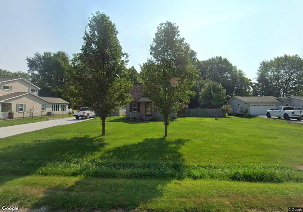
9465 Holland Rd Taylor, MI 48180
Estimated Value: $130,619 - $264,000
2
Beds
1
Bath
1,146
Sq Ft
$157/Sq Ft
Est. Value
About This Home
This home is located at 9465 Holland Rd, Taylor, MI 48180 and is currently estimated at $179,905, approximately $156 per square foot. 9465 Holland Rd is a home located in Wayne County with nearby schools including Holland Elementary School, Hoover Middle School, and Taylor High School.
Ownership History
Date
Name
Owned For
Owner Type
Purchase Details
Closed on
Dec 16, 2013
Sold by
Styles Janelle L
Bought by
Styles Janelle L
Current Estimated Value
Purchase Details
Closed on
Feb 17, 2009
Sold by
Keys Daryl L and Miller Keys Colleen
Bought by
Styles Janelle L
Purchase Details
Closed on
Jul 29, 1994
Sold by
Mark D Prior
Bought by
Mark Prior
Home Financials for this Owner
Home Financials are based on the most recent Mortgage that was taken out on this home.
Original Mortgage
$59,407
Interest Rate
8.53%
Mortgage Type
FHA
Create a Home Valuation Report for This Property
The Home Valuation Report is an in-depth analysis detailing your home's value as well as a comparison with similar homes in the area
Home Values in the Area
Average Home Value in this Area
Purchase History
| Date | Buyer | Sale Price | Title Company |
|---|---|---|---|
| Styles Janelle L | -- | Progressive Title | |
| Styles Janelle L | $58,300 | Fidelity National Title | |
| Mark Prior | $59,900 | -- |
Source: Public Records
Mortgage History
| Date | Status | Borrower | Loan Amount |
|---|---|---|---|
| Previous Owner | Mark Prior | $59,407 |
Source: Public Records
Tax History
| Year | Tax Paid | Tax Assessment Tax Assessment Total Assessment is a certain percentage of the fair market value that is determined by local assessors to be the total taxable value of land and additions on the property. | Land | Improvement |
|---|---|---|---|---|
| 2025 | $1,302 | $54,200 | $0 | $0 |
| 2024 | $1,261 | $48,100 | $0 | $0 |
| 2023 | $1,500 | $38,200 | $0 | $0 |
| 2022 | $1,203 | $33,300 | $0 | $0 |
| 2021 | $1,318 | $31,900 | $0 | $0 |
| 2020 | $1,308 | $31,600 | $0 | $0 |
| 2019 | $130,626 | $24,700 | $0 | $0 |
| 2018 | $1,262 | $31,200 | $0 | $0 |
| 2017 | $659 | $29,200 | $0 | $0 |
| 2016 | $1,546 | $28,500 | $0 | $0 |
| 2015 | $2,875 | $30,700 | $0 | $0 |
| 2013 | $2,860 | $29,400 | $0 | $0 |
| 2012 | $1,271 | $30,200 | $14,000 | $16,200 |
Source: Public Records
Map
Nearby Homes
- 9717 Rose St
- 9267 Glenis St
- 9509 Sylvia St
- 26336 Kinyon St
- 26170 Wick Rd
- 8853 Beech Daly Rd
- 25790 Madden St
- 25315 Baker St
- 10352 Gulley St
- 25556 Rusty St
- 0 Goddard Unit 20251010304
- 25615 Wohlfeil St
- 8350 Gulley St
- 11098 Partridge Dr Unit 12
- 11098 Partridge Dr
- 26376 Partridge Dr Unit 89
- 26400 Partridge Dr Unit 88
- 26031 Gary St Unit RV100
- 26110 Gary St Unit RV076
- 11516 Pheasant Cir
Your Personal Tour Guide
Ask me questions while you tour the home.