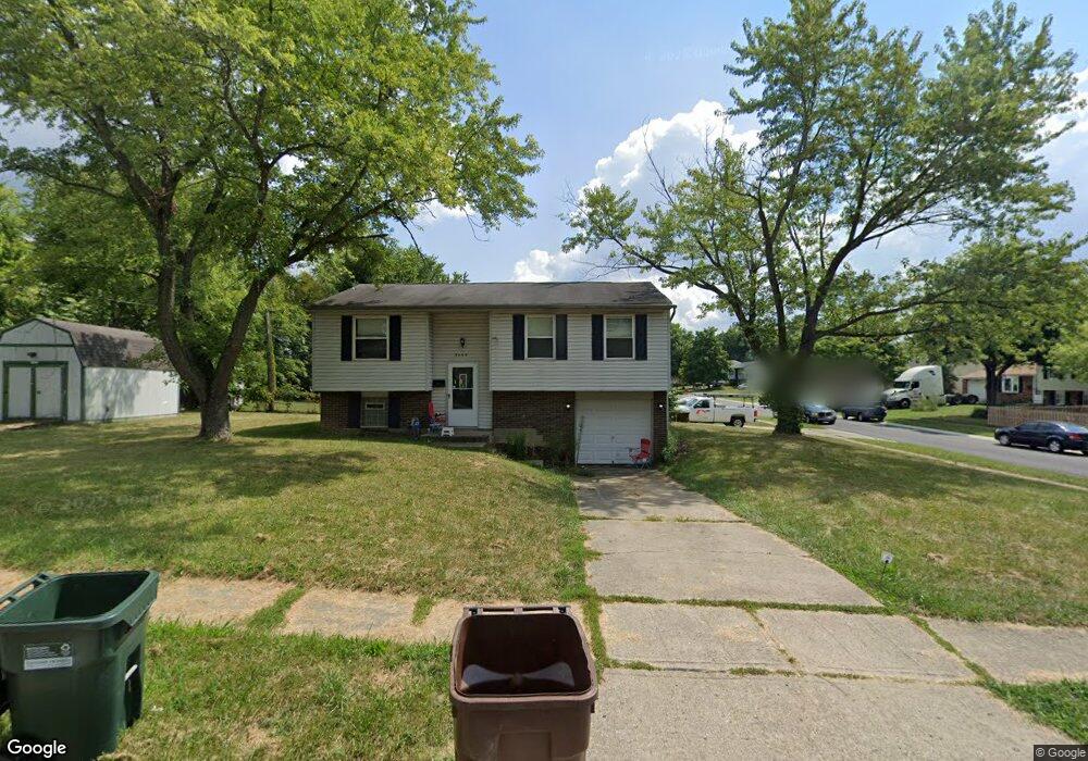
9466 Loralinda Dr Cincinnati, OH 45251
Estimated Value: $171,000 - $222,000
3
Beds
1
Bath
1,500
Sq Ft
$133/Sq Ft
Est. Value
About This Home
This home is located at 9466 Loralinda Dr, Cincinnati, OH 45251 and is currently estimated at $198,993, approximately $132 per square foot. 9466 Loralinda Dr is a home located in Hamilton County with nearby schools including Taylor Elementary School, Colerain Elementary School, and Colerain Middle School.
Ownership History
Date
Name
Owned For
Owner Type
Purchase Details
Closed on
Feb 16, 2021
Sold by
Square One Properties Llc
Bought by
Vb One Llc
Current Estimated Value
Purchase Details
Closed on
Aug 27, 2014
Sold by
Aldoud Jrouh and Aldoud Abeer
Bought by
Salem Mariam and Salem Fahed
Purchase Details
Closed on
Jan 30, 2012
Sold by
Salem Mariam N
Bought by
Aldoud Jrouh
Purchase Details
Closed on
Sep 17, 2010
Sold by
Citimortgage Inc
Bought by
Salem Mariam N
Purchase Details
Closed on
May 28, 2010
Sold by
Sanders Wade
Bought by
Citimortgage Inc
Purchase Details
Closed on
Aug 29, 1994
Sold by
Sanders Lucinda
Bought by
Sanders Wade
Create a Home Valuation Report for This Property
The Home Valuation Report is an in-depth analysis detailing your home's value as well as a comparison with similar homes in the area
Home Values in the Area
Average Home Value in this Area
Purchase History
| Date | Buyer | Sale Price | Title Company |
|---|---|---|---|
| Vb One Llc | $109,700 | None Available | |
| Square One Properties Llc | $97,000 | None Available | |
| Salem Mariam | -- | Prodigy Title Agency | |
| Aldoud Jrouh | -- | Attorney | |
| Salem Mariam N | $34,500 | Resource Title Agency Inc | |
| Citimortgage Inc | $54,000 | Attorney | |
| Sanders Wade | -- | -- |
Source: Public Records
Tax History Compared to Growth
Tax History
| Year | Tax Paid | Tax Assessment Tax Assessment Total Assessment is a certain percentage of the fair market value that is determined by local assessors to be the total taxable value of land and additions on the property. | Land | Improvement |
|---|---|---|---|---|
| 2024 | $3,049 | $54,331 | $10,206 | $44,125 |
| 2023 | $3,014 | $54,331 | $10,206 | $44,125 |
| 2022 | $2,447 | $36,057 | $9,002 | $27,055 |
| 2021 | $2,470 | $36,057 | $9,002 | $27,055 |
| 2020 | $2,441 | $36,057 | $9,002 | $27,055 |
| 2019 | $2,121 | $29,078 | $7,259 | $21,819 |
| 2018 | $1,908 | $29,078 | $7,259 | $21,819 |
| 2017 | $1,833 | $29,078 | $7,259 | $21,819 |
| 2016 | $746 | $11,474 | $7,326 | $4,148 |
| 2015 | $742 | $11,474 | $7,326 | $4,148 |
| 2014 | $745 | $11,474 | $7,326 | $4,148 |
| 2013 | $746 | $12,076 | $7,711 | $4,365 |
Source: Public Records
Map
Nearby Homes
- 9433 Willowgate Dr Unit 9433
- 3151 Birchway Dr Unit 3151
- 9302 Loralinda Dr
- 3258 Lillwood Ln
- 9717 Loralinda Dr
- 9446 Haddington Ct
- 3205 Donnybrook Ln
- 3246 Ainsworth Dr
- 2908 Libra Ln
- 9562 Trafalgar Ct
- 9558 Woodstate Dr Unit 13E
- 3275 Deshler Dr
- 3364 Amberway Ct Unit 45
- 9568 Woodstate Dr
- 3276 Deshler Dr
- 3464 Sunbury Ln
- 9738 Gibralter Dr
- 9828 Loralinda Dr
- 3351 Deshler Dr
- 3374 Deshler Dr
- 3182 Glenaire Dr
- 9490 Loralinda Dr
- 3168 Glenaire Dr
- 3187 Hyannis Dr
- 9461 Loralinda Dr
- 9471 Loralinda Dr
- 9438 Loralinda Dr
- 3175 Hyannis Dr
- 9449 Loralinda Dr
- 9483 Loralinda Dr
- 3156 Glenaire Dr
- 3173 Glenaire Dr
- 9439 Loralinda Dr
- 9491 Loralinda Dr
- 3163 Hyannis Dr
- 3161 Glenaire Dr
- 9420 Loralinda Dr
- 3142 Glenaire Dr
- 9427 Loralinda Dr
- 9501 Loralinda Dr