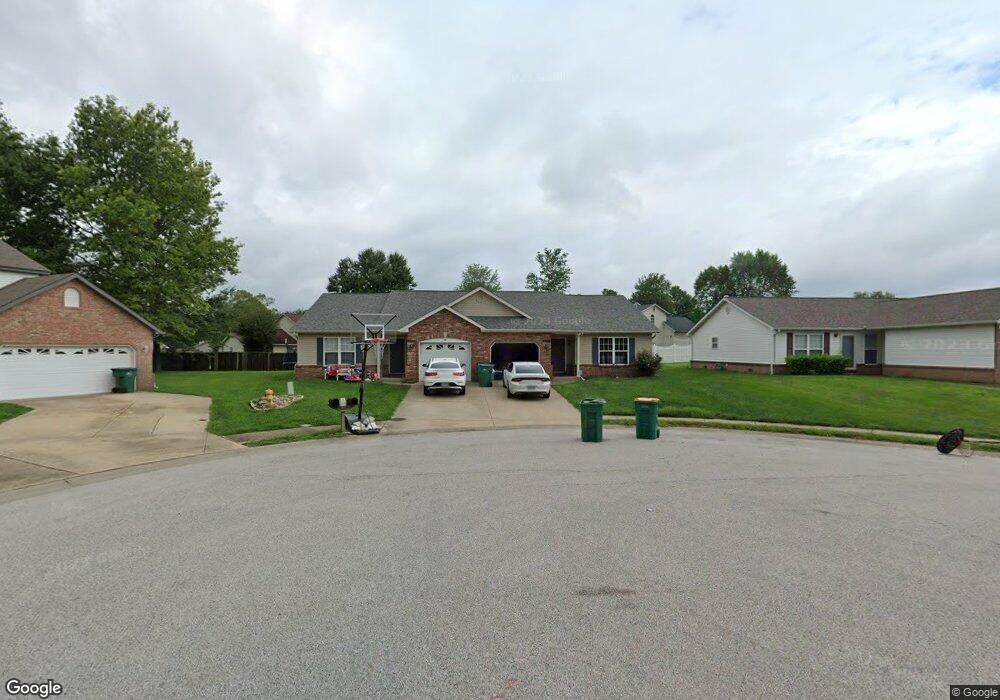
947 Evan Dr O Fallon, IL 62269
Estimated Value: $240,716 - $412,000
Studio
--
Bath
2,290
Sq Ft
$140/Sq Ft
Est. Value
About This Home
This home is located at 947 Evan Dr, O Fallon, IL 62269 and is currently estimated at $319,929, approximately $139 per square foot. 947 Evan Dr is a home located in St. Clair County with nearby schools including Evans Elementary School, Carriel Junior High School, and O'Fallon Township High School.
Ownership History
Date
Name
Owned For
Owner Type
Purchase Details
Closed on
Oct 24, 2024
Sold by
Haskenhoff Randall P and Haskenhoff Randy
Bought by
North Brook Holdings Llc
Current Estimated Value
Purchase Details
Closed on
Dec 20, 2019
Sold by
Haskenhoff Randall P and Jones Suzanne Marie
Bought by
Haskenhoff Randall Paul
Purchase Details
Closed on
Oct 23, 2015
Sold by
Mcfdden Donald Ray and Mcfadden Larry
Bought by
Haskenhoff Randall P and Jones Haskenhoff Suzanne Marie
Purchase Details
Closed on
Dec 12, 2013
Sold by
Frazier Dana
Bought by
Mcfadden Donald Ray
Create a Home Valuation Report for This Property
The Home Valuation Report is an in-depth analysis detailing your home's value as well as a comparison with similar homes in the area
Home Values in the Area
Average Home Value in this Area
Purchase History
| Date | Buyer | Sale Price | Title Company |
|---|---|---|---|
| North Brook Holdings Llc | -- | None Available | |
| Haskenhoff Randall Paul | -- | Attorney | |
| Haskenhoff Randall P | $150,000 | Fatic | |
| Mcfadden Donald Ray | $19,500 | None Available |
Source: Public Records
Tax History
| Year | Tax Paid | Tax Assessment Tax Assessment Total Assessment is a certain percentage of the fair market value that is determined by local assessors to be the total taxable value of land and additions on the property. | Land | Improvement |
|---|---|---|---|---|
| 2024 | $5,309 | $72,670 | $11,744 | $60,926 |
| 2023 | $4,898 | $64,498 | $10,423 | $54,075 |
| 2022 | $4,633 | $59,298 | $9,583 | $49,715 |
| 2021 | $4,535 | $56,978 | $9,614 | $47,364 |
| 2020 | $4,504 | $53,934 | $9,100 | $44,834 |
| 2019 | $4,407 | $53,934 | $9,100 | $44,834 |
| 2018 | $4,295 | $52,368 | $8,836 | $43,532 |
| 2017 | $3,960 | $46,549 | $6,825 | $39,724 |
| 2016 | $3,948 | $45,463 | $6,666 | $38,797 |
| 2014 | $3,657 | $44,937 | $6,589 | $38,348 |
| 2013 | $3,437 | $52,855 | $10,160 | $42,695 |
Source: Public Records
Map
Nearby Homes
- 926 - 932 Georgetowne Dr
- 411 Donna Dr
- 519 Joy Dr
- 764 Granite Dr
- 756 Erika St Unit 49
- 747 Michael St Unit 66
- 317 Aladar Dr
- 309 Griffin Gate
- 321 Amy Dr
- 521 Jeffrey Pine Ct
- 218 Evergreen Dr
- 314 Joy Dr
- 903 Dale Ave
- 421 W Highway 50
- 716 W Highway 50
- 415 Ponderosa Ave Unit 6
- 507 W 4th St
- 121 S Lawn Ave
- 405 Ponderosa Ave Unit 4
- 119 Douglas St
Your Personal Tour Guide
Ask me questions while you tour the home.