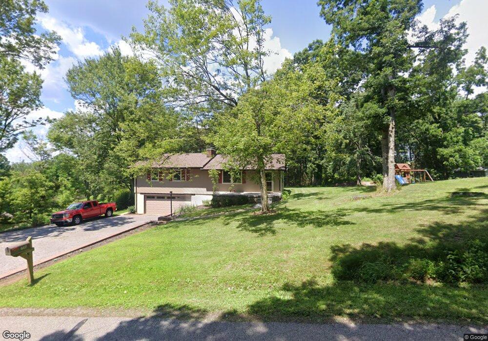
947 Martin Rd Tarentum, PA 15084
Fawn Township NeighborhoodEstimated Value: $194,000 - $322,000
3
Beds
2
Baths
1,546
Sq Ft
$153/Sq Ft
Est. Value
About This Home
This home is located at 947 Martin Rd, Tarentum, PA 15084 and is currently estimated at $236,540, approximately $153 per square foot. 947 Martin Rd is a home located in Allegheny County with nearby schools including Highlands Senior High School and Harvest Baptist Academy.
Ownership History
Date
Name
Owned For
Owner Type
Purchase Details
Closed on
Oct 16, 2012
Sold by
Woodcock Trste Ray Edwin
Bought by
Powell Gary M
Current Estimated Value
Purchase Details
Closed on
Aug 13, 2002
Sold by
Beresik Joseph Paul and Beresik Bonnie L
Bought by
Powell Gary M and Powell Susan F
Create a Home Valuation Report for This Property
The Home Valuation Report is an in-depth analysis detailing your home's value as well as a comparison with similar homes in the area
Home Values in the Area
Average Home Value in this Area
Purchase History
| Date | Buyer | Sale Price | Title Company |
|---|---|---|---|
| Powell Gary M | $6,000 | -- | |
| Powell Gary M | $125,000 | -- |
Source: Public Records
Tax History Compared to Growth
Tax History
| Year | Tax Paid | Tax Assessment Tax Assessment Total Assessment is a certain percentage of the fair market value that is determined by local assessors to be the total taxable value of land and additions on the property. | Land | Improvement |
|---|---|---|---|---|
| 2025 | $2,566 | $78,000 | $32,400 | $45,600 |
| 2024 | $2,566 | $78,000 | $32,400 | $45,600 |
| 2023 | $2,566 | $78,000 | $32,400 | $45,600 |
| 2022 | $2,547 | $78,000 | $32,400 | $45,600 |
| 2021 | $369 | $78,000 | $32,400 | $45,600 |
| 2020 | $2,547 | $78,000 | $32,400 | $45,600 |
| 2019 | $2,527 | $78,000 | $32,400 | $45,600 |
| 2018 | $369 | $78,000 | $32,400 | $45,600 |
| 2017 | $2,462 | $78,000 | $32,400 | $45,600 |
| 2016 | $369 | $78,000 | $32,400 | $45,600 |
| 2015 | $369 | $78,000 | $32,400 | $45,600 |
| 2014 | $2,462 | $78,000 | $32,400 | $45,600 |
Source: Public Records
Map
Nearby Homes
- 312 Clarice Ln
- 1194 Donnellville Rd
- 109 New Orchard Dr
- 1204 Sun Mine Rd
- 0 Bakerstown Rd
- 104 Ekastown Rd
- 306 Furer Dr
- 3052 Donnellville Rd
- 0 Hidden Hill Rd
- 105 Snyder Ln
- 605 Fleming Rd
- Lot Burtner Rd
- 130 Hidden Hill Rd
- 10 Skyline Dr
- 27 Skyline Dr
- 331 Sarver Rd
- 565 Benjamin St
- 0 Snyder St
- Lot 2R Parker Rd
- 111 Helin Dr
- 1003 Martin Rd
- 827 Martin Rd
- 1061 Martin Rd
- 932 Martin Rd
- 1115 Martin Rd
- 1138 Martin Rd
- 633 Martin Rd
- 686 Martin Rd
- 1222 Martin Rd
- 1292 Martin Rd
- 1361 Martin Rd
- 7200 State Route 908
- 980 Martin Rd
- 433 Martin Rd
- 1419 Martin Rd
- 7046 State Route 908
- 1384 Martin Rd
- 475 Martin Rd
- 7004 State Route 908
- 1487 Martin Rd