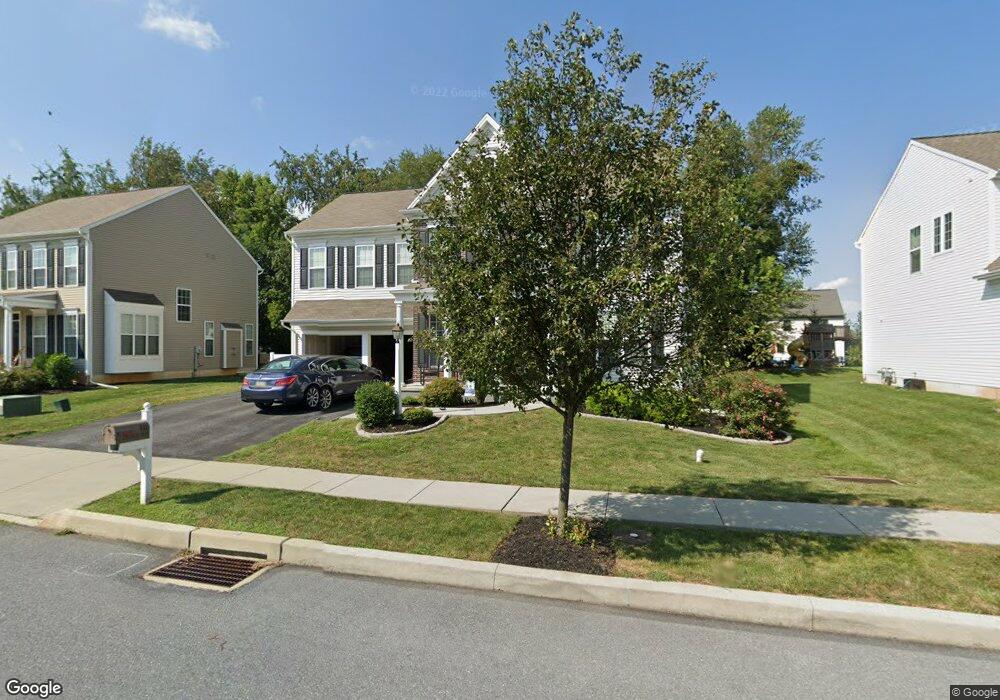
947 Powder Horn Dr Hummelstown, PA 17036
Estimated Value: $556,803 - $676,000
4
Beds
3
Baths
2,736
Sq Ft
$228/Sq Ft
Est. Value
About This Home
This home is located at 947 Powder Horn Dr, Hummelstown, PA 17036 and is currently estimated at $622,601, approximately $227 per square foot. 947 Powder Horn Dr is a home located in Dauphin County with nearby schools including Hershey Elementary School, Hershey Primary Elementary School, and Hershey Middle School.
Ownership History
Date
Name
Owned For
Owner Type
Purchase Details
Closed on
May 22, 2014
Sold by
Charter Homes At Hershey Inc
Bought by
Pogue Jon
Current Estimated Value
Home Financials for this Owner
Home Financials are based on the most recent Mortgage that was taken out on this home.
Original Mortgage
$224,240
Outstanding Balance
$170,897
Interest Rate
4.33%
Mortgage Type
New Conventional
Estimated Equity
$451,704
Create a Home Valuation Report for This Property
The Home Valuation Report is an in-depth analysis detailing your home's value as well as a comparison with similar homes in the area
Home Values in the Area
Average Home Value in this Area
Purchase History
| Date | Buyer | Sale Price | Title Company |
|---|---|---|---|
| Pogue Jon | $424,240 | -- |
Source: Public Records
Mortgage History
| Date | Status | Borrower | Loan Amount |
|---|---|---|---|
| Open | Pogue Jon | $224,240 |
Source: Public Records
Tax History Compared to Growth
Tax History
| Year | Tax Paid | Tax Assessment Tax Assessment Total Assessment is a certain percentage of the fair market value that is determined by local assessors to be the total taxable value of land and additions on the property. | Land | Improvement |
|---|---|---|---|---|
| 2025 | $9,366 | $299,700 | $38,300 | $261,400 |
| 2024 | $8,803 | $299,700 | $38,300 | $261,400 |
| 2023 | $8,646 | $299,700 | $38,300 | $261,400 |
| 2022 | $8,455 | $299,700 | $38,300 | $261,400 |
| 2021 | $8,455 | $299,700 | $38,300 | $261,400 |
| 2020 | $8,455 | $299,700 | $38,300 | $261,400 |
| 2019 | $8,302 | $299,700 | $38,300 | $261,400 |
| 2018 | $8,082 | $299,700 | $38,300 | $261,400 |
| 2017 | $8,082 | $299,700 | $38,300 | $261,400 |
| 2016 | $0 | $295,400 | $38,300 | $257,100 |
| 2015 | -- | $295,400 | $38,300 | $257,100 |
Source: Public Records
Map
Nearby Homes
- 2042 Locust Ln
- 1168 Cord Dr
- 2017B Raleigh Rd
- 2039H Raleigh Rd
- 1959 Deer Run Dr
- 1919 Limestone Dr
- 994 Clifton Heights Rd
- 497 Middletown Rd
- 285 Dogwood Dr
- 177 Middletown Rd
- 0 W Kaylor Rd
- 265 Redwood St
- 791 Gregs Dr
- 721 S 82nd St Unit L111
- 715 Gregs Dr
- 1301 Newberry Rd
- 1155 Greenwood Dr
- 1565 Brookline Dr
- 8553 Adams Ct
- 610 Carrington Ct
- 953 Powder Horn Dr
- 942 Powder Horn Dr
- 948 Powder Horn Dr
- 937 Powder Horn Dr
- 959 Powder Horn Dr
- 970 Muirfield Dr
- 960 Muirfield Dr
- 954 Powder Horn Dr
- 930 Powder Horn Dr
- 980 Muirfield Dr
- 963 Powder Horn Dr
- 929 Powder Horn Dr
- 2370 Raleigh Rd
- 960 Powder Horn Dr
- 948 Muirfield Dr
- 2223 Flintlock Dr
- 2219 Flintlock Dr
- 964 Powder Horn Dr
- 2229 Flintlock Dr
- 969 Powder Horn Dr