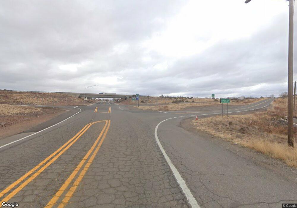
9470 W Old Highway 66 Ash Fork, AZ 86320
Estimated Value: $272,540 - $394,000
--
Bed
--
Bath
1,593
Sq Ft
$211/Sq Ft
Est. Value
About This Home
This home is located at 9470 W Old Highway 66, Ash Fork, AZ 86320 and is currently estimated at $336,180, approximately $211 per square foot. 9470 W Old Highway 66 is a home with nearby schools including Ash Fork Elementary School, Ash Fork Middle School, and Ash Fork High School.
Ownership History
Date
Name
Owned For
Owner Type
Purchase Details
Closed on
Feb 1, 2001
Sold by
Orr Michael Hayes
Bought by
Sala Maryan
Current Estimated Value
Purchase Details
Closed on
May 25, 1999
Sold by
Orr Maryan Sala
Bought by
Orr Michael Hayes
Purchase Details
Closed on
Nov 19, 1996
Sold by
Burns David J and Burns Valerie K
Bought by
Orr Michael Hayes and Orr Maryan Sala
Home Financials for this Owner
Home Financials are based on the most recent Mortgage that was taken out on this home.
Original Mortgage
$13,000
Interest Rate
7.86%
Mortgage Type
Seller Take Back
Create a Home Valuation Report for This Property
The Home Valuation Report is an in-depth analysis detailing your home's value as well as a comparison with similar homes in the area
Home Values in the Area
Average Home Value in this Area
Purchase History
| Date | Buyer | Sale Price | Title Company |
|---|---|---|---|
| Sala Maryan | -- | -- | |
| Orr Michael Hayes | -- | -- | |
| Orr Michael Hayes | $17,000 | Capital Title Agency |
Source: Public Records
Mortgage History
| Date | Status | Borrower | Loan Amount |
|---|---|---|---|
| Previous Owner | Orr Michael Hayes | $13,000 |
Source: Public Records
Tax History Compared to Growth
Tax History
| Year | Tax Paid | Tax Assessment Tax Assessment Total Assessment is a certain percentage of the fair market value that is determined by local assessors to be the total taxable value of land and additions on the property. | Land | Improvement |
|---|---|---|---|---|
| 2026 | $1,065 | $31,192 | -- | -- |
| 2024 | $947 | $30,268 | -- | -- |
| 2023 | $978 | $23,864 | $2,765 | $21,099 |
| 2022 | $947 | $19,885 | $2,097 | $17,788 |
| 2021 | $963 | $18,129 | $1,757 | $16,372 |
| 2020 | $932 | $0 | $0 | $0 |
| 2019 | $922 | $0 | $0 | $0 |
| 2018 | $882 | $0 | $0 | $0 |
| 2017 | $844 | $0 | $0 | $0 |
| 2016 | $778 | $0 | $0 | $0 |
| 2015 | -- | $0 | $0 | $0 |
| 2014 | -- | $0 | $0 | $0 |
Source: Public Records
Map
Nearby Homes
- 10111 W Old Highway 66 -- Unit 7
- 00 Crookton Rd Unit 71
- 00 Crookton Rd
- 11Cxx W Route 66 -- Unit 11
- 137/138 Dozer Ave
- 79e Falcon Flight Way
- 9188 W Gleed Station Rd
- 000 N Pineveta Rd
- 0 Dozer Unit 202460
- 0 Dozer Unit PAR1077142
- 0 Dozer Unit PAR1077141
- 0 Dozer Unit 202461
- 0 Dozer -- Unit 6933054
- 0 Dozer -- Unit 145
- 6800 Grand Vista Ranch Rd
- 16 Tuscan Rd
- 00 Triple H Ranch Rd
- Lot 102 N Raz Rd
- Lot 66 Juniperwood Ranch
- 11100 Rawhide Ranch Rd
- 94 Crookton Rd
- 9599 W Old Highway 66
- 228 Lowe Ranch Rd
- 206 Juniper Ranch
- 206 Crookton Rd Unit C
- 206 Crookton Rd
- Lot 12e Route 66
- Lot 12b Route 66
- 98xx W Old Highway 66 Unit 99
- 98xx W Old Highway 66
- 98xx W Old Highway 66 -- Unit 99
- Lot 99 Juniperwood Ranch Rd
- Lot 99 N Juniperwood Ranch -- Unit 99
- 212 Off of Route 66
- 139 Gleed Station Rd
- 9908 Gleed Station Rd Unit 187
- 00 Gleed Station Rd
- None Gleed Station Rd
- 0 Northland Dr Unit 132080
- 0 Northland Dr Unit 125012
