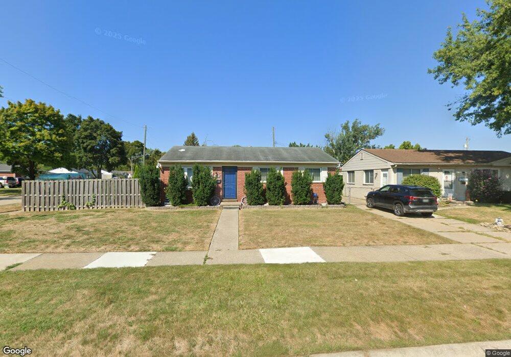
9476 Barry Dr Unit Bldg-Unit Romulus, MI 48174
Estimated Value: $193,000 - $216,000
3
Beds
2
Baths
1,128
Sq Ft
$177/Sq Ft
Est. Value
About This Home
This home is located at 9476 Barry Dr Unit Bldg-Unit, Romulus, MI 48174 and is currently estimated at $199,913, approximately $177 per square foot. 9476 Barry Dr Unit Bldg-Unit is a home located in Wayne County with nearby schools including Wick Elementary School, Romulus Middle School, and Romulus Senior High School.
Ownership History
Date
Name
Owned For
Owner Type
Purchase Details
Closed on
Jul 23, 2018
Sold by
Welch Michael
Bought by
Zelenak Thomas and Hatfield Halee
Current Estimated Value
Home Financials for this Owner
Home Financials are based on the most recent Mortgage that was taken out on this home.
Original Mortgage
$118,808
Outstanding Balance
$102,965
Interest Rate
4.5%
Mortgage Type
FHA
Estimated Equity
$96,948
Purchase Details
Closed on
Apr 9, 2015
Sold by
Blue Horseshoe Holding Co
Bought by
Welch Michael
Home Financials for this Owner
Home Financials are based on the most recent Mortgage that was taken out on this home.
Original Mortgage
$68,732
Interest Rate
5.5%
Mortgage Type
FHA
Purchase Details
Closed on
Nov 14, 2013
Sold by
Richardson Curtis and Bank Of America Na
Bought by
Blue Horseshoe Holding
Purchase Details
Closed on
Dec 2, 2003
Sold by
Kish Aldona and Bavarskas Aldona
Bought by
Richardson Curtis
Create a Home Valuation Report for This Property
The Home Valuation Report is an in-depth analysis detailing your home's value as well as a comparison with similar homes in the area
Home Values in the Area
Average Home Value in this Area
Purchase History
| Date | Buyer | Sale Price | Title Company |
|---|---|---|---|
| Zelenak Thomas | $123,000 | None Available | |
| Welch Michael | $70,000 | Multiple | |
| Blue Horseshoe Holding | $27,031 | None Available | |
| Richardson Curtis | $128,000 | Multiple |
Source: Public Records
Mortgage History
| Date | Status | Borrower | Loan Amount |
|---|---|---|---|
| Open | Zelenak Thomas | $118,808 | |
| Previous Owner | Welch Michael | $68,732 |
Source: Public Records
Tax History Compared to Growth
Tax History
| Year | Tax Paid | Tax Assessment Tax Assessment Total Assessment is a certain percentage of the fair market value that is determined by local assessors to be the total taxable value of land and additions on the property. | Land | Improvement |
|---|---|---|---|---|
| 2025 | $1,829 | $88,500 | $0 | $0 |
| 2024 | $1,829 | $81,800 | $0 | $0 |
| 2023 | $1,759 | $72,800 | $0 | $0 |
| 2022 | $2,056 | $68,000 | $0 | $0 |
| 2021 | $1,991 | $53,000 | $0 | $0 |
| 2020 | $1,957 | $42,700 | $0 | $0 |
| 2019 | $1,955 | $34,200 | $0 | $0 |
| 2018 | $1,332 | $37,600 | $0 | $0 |
| 2017 | $963 | $37,000 | $0 | $0 |
| 2016 | $1,747 | $33,800 | $0 | $0 |
| 2015 | $3,055 | $32,700 | $0 | $0 |
| 2013 | $2,960 | $32,200 | $0 | $0 |
| 2012 | $1,244 | $31,500 | $4,900 | $26,600 |
Source: Public Records
Map
Nearby Homes
- 9405 Chamberlain St
- 34836 Michelle Dr
- 9274 Chamberlain St
- 9829 Gary St
- 35030 Michelle Dr
- 0000 Wayne Rd
- 35945 Herman St
- 0000 Wahrman St
- 35773 Surrey Dr
- 35209 Atlas St
- 11126 Grover St
- Vacant Bibbins St
- 35953 Bibbins St
- 11200 Wahrman St
- 35901 Abbey Ct
- 7197 Cambridge Dr
- 35344 Ecorse Rd
- VACANT Wayne
- 11238 Moore St
- 7063 Sargent St
- 9476 Barry Dr
- 9464 Barry Dr
- 9452 Barry Dr
- 9477 Karen St
- 34731 Malcolm St
- 9465 Karen St
- 34719 Malcolm St
- 34707 Malcolm St
- 9453 Karen St
- 9475 Barry Dr
- 9440 Barry Dr
- 34743 Malcolm St
- 9463 Barry Dr
- 9451 Barry Dr
- 34549 Malcolm St
- 34755 Malcolm St
- 9441 Karen St
- 9428 Barry Dr
- 34535 Malcolm St
- 9439 Barry Dr