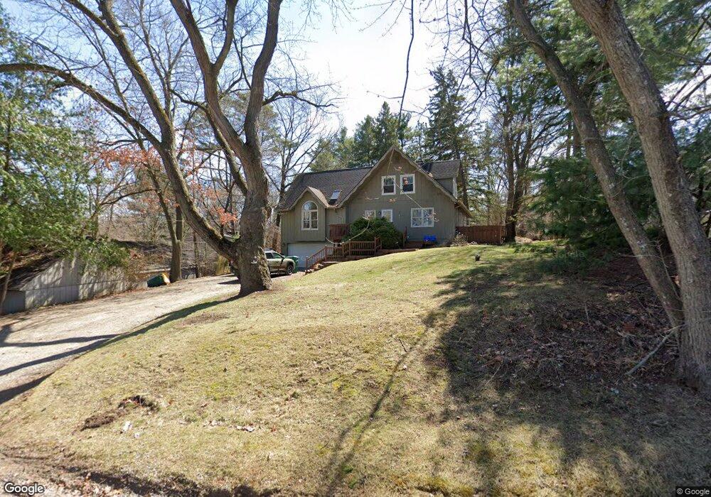
9477 Silverside Unit Bldg-Unit South Lyon, MI 48178
Estimated Value: $437,000 - $511,000
4
Beds
3
Baths
2,001
Sq Ft
$233/Sq Ft
Est. Value
About This Home
This home is located at 9477 Silverside Unit Bldg-Unit, South Lyon, MI 48178 and is currently estimated at $466,093, approximately $232 per square foot. 9477 Silverside Unit Bldg-Unit is a home located in Livingston County with nearby schools including William A. Brummer Elementary School, Centennial Middle School, and South Lyon High School.
Ownership History
Date
Name
Owned For
Owner Type
Purchase Details
Closed on
Jul 24, 2018
Sold by
Macdonald Daniel and Macdonald Courtney M
Bought by
Smith Matthew J and Smith Jenna M
Current Estimated Value
Purchase Details
Closed on
Dec 22, 2017
Sold by
Macdonald Daniel
Bought by
Macdonald Daniel and Macdonald Courtney M
Purchase Details
Closed on
Jun 2, 2014
Sold by
Bunn William G and Bunn Eileen R
Bought by
Macdonald Daniel
Purchase Details
Closed on
May 22, 1995
Sold by
Lynn Dwight
Bought by
Huss Randall R and Huss Lorenzen M
Create a Home Valuation Report for This Property
The Home Valuation Report is an in-depth analysis detailing your home's value as well as a comparison with similar homes in the area
Home Values in the Area
Average Home Value in this Area
Purchase History
| Date | Buyer | Sale Price | Title Company |
|---|---|---|---|
| Smith Matthew J | $309,000 | -- | |
| Macdonald Daniel | -- | -- | |
| Macdonald Daniel | $248,000 | -- | |
| Huss Randall R | $163,500 | -- |
Source: Public Records
Tax History Compared to Growth
Tax History
| Year | Tax Paid | Tax Assessment Tax Assessment Total Assessment is a certain percentage of the fair market value that is determined by local assessors to be the total taxable value of land and additions on the property. | Land | Improvement |
|---|---|---|---|---|
| 2025 | $4,543 | $179,300 | $0 | $0 |
| 2024 | $3,060 | $170,700 | $0 | $0 |
| 2023 | $2,919 | $159,500 | $0 | $0 |
| 2022 | $3,710 | $123,600 | $0 | $0 |
| 2021 | $3,710 | $140,500 | $0 | $0 |
| 2020 | $3,691 | $139,600 | $0 | $0 |
| 2019 | $3,727 | $123,600 | $0 | $0 |
| 2018 | $3,147 | $115,600 | $0 | $0 |
| 2017 | $3,197 | $113,600 | $0 | $0 |
| 2016 | $3,243 | $110,800 | $0 | $0 |
| 2014 | $2,788 | $96,400 | $0 | $0 |
| 2012 | $2,788 | $87,500 | $0 | $0 |
Source: Public Records
Map
Nearby Homes
- 11390 Ridge Rd
- 11860 Crooked Ln
- 11755 Shenandoah Dr Unit 159-4
- 11734 Shenandoah Dr Unit 3
- 11889 Shenandoah Dr Unit 3
- 11904 Moose Ridge Dr
- 11047 Silver View Ct
- 11055 Silver View Ct
- 9044 Kemper Dr
- 12192 Doane Rd
- 0 Hillview Dr Unit 25052269
- 11108 Silver Lake Rd
- 9870 Cambridge Ct Unit 2
- 9920 Cambridge Ct
- 10993 Stoney Point Dr
- 10537 Oak Forest Dr
- 10512 Oak Forest Dr
- 51 Deanna Kay Ct Unit 51
- 50 Deanna Kay Ct Unit 50
- 12324 Nantucket Dr Unit 1
- 9477 Silverside
- 9479 Silverside
- 9461 Silverside
- 9470 Silverside
- 9480 Silverside
- 11356 Ridge Rd
- 9484 Silverside
- 9464 Silverside
- 9488 Silverside
- 9492 Silverside
- 9490 Silverside
- 9508 Silverside
- 9458 Silverside
- 9452 Silverside
- 9516 Silverside
- 9498 Silverside
- 9494 Silverside
- 9502 Silverside
- 0 Silverside
- 9530 Silverside