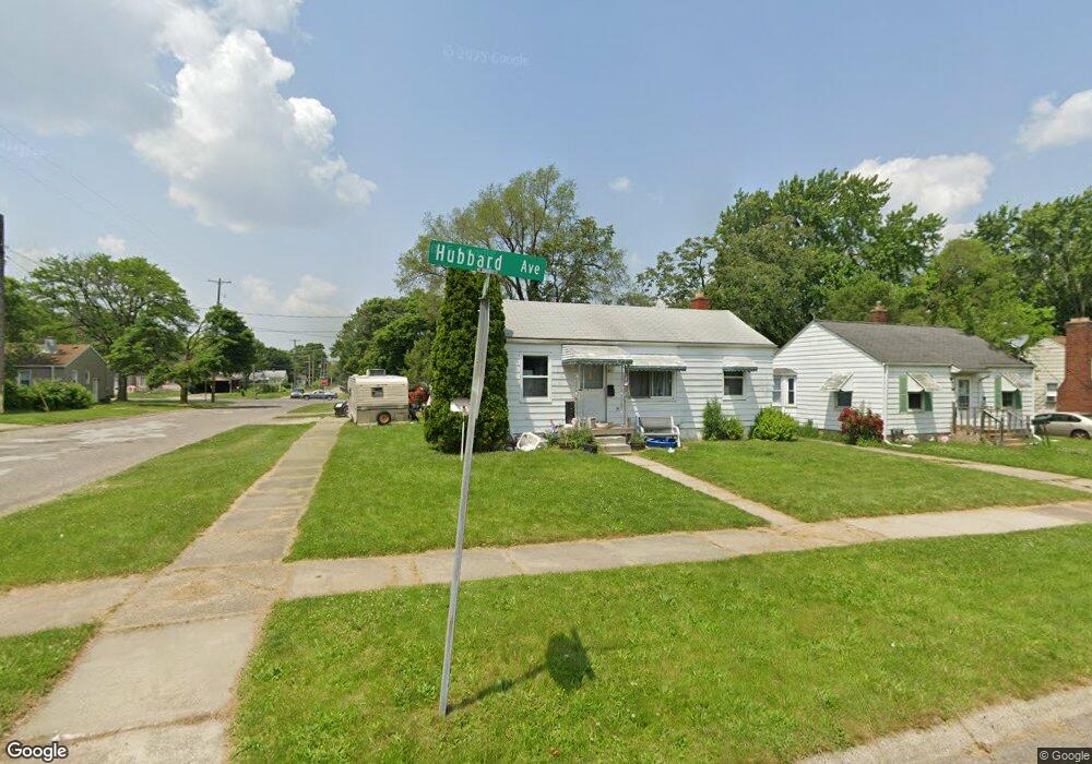
948 Hubbard Ave Flint, MI 48503
Mannhall Park NeighborhoodEstimated Value: $47,000 - $55,706
2
Beds
1
Bath
941
Sq Ft
$54/Sq Ft
Est. Value
About This Home
This home is located at 948 Hubbard Ave, Flint, MI 48503 and is currently estimated at $50,427, approximately $53 per square foot. 948 Hubbard Ave is a home located in Genesee County with nearby schools including Durant-Tuuri-Mott Elementary School, St. Paul Lutheran School, and First Flint Seventh-day Adventist Christian School.
Ownership History
Date
Name
Owned For
Owner Type
Purchase Details
Closed on
Jan 12, 2016
Sold by
Zerka Milad and Lerka Georgette
Bought by
Flint River Properties Llc
Current Estimated Value
Purchase Details
Closed on
May 19, 2008
Sold by
Zerka Danny M
Bought by
Zerka Milad
Purchase Details
Closed on
Jun 14, 2006
Sold by
Krupa Kathy
Bought by
Hsbc Mortgage Services Inc
Purchase Details
Closed on
Dec 18, 2004
Sold by
Barrera Nicole L
Bought by
Krupa Kathy
Create a Home Valuation Report for This Property
The Home Valuation Report is an in-depth analysis detailing your home's value as well as a comparison with similar homes in the area
Home Values in the Area
Average Home Value in this Area
Purchase History
| Date | Buyer | Sale Price | Title Company |
|---|---|---|---|
| Flint River Properties Llc | -- | Attorney | |
| Zerka Milad | -- | Sargents Title Company | |
| Hsbc Mortgage Services Inc | $61,180 | None Available | |
| Krupa Kathy | $58,000 | Sargents Title Company |
Source: Public Records
Tax History
| Year | Tax Paid | Tax Assessment Tax Assessment Total Assessment is a certain percentage of the fair market value that is determined by local assessors to be the total taxable value of land and additions on the property. | Land | Improvement |
|---|---|---|---|---|
| 2025 | $635 | $21,100 | $0 | $0 |
| 2024 | $600 | $21,400 | $0 | $0 |
| 2023 | $595 | $18,800 | $0 | $0 |
| 2022 | $0 | $15,200 | $0 | $0 |
| 2021 | $597 | $13,000 | $0 | $0 |
| 2020 | $562 | $11,600 | $0 | $0 |
| 2019 | $558 | $10,700 | $0 | $0 |
| 2018 | $522 | $10,200 | $0 | $0 |
| 2017 | $511 | $0 | $0 | $0 |
| 2016 | $509 | $0 | $0 | $0 |
| 2015 | -- | $0 | $0 | $0 |
| 2014 | -- | $0 | $0 | $0 |
| 2012 | -- | $5,700 | $0 | $0 |
Source: Public Records
Map
Nearby Homes
- 976 Barney Ave
- 960 Mann Ave
- 916 Mann Ave
- 3302 Van Buren Ave
- 1017 Stocker Ave
- 911 Hughes Ave
- 863 Tacken St
- 3413 Augusta St
- 1122 Stocker Ave
- 874 Tacken St
- 870 Tacken St
- 3801 Augusta St
- 1202 Knapp Ave
- 1308 Barney Ave
- 3517 Norwood Dr
- 3805 Brown St
- 932 Bradley Ave
- 0000 Beecher Rd
- 2805 Reynolds St
- 1412 S Ballenger Hwy
- 944 Hubbard Ave
- 936 Hubbard Ave
- 952 Hubbard Ave
- 945 S Ballenger Hwy
- 941 S Ballenger Hwy
- 956 Hubbard Ave
- 932 Hubbard Ave
- 937 S Ballenger Hwy
- 949 Hubbard Ave
- 945 Hubbard Ave
- 955 S Ballenger Hwy
- 960 Hubbard Ave
- 933 S Ballenger Hwy
- 939 Hubbard Ave
- 951 Hubbard Ave
- 928 Hubbard Ave
- 959 S Ballenger Hwy
- 955 Hubbard Ave
- 933 Hubbard Ave
- 929 S Ballenger Hwy
Your Personal Tour Guide
Ask me questions while you tour the home.