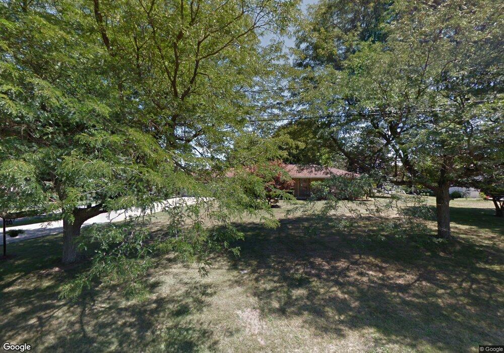
948 Lynita Dr NE Brookfield, OH 44403
Estimated Value: $198,680 - $252,000
3
Beds
2
Baths
1,642
Sq Ft
$134/Sq Ft
Est. Value
About This Home
This home is located at 948 Lynita Dr NE, Brookfield, OH 44403 and is currently estimated at $219,420, approximately $133 per square foot. 948 Lynita Dr NE is a home located in Trumbull County with nearby schools including Brookfield Elementary School, Brookfield Middle School, and Brookfield High School.
Ownership History
Date
Name
Owned For
Owner Type
Purchase Details
Closed on
Oct 22, 2017
Sold by
Stevenson Hugh M and Stevenson Arleen
Bought by
Stevenson Hugh M and Stevenson Arleen
Current Estimated Value
Purchase Details
Closed on
Feb 22, 2006
Sold by
Baver Albert N
Bought by
Stevenson Hugh M and Stevenson Arleen
Purchase Details
Closed on
Feb 9, 2006
Sold by
Baver Albert N
Bought by
Stevenson Hugh M and Stevenson Arleen
Purchase Details
Closed on
Sep 13, 2004
Sold by
Bayer Diane C
Bought by
Bayer Albert N
Purchase Details
Closed on
Jan 1, 1990
Bought by
Albert Albert N and Albert S
Create a Home Valuation Report for This Property
The Home Valuation Report is an in-depth analysis detailing your home's value as well as a comparison with similar homes in the area
Home Values in the Area
Average Home Value in this Area
Purchase History
| Date | Buyer | Sale Price | Title Company |
|---|---|---|---|
| Stevenson Hugh M | -- | None Available | |
| Stevenson Hugh M | -- | None Available | |
| Stevenson Hugh M | -- | None Available | |
| Bayer Albert N | -- | -- | |
| Albert Albert N | -- | -- |
Source: Public Records
Tax History Compared to Growth
Tax History
| Year | Tax Paid | Tax Assessment Tax Assessment Total Assessment is a certain percentage of the fair market value that is determined by local assessors to be the total taxable value of land and additions on the property. | Land | Improvement |
|---|---|---|---|---|
| 2024 | $2,167 | $46,730 | $10,960 | $35,770 |
| 2023 | $2,167 | $46,730 | $10,960 | $35,770 |
| 2022 | $2,204 | $38,650 | $9,490 | $29,160 |
| 2021 | $2,066 | $38,650 | $9,490 | $29,160 |
| 2020 | $2,053 | $38,650 | $9,490 | $29,160 |
| 2019 | $2,107 | $37,000 | $9,490 | $27,510 |
| 2018 | $2,089 | $37,000 | $9,490 | $27,510 |
| 2017 | $2,086 | $37,000 | $9,490 | $27,510 |
| 2016 | $2,012 | $34,310 | $9,490 | $24,820 |
| 2015 | $2,178 | $34,310 | $9,490 | $24,820 |
| 2014 | $2,006 | $34,310 | $9,490 | $24,820 |
| 2013 | $2,076 | $36,160 | $9,490 | $26,670 |
Source: Public Records
Map
Nearby Homes
- 7290 Lee Rd NE
- 7085 Sunnydell Dr
- 7091 Warren Sharon Rd
- 7086 Warren Sharon Rd
- 1212 State Route 7 NE
- 209 Wyngate Dr
- 872 Yankee Run Rd
- 365 Brookfield Ave
- 887 State Route 7 SE
- 805 Kimberly Ave
- 1921 Custer Orangeville Rd
- 461 Grove St
- 7440 Stewart Sharon Rd
- 7182 Stewart Sharon Rd
- 425 Grove St
- 609 Syme St
- 6855 Stewart Sharon Rd
- 276 Lincoln St
- 268 Ridge Way
- 449 N Water Ave
- 936 Lynita Dr NE
- 7259 Northview Dr
- 953 Valley View Dr
- 7249 Northview Dr
- 943 Valley View Dr
- 926 Lynita Dr NE
- 943 Lynita Dr NE
- 7269 Northview Dr
- 7239 Northview Dr
- 933 Lynita Dr NE
- 933 Valley View Dr
- 916 Lynita Dr NE
- 923 Lynita Dr NE
- 923 Valley View Dr
- 7277 Northview Dr
- 7256 Wildwood Dr
- 7231 Northview Dr
- 7266 Wildwood Dr
- 913 Valley View Dr
- 7248 Wildwood Dr