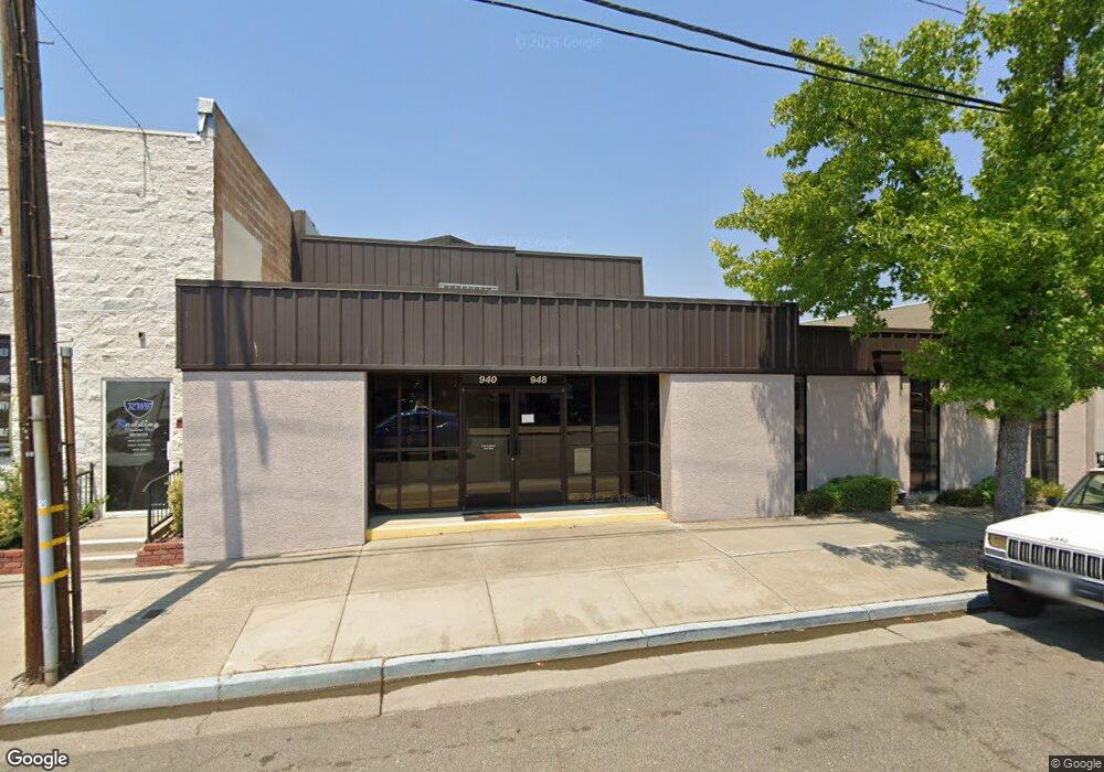
948 Merchant St Redding, CA 96002
Estimated Value: $609,933
Studio
--
Bath
4,180
Sq Ft
$146/Sq Ft
Est. Value
About This Home
This home is located at 948 Merchant St, Redding, CA 96002 and is currently estimated at $609,933, approximately $145 per square foot. 948 Merchant St is a home located in Shasta County with nearby schools including Mistletoe Elementary School, Enterprise High School, and Trinity Lutheran School.
Ownership History
Date
Name
Owned For
Owner Type
Purchase Details
Closed on
May 2, 2023
Sold by
Susan Charles E and Susan Philpot
Bought by
Reg Legacy Holdings Llc
Current Estimated Value
Home Financials for this Owner
Home Financials are based on the most recent Mortgage that was taken out on this home.
Original Mortgage
$470,000
Outstanding Balance
$454,982
Interest Rate
6.42%
Mortgage Type
New Conventional
Estimated Equity
$154,951
Purchase Details
Closed on
Nov 23, 2010
Sold by
Philpot Charles E and Philpot Susan
Bought by
Philpot Charles E and Philpot Susan
Purchase Details
Closed on
Jan 9, 2002
Sold by
Knighten Kenneth L
Bought by
Philpot Charles E and Philpot Susan
Home Financials for this Owner
Home Financials are based on the most recent Mortgage that was taken out on this home.
Original Mortgage
$320,000
Interest Rate
6.84%
Mortgage Type
Commercial
Create a Home Valuation Report for This Property
The Home Valuation Report is an in-depth analysis detailing your home's value as well as a comparison with similar homes in the area
Purchase History
We collect this data history from publicly available records. To have your information removed, we recommend requesting removal directly through your county’s website.
| Date | Buyer | Sale Price | Title Company |
|---|---|---|---|
| Reg Legacy Holdings Llc | $600,000 | Placer Title | |
| Philpot Charles E | -- | None Available | |
| Philpot Charles E | $470,000 | Placer Title Company |
Source: Public Records
Mortgage History
We collect this data history from publicly available records. To have your information removed, we recommend requesting removal directly through your county’s website.
| Date | Status | Borrower | Loan Amount |
|---|---|---|---|
| Open | Reg Legacy Holdings Llc | $470,000 | |
| Previous Owner | Philpot Charles E | $320,000 |
Source: Public Records
Tax History
| Year | Tax Paid | Tax Assessment Tax Assessment Total Assessment is a certain percentage of the fair market value that is determined by local assessors to be the total taxable value of land and additions on the property. | Land | Improvement |
|---|---|---|---|---|
| 2025 | $6,852 | $624,240 | $156,060 | $468,180 |
| 2024 | $5,656 | $612,000 | $153,000 | $459,000 |
| 2023 | $5,656 | $500,000 | $125,000 | $375,000 |
| 2022 | $5,605 | $500,000 | $125,000 | $375,000 |
| 2021 | $5,950 | $540,000 | $125,000 | $415,000 |
| 2020 | $5,984 | $540,000 | $125,000 | $415,000 |
| 2019 | $5,724 | $510,000 | $120,000 | $390,000 |
| 2018 | $5,769 | $510,000 | $120,000 | $390,000 |
| 2017 | $5,354 | $455,000 | $100,000 | $355,000 |
| 2016 | $5,109 | $455,000 | $100,000 | $355,000 |
| 2015 | $4,978 | $440,000 | $100,000 | $340,000 |
| 2014 | $4,816 | $420,000 | $95,000 | $325,000 |
Source: Public Records
Map
Nearby Homes
- 2584 Reservoir Ln
- 2583 Reservoir Ln
- 1943 Bechelli Ln
- 1807 Forest Glen Ct
- 1968 Bechelli Ln
- 1937 Bechelli Ln
- 1448 Mistletoe Ln
- 890 Parsons Dr
- 0 Churn Creek Rd Unit 25-496
- 0 Churn Creek Rd Unit 26-609
- 1928 Bechelli Ln
- 1911 Bechelli Ln
- 1451 Carter Way
- 1953 Cameo Ct
- 2786 Regal Ave
- 2810 Bechelli Ln
- 3140 C St
- 1075 Le Brun Ln
- 3178 Lawrence Rd
- 2093 Victor Ave
- 946 Merchant St
- 940 Merchant St
- 940 Merchant St
- 944 Merchant St
- 942 Merchant St
- 930 Merchant St
- 945 Merchant St
- 2330 Churn Creek Rd
- 915 Merchant St
- 2305 Larkspur Ln
- 2313 Larkspur Ln
- 2250 Churn Creek Rd
- 2335 Larkspur Ln
- 940 Wall St
- 910 Wall St
- 2225 Larkspur Ln
- 2223 Larkspur Ln
- 2223 Larkspur Ln
- 5025 Industrial St
- 1400 Industrial St
Your Personal Tour Guide
Ask me questions while you tour the home.