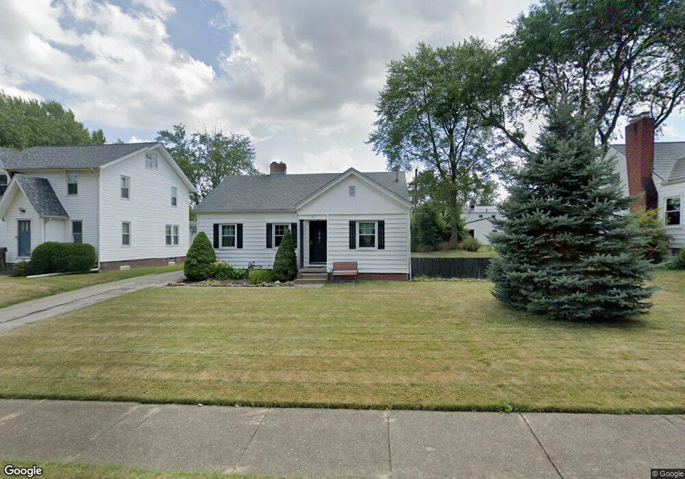
948 Overlook Dr Alliance, OH 44601
Estimated Value: $138,000 - $152,000
3
Beds
1
Bath
1,032
Sq Ft
$141/Sq Ft
Est. Value
About This Home
This home is located at 948 Overlook Dr, Alliance, OH 44601 and is currently estimated at $146,006, approximately $141 per square foot. 948 Overlook Dr is a home located in Stark County with nearby schools including Alliance Early Learning School, Alliance Intermediate School at Northside, and Alliance Middle School.
Ownership History
Date
Name
Owned For
Owner Type
Purchase Details
Closed on
Feb 20, 2006
Sold by
Martin Jeffrey F and Martin Brian T
Bought by
Bell Jeremy R and Bell Suzanne M
Current Estimated Value
Home Financials for this Owner
Home Financials are based on the most recent Mortgage that was taken out on this home.
Original Mortgage
$60,000
Outstanding Balance
$33,977
Interest Rate
6.3%
Mortgage Type
Fannie Mae Freddie Mac
Estimated Equity
$112,029
Create a Home Valuation Report for This Property
The Home Valuation Report is an in-depth analysis detailing your home's value as well as a comparison with similar homes in the area
Home Values in the Area
Average Home Value in this Area
Purchase History
| Date | Buyer | Sale Price | Title Company |
|---|---|---|---|
| Bell Jeremy R | $75,000 | None Available |
Source: Public Records
Mortgage History
| Date | Status | Borrower | Loan Amount |
|---|---|---|---|
| Open | Bell Jeremy R | $60,000 |
Source: Public Records
Tax History Compared to Growth
Tax History
| Year | Tax Paid | Tax Assessment Tax Assessment Total Assessment is a certain percentage of the fair market value that is determined by local assessors to be the total taxable value of land and additions on the property. | Land | Improvement |
|---|---|---|---|---|
| 2025 | -- | $35,560 | $8,190 | $27,370 |
| 2024 | -- | $35,560 | $8,190 | $27,370 |
| 2023 | $1,270 | $31,610 | $7,210 | $24,400 |
| 2022 | $1,279 | $31,610 | $7,210 | $24,400 |
| 2021 | $1,280 | $31,610 | $7,210 | $24,400 |
| 2020 | $1,174 | $27,130 | $6,270 | $20,860 |
| 2019 | $1,159 | $27,140 | $6,270 | $20,870 |
| 2018 | $1,165 | $27,140 | $6,270 | $20,870 |
| 2017 | $1,034 | $23,700 | $5,220 | $18,480 |
| 2016 | $1,051 | $23,880 | $5,220 | $18,660 |
| 2015 | $1,060 | $23,880 | $5,220 | $18,660 |
| 2014 | $987 | $21,180 | $4,620 | $16,560 |
| 2013 | $493 | $21,180 | $4,620 | $16,560 |
Source: Public Records
Map
Nearby Homes
- 1321 Parkway Blvd
- 1515 S Rockhill Ave
- 884 W College Rd
- 738 Kingsway St
- 970 Kingsway St
- 1038 Fairview Place
- 896 Parkway Blvd
- 1201 Overlook Dr
- 734 Parkway Blvd
- 725 W Summit St
- 645 W Summit St
- 2050 Federal Ave
- 2112 Blenheim Ave
- 140 W Summit St
- 1475 Chatauqua Ct
- 112 E College St
- 807 S Union Ave
- 565 W Broadway St
- 2220 Western Ave
- 1437 S Linden Ave
- 932 Overlook Dr
- 964 Overlook Dr
- 945 Glenwood Dr
- 959 Glenwood Dr
- 929 Glenwood Dr
- 1403 Parkway Blvd
- 1411 Parkway Blvd
- 1349 Parkway Blvd
- 988 Overlook Dr
- 947 Overlook Dr
- 977 Glenwood Dr
- 965 Overlook Dr
- 1419 Parkway Blvd
- 1335 Parkway Blvd
- 993 Glenwood Dr
- 1429 Parkway Blvd
- 998 Overlook Dr
- 975 Overlook Dr
- 954 Glenwood Dr
- 938 Glenwood Dr