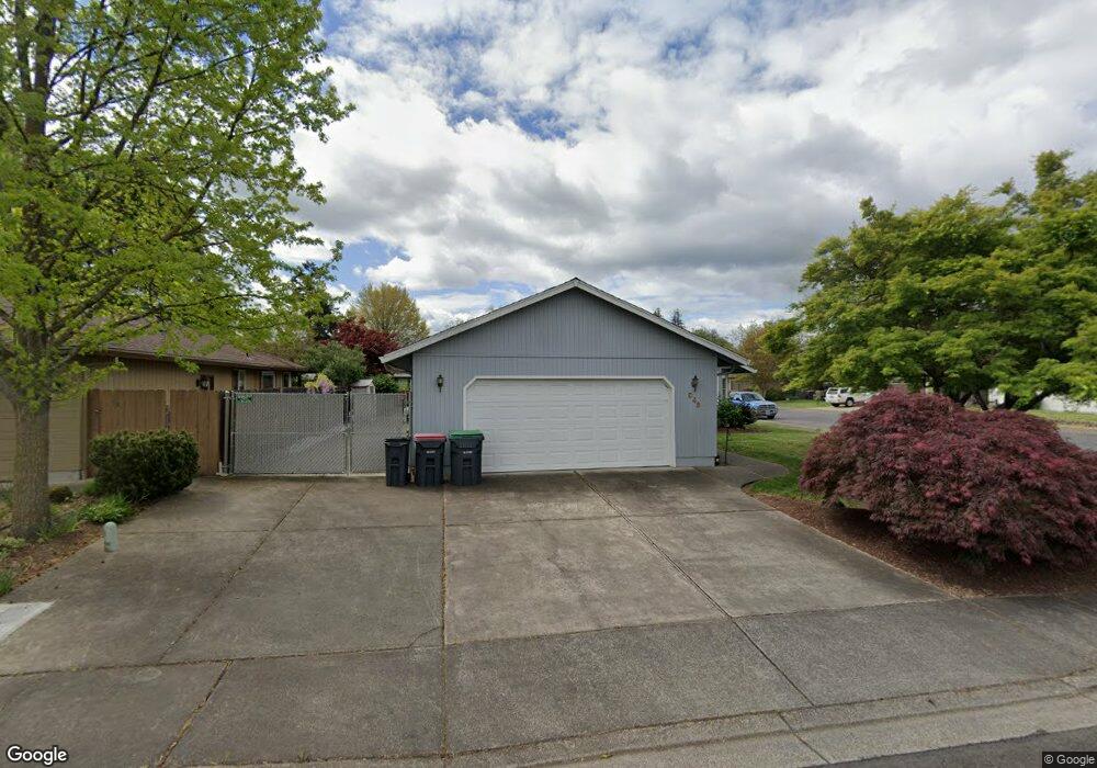
948 Westrop Dr Central Point, OR 97502
Estimated Value: $407,277 - $442,000
3
Beds
2
Baths
1,771
Sq Ft
$239/Sq Ft
Est. Value
About This Home
This home is located at 948 Westrop Dr, Central Point, OR 97502 and is currently estimated at $422,569, approximately $238 per square foot. 948 Westrop Dr is a home located in Jackson County with nearby schools including Howard Elementary School, McLoughlin Middle School, and North Medford High School.
Ownership History
Date
Name
Owned For
Owner Type
Purchase Details
Closed on
Jul 10, 2025
Sold by
Ambro Martha A
Bought by
Ambro Family Trust and Ambro
Current Estimated Value
Purchase Details
Closed on
Sep 12, 2006
Sold by
Franklin Douglas W and Franklin Patricia L
Bought by
Ambro John F and Ambro Martha A
Purchase Details
Closed on
Dec 19, 2001
Sold by
Bitterling Raymond R and Bitterling Virginia G
Bought by
Franklin Douglas W and Franklin Patricia L
Home Financials for this Owner
Home Financials are based on the most recent Mortgage that was taken out on this home.
Original Mortgage
$136,400
Interest Rate
6.73%
Purchase Details
Closed on
Nov 12, 1997
Sold by
Ferreira James Anthony
Bought by
Bitterling Raymond R and Bitterling Virginia G
Home Financials for this Owner
Home Financials are based on the most recent Mortgage that was taken out on this home.
Original Mortgage
$90,000
Interest Rate
7.3%
Create a Home Valuation Report for This Property
The Home Valuation Report is an in-depth analysis detailing your home's value as well as a comparison with similar homes in the area
Purchase History
| Date | Buyer | Sale Price | Title Company |
|---|---|---|---|
| Ambro Family Trust | -- | None Listed On Document | |
| Ambro John F | $293,000 | First American Title | |
| Franklin Douglas W | $170,500 | Amerititle Inc | |
| Bitterling Raymond R | $134,000 | Crater Title Insurance |
Source: Public Records
Mortgage History
| Date | Status | Borrower | Loan Amount |
|---|---|---|---|
| Previous Owner | Franklin Douglas W | $136,400 | |
| Previous Owner | Bitterling Raymond R | $90,000 |
Source: Public Records
Tax History
| Year | Tax Paid | Tax Assessment Tax Assessment Total Assessment is a certain percentage of the fair market value that is determined by local assessors to be the total taxable value of land and additions on the property. | Land | Improvement |
|---|---|---|---|---|
| 2026 | $3,212 | $220,480 | -- | -- |
| 2025 | $3,141 | $214,060 | $66,170 | $147,890 |
| 2024 | $3,141 | $207,830 | $64,240 | $143,590 |
| 2023 | $3,046 | $201,780 | $62,370 | $139,410 |
| 2022 | $2,970 | $201,780 | $62,370 | $139,410 |
| 2021 | $2,892 | $195,910 | $60,550 | $135,360 |
| 2020 | $2,819 | $190,210 | $58,790 | $131,420 |
| 2019 | $2,750 | $179,300 | $55,410 | $123,890 |
| 2018 | $2,678 | $174,080 | $53,800 | $120,280 |
| 2017 | $2,625 | $174,080 | $53,800 | $120,280 |
| 2016 | $2,569 | $164,090 | $50,710 | $113,380 |
| 2015 | $2,469 | $164,090 | $50,710 | $113,380 |
| 2014 | $2,424 | $154,680 | $47,800 | $106,880 |
Source: Public Records
Map
Nearby Homes
- 959 Westrop Dr
- 1258 Joshua Ct
- 1379 Circle Wood Dr
- 1204 Heather Ln
- 659 Herman Ave
- 3358 Bursell Rd
- 3364 Bursell Rd
- 105 Queens Gate Ct
- 14 Scholarship Way
- 18 Scholarship Way
- 1025 Fairfield Ave
- 2825 Howard Ave
- 2817 Howard Ave
- 2727 Connell Ave
- 736 Hemlock Ave
- 3600 N Pacific Hwy
- 171 Mellecker Way
- 918 Brandi Way
- 199 Mellecker Way
- 2717 Elliott Ave
- 952 Westrop Dr
- 892 Westrop Dr
- 958 Westrop Dr
- 1321 Marilee St
- 951 Westrop Dr
- 654 Marlin Way
- 953 Westrop Dr
- 1303 Benjamin Ct
- 890 Westrop Dr
- 964 Westrop Dr
- 1341 Marilee St
- 1323 Benjamin Ct
- 899 Westrop Dr
- 1343 Benjamin Ct
- 1361 Marilee St
- 886 Westrop Dr
- 891 Westrop Dr
- 1246 Marilee St
- 1299 Joshua Ct
- 972 Westrop Dr
Your Personal Tour Guide
Ask me questions while you tour the home.