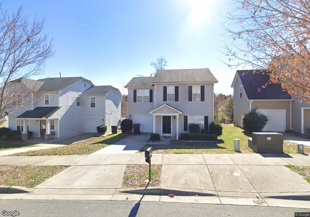
949 Ramsgate Dr SW Concord, NC 28025
Estimated Value: $295,931 - $305,000
3
Beds
3
Baths
1,762
Sq Ft
$170/Sq Ft
Est. Value
About This Home
This home is located at 949 Ramsgate Dr SW, Concord, NC 28025 and is currently estimated at $300,233, approximately $170 per square foot. 949 Ramsgate Dr SW is a home located in Cabarrus County with nearby schools including A.T. Allen Elementary School, C.C. Griffin Middle School, and Central Cabarrus High School.
Ownership History
Date
Name
Owned For
Owner Type
Purchase Details
Closed on
Jun 17, 2022
Sold by
Keep Going Investments Llc
Bought by
Sfr Jv-2 Property Llc
Current Estimated Value
Purchase Details
Closed on
Jun 14, 2022
Sold by
Anthony Carnesi
Bought by
Keep Going Investments Llc
Purchase Details
Closed on
Feb 7, 2017
Sold by
Carnesi Gina Marie
Bought by
Carnesi Anthony
Purchase Details
Closed on
Aug 25, 2006
Sold by
Dan Moser Co Inc
Bought by
Carnesi Anthony
Home Financials for this Owner
Home Financials are based on the most recent Mortgage that was taken out on this home.
Original Mortgage
$104,000
Interest Rate
6.67%
Mortgage Type
Purchase Money Mortgage
Create a Home Valuation Report for This Property
The Home Valuation Report is an in-depth analysis detailing your home's value as well as a comparison with similar homes in the area
Home Values in the Area
Average Home Value in this Area
Purchase History
| Date | Buyer | Sale Price | Title Company |
|---|---|---|---|
| Sfr Jv-2 Property Llc | $330,000 | Os National Title | |
| Keep Going Investments Llc | $295,000 | Barone Law Offices Pc | |
| Carnesi Anthony | -- | None Available | |
| Carnesi Anthony | $130,000 | None Available |
Source: Public Records
Mortgage History
| Date | Status | Borrower | Loan Amount |
|---|---|---|---|
| Previous Owner | Carnesi Anthony | $104,000 |
Source: Public Records
Tax History
| Year | Tax Paid | Tax Assessment Tax Assessment Total Assessment is a certain percentage of the fair market value that is determined by local assessors to be the total taxable value of land and additions on the property. | Land | Improvement |
|---|---|---|---|---|
| 2025 | $2,904 | $291,610 | $68,000 | $223,610 |
| 2024 | $2,904 | $291,610 | $68,000 | $223,610 |
| 2023 | $2,149 | $176,130 | $40,000 | $136,130 |
| 2022 | $2,149 | $176,130 | $40,000 | $136,130 |
| 2021 | $2,149 | $176,130 | $40,000 | $136,130 |
| 2020 | $2,149 | $176,130 | $40,000 | $136,130 |
| 2019 | $1,570 | $128,660 | $20,000 | $108,660 |
| 2018 | $1,531 | $127,570 | $20,000 | $107,570 |
| 2017 | $1,505 | $127,570 | $20,000 | $107,570 |
| 2016 | $893 | $117,440 | $24,000 | $93,440 |
| 2015 | $1,386 | $117,440 | $24,000 | $93,440 |
| 2014 | $1,386 | $117,440 | $24,000 | $93,440 |
Source: Public Records
Map
Nearby Homes
- 1039 Manston Place SW
- 836 Chastain Ave
- 4194 Clifftonville Ave SW
- 741 Nannyberry Ln
- 3969 Potts Grove Place
- 608 Nannyberry Ln
- 4003 Long Arrow Dr Unit 366
- 4018 Bethesda Place
- 303 Olde North Church Dr Unit 38
- 685 Continental Dr
- 1308 Roseberry Place SW
- 3560 Us Highway 601 S
- 5016 Hildreth Ct
- 5248 Ellie Ct
- 4227 Kiser Woods Dr SW
- 1562 Piney Church Rd
- 5582 Flowes Store Rd
- 847 Kathryn Dr SE
- 3044 Parade Ln SW
- 456 Debra Cir SW
- 945 Ramsgate Dr SW
- 951 Ramsgate Dr SW
- 955 Ramsgate Dr SW
- 959 Ramsgate Dr SW
- 4129 Margate St SW
- 946 Ramsgate Dr SW
- 963 Ramsgate Dr SW
- 942 Ramsgate Dr SW
- 958 Ramsgate Dr SW
- 938 Ramsgate Dr SW
- 935 Ramsgate Dr SW
- 967 Ramsgate Dr SW
- 962 Ramsgate Dr SW
- 931 Ramsgate Dr SW
- 4124 Margate St SW
- 926 Ramsgate Dr SW
- 966 Ramsgate Dr SW
- 966 Ramsgate Dr SW Unit 128
- 971 Ramsgate Dr SW
- 927 Ramsgate Dr SW
Your Personal Tour Guide
Ask me questions while you tour the home.