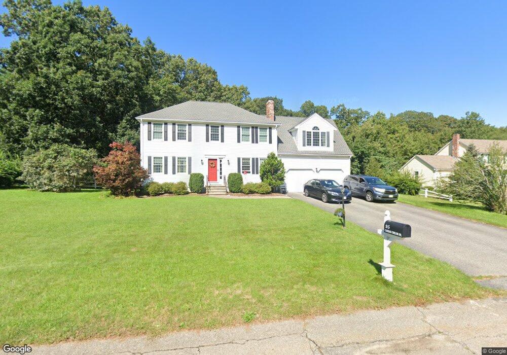
95 Caesar Chelor Dr Wrentham, MA 02093
Estimated Value: $818,000 - $1,021,000
3
Beds
4
Baths
2,695
Sq Ft
$332/Sq Ft
Est. Value
About This Home
This home is located at 95 Caesar Chelor Dr, Wrentham, MA 02093 and is currently estimated at $893,455, approximately $331 per square foot. 95 Caesar Chelor Dr is a home located in Norfolk County with nearby schools including Delaney Elementary School and Charles E Roderick.
Ownership History
Date
Name
Owned For
Owner Type
Purchase Details
Closed on
Apr 1, 1994
Sold by
Cj Mclaughlin Bldr Inc
Bought by
Lacke Anthony D and Lacke Linda R
Current Estimated Value
Home Financials for this Owner
Home Financials are based on the most recent Mortgage that was taken out on this home.
Original Mortgage
$180,677
Interest Rate
7.07%
Mortgage Type
Purchase Money Mortgage
Create a Home Valuation Report for This Property
The Home Valuation Report is an in-depth analysis detailing your home's value as well as a comparison with similar homes in the area
Purchase History
| Date | Buyer | Sale Price | Title Company |
|---|---|---|---|
| Lacke Anthony D | $195,000 | -- |
Source: Public Records
Mortgage History
| Date | Status | Borrower | Loan Amount |
|---|---|---|---|
| Closed | Lacke Anthony D | $166,000 | |
| Closed | Lacke Anthony D | $183,500 | |
| Closed | Lacke Anthony D | $180,677 |
Source: Public Records
Tax History
| Year | Tax Paid | Tax Assessment Tax Assessment Total Assessment is a certain percentage of the fair market value that is determined by local assessors to be the total taxable value of land and additions on the property. | Land | Improvement |
|---|---|---|---|---|
| 2025 | $8,850 | $763,600 | $329,500 | $434,100 |
| 2024 | $8,597 | $716,400 | $329,500 | $386,900 |
| 2023 | $8,306 | $658,200 | $299,700 | $358,500 |
| 2022 | $8,017 | $586,500 | $272,500 | $314,000 |
| 2021 | $7,899 | $561,400 | $272,500 | $288,900 |
| 2020 | $7,728 | $542,300 | $224,000 | $318,300 |
| 2019 | $7,453 | $527,800 | $224,000 | $303,800 |
| 2018 | $7,261 | $509,900 | $224,200 | $285,700 |
| 2017 | $7,097 | $498,000 | $219,900 | $278,100 |
| 2016 | $6,946 | $486,400 | $213,600 | $272,800 |
| 2015 | $6,852 | $457,400 | $205,300 | $252,100 |
| 2014 | $6,306 | $411,900 | $169,200 | $242,700 |
Source: Public Records
Map
Nearby Homes
- 10 Nature View Dr
- 15 Nature View Dr
- 2 Earle Stewart Ln
- 3 Earle Stewart Ln
- 12 Earle Stewart Ln
- 10 Earle Stewart Ln Unit Lot 5
- 500 Franklin St
- 287 Park St
- 50 Reed Fulton Ave Unit Lot 61
- 246 Forest Grove Ave
- 45 Joshua Rd
- 576 Dedham St
- 11 Weber Farm Rd Unit 11
- 8 Weber Farm Rd Unit 8
- 0 W Birch Rd
- 30 Weber Farm Rd Unit 30
- 8 Ridgefield Rd
- 483 Thurston St
- 75 Jordan Rd
- 440 Chestnut St
- 85 Caesar Chelor Dr
- 105 Caesar Chelor Dr
- 75 Caesar Chelor Dr
- 80 Caesar Chelor Dr
- 70 Caesar Chelor Dr
- 115 Caesar Chelor Dr
- 136 Lakeside Ave
- 136 Lakeside Ave Unit 136
- 138 Lakeside Ave
- 134 Lakeside Ave
- 132 Lakeside Ave
- 140 Lakeside Ave
- 130 Lakeside Ave
- 60 Caesar Chelor Dr
- 65 Caesar Chelor Dr
- 142 Lakeside Ave
- 100 Caesar Chelor Dr
- 50 Caesar Chelor Dr
- 135 Lakeside Ave
- 137 Lakeside Ave
Your Personal Tour Guide
Ask me questions while you tour the home.