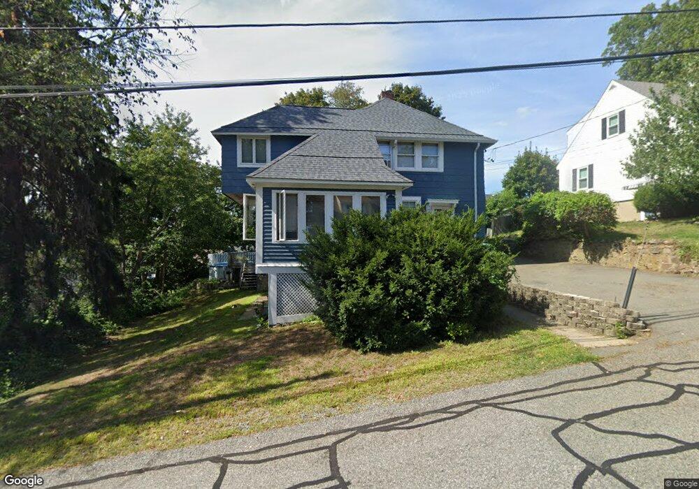
95 Cedar Cliff Rd Braintree, MA 02184
East Braintree NeighborhoodEstimated Value: $743,000 - $812,000
4
Beds
2
Baths
1,932
Sq Ft
$396/Sq Ft
Est. Value
About This Home
This home is located at 95 Cedar Cliff Rd, Braintree, MA 02184 and is currently estimated at $765,230, approximately $396 per square foot. 95 Cedar Cliff Rd is a home located in Norfolk County with nearby schools including Braintree High School, Sacred Heart Elementary School, and South Shore Christian Academy.
Ownership History
Date
Name
Owned For
Owner Type
Purchase Details
Closed on
Jun 4, 1987
Sold by
Cannon Ex Laura W
Bought by
Keaney Joseph J
Current Estimated Value
Home Financials for this Owner
Home Financials are based on the most recent Mortgage that was taken out on this home.
Original Mortgage
$104,000
Interest Rate
10.38%
Mortgage Type
Purchase Money Mortgage
Create a Home Valuation Report for This Property
The Home Valuation Report is an in-depth analysis detailing your home's value as well as a comparison with similar homes in the area
Home Values in the Area
Average Home Value in this Area
Purchase History
| Date | Buyer | Sale Price | Title Company |
|---|---|---|---|
| Keaney Joseph J | $160,000 | -- |
Source: Public Records
Mortgage History
| Date | Status | Borrower | Loan Amount |
|---|---|---|---|
| Open | Keaney Joseph J | $98,000 | |
| Closed | Keaney Joseph J | $104,000 |
Source: Public Records
Tax History
| Year | Tax Paid | Tax Assessment Tax Assessment Total Assessment is a certain percentage of the fair market value that is determined by local assessors to be the total taxable value of land and additions on the property. | Land | Improvement |
|---|---|---|---|---|
| 2025 | $6,865 | $687,900 | $342,000 | $345,900 |
| 2024 | $6,157 | $649,500 | $310,500 | $339,000 |
| 2023 | $5,846 | $599,000 | $279,000 | $320,000 |
| 2022 | $5,691 | $572,000 | $252,000 | $320,000 |
| 2021 | $5,261 | $528,700 | $227,700 | $301,000 |
| 2020 | $4,877 | $494,600 | $207,000 | $287,600 |
| 2019 | $4,717 | $467,500 | $198,000 | $269,500 |
| 2018 | $4,618 | $438,100 | $180,000 | $258,100 |
| 2017 | $4,445 | $413,900 | $171,000 | $242,900 |
| 2016 | $4,332 | $394,500 | $162,000 | $232,500 |
| 2015 | $3,973 | $358,900 | $135,000 | $223,900 |
| 2014 | $3,842 | $336,400 | $129,600 | $206,800 |
Source: Public Records
Map
Nearby Homes
- 54 Edgemont Rd
- 18 Hobart St
- 140 Commercial St
- 312 Shaw St
- 41 Lantern Ln
- 37 Lantern Ln
- 26 Tingley Rd
- 87 Arborway Dr
- 300 Commercial St Unit 23
- 122 Washington St Unit Twenty-two
- 599 Union St
- 25 Richmond St
- 30 Skyline Dr Unit 6
- 37 Skyline Dr Unit 11
- 14 Hillside Rd
- 15 Summer St
- 25 W Howard St Unit C3
- 46 Roosevelt Rd
- 19 Vine St Unit 2
- 255 River St
- 99 Cedar Cliff Rd
- 89 Cedar Cliff Rd
- 114 Edgemont Rd
- 103 Cedar Cliff Rd
- 106 Edgemont Rd
- 118 Edgemont Rd
- 94 Cedar Cliff Rd
- 85 Cedar Cliff Rd
- 102 Edgemont Rd
- 122 Edgemont Rd
- 107 Cedar Cliff Rd
- 100 Cedar Cliff Rd
- 98 Edgemont Rd
- 126 Edgemont Rd
- 106 Cedar Cliff Rd
- 84 Cedar Cliff Rd
- 111 Cedar Cliff Rd
- 77 Cedar Cliff Rd
- 94 Edgemont Rd
- 110 Cedar Cliff Rd
Your Personal Tour Guide
Ask me questions while you tour the home.