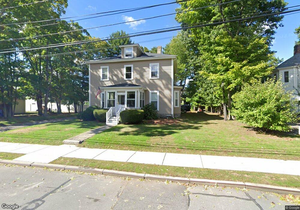
95 Crescent St Auburndale, MA 02466
Auburndale NeighborhoodEstimated Value: $1,166,000 - $1,504,000
4
Beds
2
Baths
2,425
Sq Ft
$529/Sq Ft
Est. Value
About This Home
This home is located at 95 Crescent St, Auburndale, MA 02466 and is currently estimated at $1,281,954, approximately $528 per square foot. 95 Crescent St is a home located in Middlesex County with nearby schools including Williams Elementary School, Charles E Brown Middle School, and Newton South High School.
Ownership History
Date
Name
Owned For
Owner Type
Purchase Details
Closed on
Apr 17, 2015
Sold by
Sullivan James J and Sullivan Christine F
Bought by
95-97 Crescent Street
Current Estimated Value
Purchase Details
Closed on
Dec 6, 2012
Sold by
95-97 Crescent Street and Sullivan James J
Bought by
Sullivan James J and Sullivan Christine F
Purchase Details
Closed on
Apr 17, 2003
Sold by
Sullivan Christine and Sullivan James J
Bought by
Tr 95-97 Crescent and Tr James J Sulliva
Create a Home Valuation Report for This Property
The Home Valuation Report is an in-depth analysis detailing your home's value as well as a comparison with similar homes in the area
Home Values in the Area
Average Home Value in this Area
Purchase History
| Date | Buyer | Sale Price | Title Company |
|---|---|---|---|
| 95-97 Crescent Street | -- | -- | |
| Sullivan James J | -- | -- | |
| Tr 95-97 Crescent | -- | -- | |
| Sullivan Christine | -- | -- |
Source: Public Records
Tax History
| Year | Tax Paid | Tax Assessment Tax Assessment Total Assessment is a certain percentage of the fair market value that is determined by local assessors to be the total taxable value of land and additions on the property. | Land | Improvement |
|---|---|---|---|---|
| 2025 | $10,059 | $1,026,400 | $709,600 | $316,800 |
| 2024 | $9,726 | $996,500 | $688,900 | $307,600 |
| 2023 | $9,324 | $915,900 | $557,400 | $358,500 |
| 2022 | $8,922 | $848,100 | $516,100 | $332,000 |
| 2021 | $11,678 | $778,100 | $473,500 | $304,600 |
| 2020 | $9,506 | $778,100 | $473,500 | $304,600 |
| 2019 | $7,599 | $727,200 | $442,500 | $284,700 |
| 2018 | $7,484 | $691,700 | $418,900 | $272,800 |
| 2017 | $7,057 | $634,600 | $384,300 | $250,300 |
| 2016 | $6,592 | $579,300 | $352,600 | $226,700 |
| 2015 | $6,286 | $541,400 | $329,500 | $211,900 |
Source: Public Records
Map
Nearby Homes
- 7 Sharon Ave Unit 7
- 1917 Commonwealth Ave Unit 1917
- 1919 Commonwealth Ave Unit 1919
- 0 Duncan Rd Unit 72925240
- 194 Auburn St
- 305 Webster St Unit 2
- 226 Auburn St Unit 226
- 27 Tennyson Rd
- 160 Pine St Unit 15
- 160 Pine St Unit 12
- 1754 Washington St
- 283 Melrose St
- 232 Melrose St Unit 2
- 17 Lasell St
- 10 Higgins St
- 40 Sewall St
- 26 Sewall St
- 383 Cherry St Unit 383
- 8 Elm St Unit 8
- 6 Elm St Unit 6
- 95 Crescent St Unit 97
- 95 Crescent St Unit 2
- 89 Crescent St Unit 2
- 89 Crescent St Unit 1
- 89 Crescent St Unit 89
- 97 Crescent St Unit 97 Crescent Street
- 103 Crescent St
- 85 Crescent St
- 85 Crescent St Unit 2
- 85 Crescent St Unit 1
- 7 Sharon Ave
- 7 Sharon Ave Unit A
- 9 Sharon Ave
- 9 Sharon Ave Unit A
- 100 Crescent St
- 100 Crescent St Unit 2
- 100 Crescent St Unit 1
- 81 Crescent St
- 81 Crescent St Unit 81
- 16 Robinhood St
Your Personal Tour Guide
Ask me questions while you tour the home.