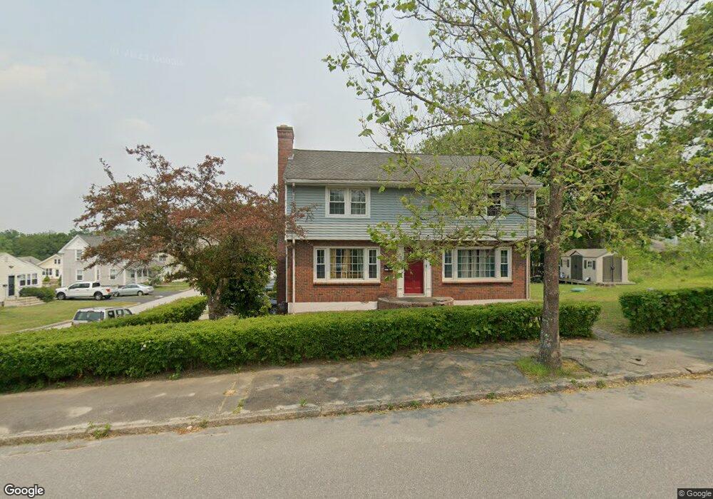
95 Farrar Ave Worcester, MA 01604
Grafton Hill NeighborhoodEstimated Value: $507,000 - $536,000
4
Beds
3
Baths
1,995
Sq Ft
$262/Sq Ft
Est. Value
About This Home
This home is located at 95 Farrar Ave, Worcester, MA 01604 and is currently estimated at $521,950, approximately $261 per square foot. 95 Farrar Ave is a home located in Worcester County with nearby schools including Jacob Hiatt Magnet School, Chandler Magnet, and Rice Square Elementary School.
Ownership History
Date
Name
Owned For
Owner Type
Purchase Details
Closed on
Mar 31, 2020
Sold by
Mcgrory Kathleen
Bought by
Baah Osei
Current Estimated Value
Purchase Details
Closed on
Apr 17, 2014
Sold by
Austin Anne M and Hasson Barbara J
Bought by
Mcgrory Kathleen G and Mcgrory Kathleen M
Create a Home Valuation Report for This Property
The Home Valuation Report is an in-depth analysis detailing your home's value as well as a comparison with similar homes in the area
Home Values in the Area
Average Home Value in this Area
Purchase History
| Date | Buyer | Sale Price | Title Company |
|---|---|---|---|
| Baah Osei | $300,000 | None Available | |
| Mcgrory Kathleen G | $120,000 | -- |
Source: Public Records
Tax History Compared to Growth
Tax History
| Year | Tax Paid | Tax Assessment Tax Assessment Total Assessment is a certain percentage of the fair market value that is determined by local assessors to be the total taxable value of land and additions on the property. | Land | Improvement |
|---|---|---|---|---|
| 2025 | $6,125 | $464,400 | $117,700 | $346,700 |
| 2024 | $5,992 | $435,800 | $117,700 | $318,100 |
| 2023 | $5,775 | $402,700 | $102,400 | $300,300 |
| 2022 | $5,167 | $339,700 | $81,900 | $257,800 |
| 2021 | $5,052 | $310,300 | $65,500 | $244,800 |
| 2020 | $4,757 | $279,800 | $65,500 | $214,300 |
| 2019 | $4,581 | $254,500 | $58,900 | $195,600 |
| 2018 | $4,552 | $240,700 | $58,900 | $181,800 |
| 2017 | $4,374 | $227,600 | $58,900 | $168,700 |
| 2016 | $4,353 | $211,200 | $42,900 | $168,300 |
| 2015 | $4,239 | $211,200 | $42,900 | $168,300 |
| 2014 | $4,127 | $211,200 | $42,900 | $168,300 |
Source: Public Records
Map
Nearby Homes
- 573 Grafton St
- 78 Dana Ave
- 169 Fairmont Ave
- 247 Pilgrim Ave
- 121 Pilgrim Ave
- 10 Lamar Ave
- 91 Standish St
- 17 Plantation St
- 94 Massasoit Rd
- 3 Bowker St
- 423 Grafton St Unit 7
- 68 Dartmouth St
- 4 Everton Ave
- 10 Almont Ave
- 62 Allston Ave
- 21-23 Maranda St
- 25-27 Maranda St
- 133 Derby St
- 8 Beaumont Rd
- 93 Plantation St
- 95 Farrar Ave Unit 1
- 95 Farrar Ave Unit SF
- 158 Dana Ave
- 101 Farrar Ave
- 48 Bedford Ave
- 52B Bedford Ave
- 52A Bedford Ave
- 160 Dana Ave
- 91 Farrar Ave
- 46 Bedford Ave
- 102 Farrar Ave
- 51 Bedford Ave
- 3 Vig Way
- Business for Sale
- 100 Confidential St
- 394 Confidential
- 123 Confidential Ave
- 170 Dana Ave
- 47 Bedford Ave
- 53 Bedford Ave