Estimated Value: $139,000 - $210,000
3
Beds
2
Baths
1,272
Sq Ft
$145/Sq Ft
Est. Value
About This Home
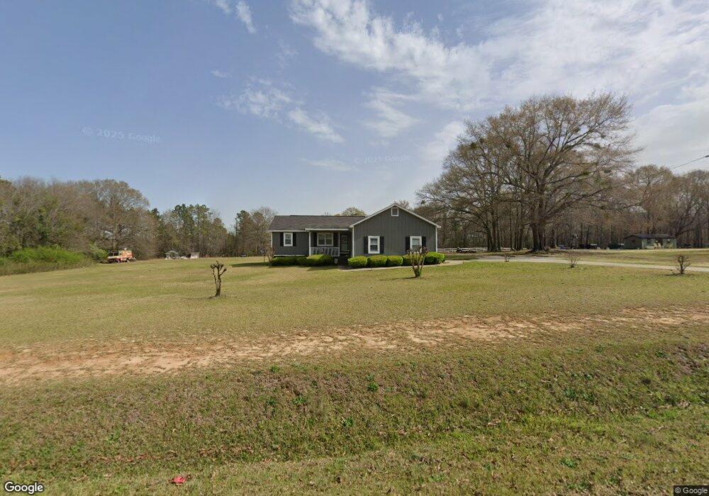
This home is located at 95 Kay Rd, Byron, GA 31008 and is currently estimated at $184,043, approximately $144 per square foot. 95 Kay Rd is a home located in Peach County with nearby schools including Kay Road Elementary School, Fort Valley Middle School, and Peach County High School.
Ownership History
Date
Name
Owned For
Owner Type
Purchase Details
Closed on
Jun 25, 1999
Sold by
First Liberty Bank
Bought by
Grace John Henry and Grace Mary S
Current Estimated Value
Purchase Details
Closed on
Apr 6, 1999
Sold by
Grace John H
Bought by
First Liberty Bank
Purchase Details
Closed on
Oct 7, 1997
Bought by
Grace John H and Grace Mary S
Purchase Details
Closed on
Mar 31, 1994
Bought by
Lowe Daren and Lowe Rhonda
Create a Home Valuation Report for This Property
The Home Valuation Report is an in-depth analysis detailing your home's value as well as a comparison with similar homes in the area
Home Values in the Area
Average Home Value in this Area
Purchase History
| Date | Buyer | Sale Price | Title Company |
|---|---|---|---|
| Grace John Henry | -- | -- | |
| First Liberty Bank | -- | -- | |
| Grace John H | -- | -- | |
| Lowe Daren | -- | -- |
Source: Public Records
Tax History
| Year | Tax Paid | Tax Assessment Tax Assessment Total Assessment is a certain percentage of the fair market value that is determined by local assessors to be the total taxable value of land and additions on the property. | Land | Improvement |
|---|---|---|---|---|
| 2025 | $1,591 | $53,600 | $16,680 | $36,920 |
| 2024 | $1,597 | $52,200 | $16,680 | $35,520 |
| 2023 | $1,436 | $46,160 | $11,480 | $34,680 |
| 2022 | $1,327 | $41,720 | $11,480 | $30,240 |
| 2021 | $1,374 | $37,480 | $11,480 | $26,000 |
| 2020 | $1,482 | $40,920 | $11,480 | $29,440 |
| 2019 | $1,460 | $40,040 | $11,480 | $28,560 |
| 2018 | $1,467 | $40,040 | $11,480 | $28,560 |
| 2017 | $1,473 | $40,040 | $11,480 | $28,560 |
| 2016 | $1,488 | $40,680 | $12,120 | $28,560 |
| 2015 | $1,419 | $38,440 | $9,880 | $28,560 |
| 2014 | $1,421 | $38,440 | $9,880 | $28,560 |
| 2013 | -- | $38,440 | $9,880 | $28,560 |
Source: Public Records
Map
Nearby Homes
- 510 Southland Trail
- 538 Southland Trail
- 0 Barker Rd Unit 243030
- 0 Barker Rd Unit 14258525
- 0 Barker Rd Unit 175053
- 251 Hampton Oaks Way
- 420 Southland Trail
- 450 Jones Rd
- 103 June Crest Ct
- 173 Preston Rd
- 109 Red Tail Cir
- 161 Rowland Cir
- 51 Allred Rd
- 204 Brandon Way
- 35 Falcon Crest Way
- 264 Lillian Dr
- Lot 6 Trojan Way
- Lot 5 Trojan Way
- 125 Peregrine Dr
- 100 Meadows Walk Dr
- 1554 Powersville Rd
- 88 Avera Ln
- 1745 Powersville Rd
- 18 Avera Ln
- 1552 Powersville Rd
- 1556 Powersville Rd
- 1731 Powersville Rd
- 253 Kay Rd
- 1502 Powersville Rd
- 1543 Powersville Rd
- 1673 Powersville Rd
- 15 Happy Ln
- 248 Avera Ln
- 1491 Powersville Rd
- 171 Avera Ln
- 90 Kimberly Dr
- 35 Kimberly Dr
- 1459 Powersville Rd
- 249 Avera Ln
- 125 Kimberly Dr
Your Personal Tour Guide
Ask me questions while you tour the home.