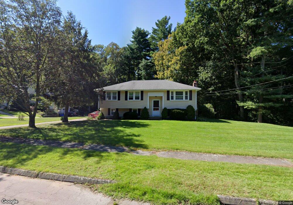
95 King James Way Wrentham, MA 02093
Estimated Value: $600,000 - $640,000
3
Beds
2
Baths
1,552
Sq Ft
$403/Sq Ft
Est. Value
About This Home
This home is located at 95 King James Way, Wrentham, MA 02093 and is currently estimated at $625,407, approximately $402 per square foot. 95 King James Way is a home located in Norfolk County with nearby schools including Delaney Elementary School, Charles E Roderick, and Foxborough Regional Charter School.
Ownership History
Date
Name
Owned For
Owner Type
Purchase Details
Closed on
Apr 29, 2008
Sold by
Clarke Judith A and Clarke Nelson E
Bought by
Clarke Ft
Current Estimated Value
Create a Home Valuation Report for This Property
The Home Valuation Report is an in-depth analysis detailing your home's value as well as a comparison with similar homes in the area
Home Values in the Area
Average Home Value in this Area
Purchase History
| Date | Buyer | Sale Price | Title Company |
|---|---|---|---|
| Clarke Ft | -- | -- |
Source: Public Records
Tax History Compared to Growth
Tax History
| Year | Tax Paid | Tax Assessment Tax Assessment Total Assessment is a certain percentage of the fair market value that is determined by local assessors to be the total taxable value of land and additions on the property. | Land | Improvement |
|---|---|---|---|---|
| 2025 | $6,211 | $535,900 | $289,100 | $246,800 |
| 2024 | $5,791 | $482,600 | $289,100 | $193,500 |
| 2023 | $5,451 | $431,900 | $262,900 | $169,000 |
| 2022 | $5,326 | $389,600 | $245,300 | $144,300 |
| 2021 | $4,522 | $321,400 | $214,100 | $107,300 |
| 2020 | $4,950 | $347,400 | $190,400 | $157,000 |
| 2019 | $4,766 | $337,500 | $190,400 | $147,100 |
| 2018 | $4,718 | $331,300 | $190,600 | $140,700 |
| 2017 | $4,480 | $314,400 | $186,900 | $127,500 |
| 2016 | $4,378 | $306,600 | $181,500 | $125,100 |
| 2015 | $4,260 | $284,400 | $174,500 | $109,900 |
| 2014 | $3,996 | $261,000 | $153,800 | $107,200 |
Source: Public Records
Map
Nearby Homes
- 1 Lorraine Metcalf Dr
- 362 East St
- 270 Dedham St
- 10 Nature View Dr
- 15 Nature View Dr
- 65 Pond St
- 319 Taunton St
- 25 Foxboro Rd
- 120 Hawes St
- 483 Thurston St
- 131 Creek St Unit 7
- 246 Forest Grove Ave
- 11 Earle Stewart Ln
- 10 W Birch Rd
- 0 W Birch Rd
- 3 Oak Rd
- Lot 3 - 14 Earle Stewart Ln
- Lot 1 - Blueberry 2 Car Plan at King Philip Estates
- Lot 8 - Blueberry 2 Car Plan at King Philip Estates
- Lot 6 - Blueberry 3 Car Plan at King Philip Estates
- 85 King James Way
- 105 King James Way
- 75 King James Way
- 183 Janice Cir
- 191 Janice Cir
- 80 King James Way
- 115 King James Way
- 125 King James Way
- 90 King James Way
- 175 Janice Cir
- 199 Janice Cir
- 70 King James Way
- 186 Janice Cir
- 140 King James Way
- 198 Janice Cir
- 201 Janice Cir
- 60 King James Way
- 167 Janice Cir
- 162 Janice Cir
- 65 King James Way