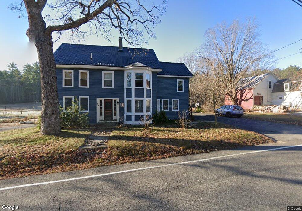
95 Main St Cornish, ME 04020
Estimated Value: $236,000 - $390,467
5
Beds
2
Baths
2,216
Sq Ft
$154/Sq Ft
Est. Value
About This Home
This home is located at 95 Main St, Cornish, ME 04020 and is currently estimated at $341,867, approximately $154 per square foot. 95 Main St is a home located in York County.
Ownership History
Date
Name
Owned For
Owner Type
Purchase Details
Closed on
Aug 25, 2023
Sold by
Riverside Cemetery Assn
Bought by
Lack Nancy J
Current Estimated Value
Purchase Details
Closed on
Jul 26, 2018
Sold by
Steed Jaime
Bought by
Steed Alexander
Purchase Details
Closed on
Sep 7, 2010
Sold by
Steed Charles T Est
Bought by
Steed Alexander C
Create a Home Valuation Report for This Property
The Home Valuation Report is an in-depth analysis detailing your home's value as well as a comparison with similar homes in the area
Home Values in the Area
Average Home Value in this Area
Purchase History
| Date | Buyer | Sale Price | Title Company |
|---|---|---|---|
| Lack Nancy J | $350 | None Available | |
| Lack Nancy J | $350 | None Available | |
| Lack Nancy J | $350 | None Available | |
| Steed Alexander | -- | -- | |
| Steed Alexander | -- | -- | |
| Steed Alexander | -- | -- | |
| Steed Alexander C | -- | -- | |
| Steed Alexander C | -- | -- |
Source: Public Records
Tax History
| Year | Tax Paid | Tax Assessment Tax Assessment Total Assessment is a certain percentage of the fair market value that is determined by local assessors to be the total taxable value of land and additions on the property. | Land | Improvement |
|---|---|---|---|---|
| 2025 | $3,737 | $395,500 | $123,700 | $271,800 |
| 2024 | $2,971 | $322,900 | $81,300 | $241,600 |
| 2023 | $2,387 | $166,900 | $48,600 | $118,300 |
| 2022 | $2,303 | $166,900 | $48,600 | $118,300 |
| 2021 | $2,253 | $166,900 | $48,600 | $118,300 |
| 2020 | $3,289 | $170,100 | $48,600 | $121,500 |
| 2019 | $3,289 | $170,100 | $48,600 | $121,500 |
| 2018 | $4,138 | $170,100 | $48,600 | $121,500 |
| 2016 | $2,193 | $170,100 | $48,600 | $121,500 |
| 2015 | $2,194 | $170,100 | $48,600 | $121,500 |
| 2014 | $2,171 | $168,300 | $48,600 | $119,700 |
Source: Public Records
Map
Nearby Homes
- 4 Bridge St
- 20 Main St
- 6-13 Main St
- 96 Maple St
- Lot #3 Jordan Heights Rd
- Lot #2 Jordan Heights Rd
- Lot #8 Jordan Heights Rd
- Lot #4 Jordan Heights Rd
- 490 S Hiram Rd
- 992 Pequawket Trail
- 198 Senator Black Rd
- 0 Durgintown Rd
- TBD Sokokis Trail N
- 174 Marston Rd
- 5 Kimball Hill Rd
- 8 Graffam Rd
- 8 - A Graffam Rd
- 50AC Sawyer Mountain Rd
- 30 Graffam Rd
- 12 Main St
Your Personal Tour Guide
Ask me questions while you tour the home.