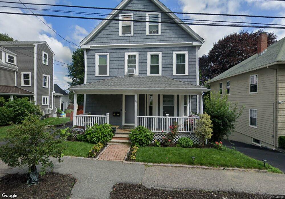
95 Maple St Unit 2 Milton, MA 02186
Columbine Cliffs NeighborhoodEstimated Value: $931,000 - $1,063,000
3
Beds
2
Baths
1,750
Sq Ft
$564/Sq Ft
Est. Value
About This Home
This home is located at 95 Maple St Unit 2, Milton, MA 02186 and is currently estimated at $986,852, approximately $563 per square foot. 95 Maple St Unit 2 is a home located in Norfolk County with nearby schools including Milton High School, Conservatory Lab Upper School, and Saint John Paul II Catholic Academy.
Ownership History
Date
Name
Owned For
Owner Type
Purchase Details
Closed on
Dec 6, 2021
Sold by
Horsman Dale A and Horsman Eric C
Bought by
Thomas Andre S and Thomas Andre K
Current Estimated Value
Home Financials for this Owner
Home Financials are based on the most recent Mortgage that was taken out on this home.
Original Mortgage
$824,785
Outstanding Balance
$758,382
Interest Rate
3.09%
Mortgage Type
FHA
Estimated Equity
$228,470
Purchase Details
Closed on
May 12, 2008
Sold by
Hsbc Bank Usa
Bought by
Horsman Dale A and Horsman Eric C
Home Financials for this Owner
Home Financials are based on the most recent Mortgage that was taken out on this home.
Original Mortgage
$328,000
Interest Rate
5.93%
Mortgage Type
Purchase Money Mortgage
Purchase Details
Closed on
Aug 22, 2007
Sold by
Milius Ronald and Hsbc Bank Usa
Bought by
Hsbc Bank Usa
Purchase Details
Closed on
Aug 29, 1996
Sold by
Edwards Clifford C
Bought by
Milius Ronald and Milius Shernell
Purchase Details
Closed on
Mar 16, 1990
Sold by
Meetinghouse Coop B
Bought by
Edwards Cliffore C
Create a Home Valuation Report for This Property
The Home Valuation Report is an in-depth analysis detailing your home's value as well as a comparison with similar homes in the area
Home Values in the Area
Average Home Value in this Area
Purchase History
| Date | Buyer | Sale Price | Title Company |
|---|---|---|---|
| Thomas Andre S | $840,000 | None Available | |
| Horsman Dale A | $410,000 | -- | |
| Hsbc Bank Usa | $490,000 | -- | |
| Milius Ronald | $149,000 | -- | |
| Edwards Cliffore C | $159,000 | -- |
Source: Public Records
Mortgage History
| Date | Status | Borrower | Loan Amount |
|---|---|---|---|
| Open | Thomas Andre S | $824,785 | |
| Previous Owner | Edwards Cliffore C | $400,000 | |
| Previous Owner | Horsman Dale A | $328,000 | |
| Previous Owner | Edwards Cliffore C | $350,000 |
Source: Public Records
Tax History Compared to Growth
Tax History
| Year | Tax Paid | Tax Assessment Tax Assessment Total Assessment is a certain percentage of the fair market value that is determined by local assessors to be the total taxable value of land and additions on the property. | Land | Improvement |
|---|---|---|---|---|
| 2025 | $9,490 | $855,700 | $362,200 | $493,500 |
| 2024 | $9,266 | $848,500 | $344,900 | $503,600 |
| 2023 | $8,682 | $761,600 | $306,600 | $455,000 |
| 2022 | $8,304 | $665,900 | $306,600 | $359,300 |
| 2021 | $8,402 | $639,900 | $297,700 | $342,200 |
| 2020 | $7,823 | $596,300 | $292,100 | $304,200 |
| 2019 | $7,244 | $549,600 | $283,600 | $266,000 |
| 2018 | $6,783 | $491,200 | $226,300 | $264,900 |
| 2017 | $6,183 | $456,000 | $215,500 | $240,500 |
| 2016 | $6,310 | $467,400 | $246,300 | $221,100 |
| 2015 | $5,469 | $392,300 | $179,600 | $212,700 |
Source: Public Records
Map
Nearby Homes
- 4 School St
- 333 Eliot St
- 131 Eliot St Unit 312
- 131 Eliot St Unit 408
- 131 Eliot St Unit 305
- 20 Herrick Dr
- 32 Columbine Rd
- 290 Central Ave
- 8-14R Temple St
- 67 Idaho St
- 32-32R Temple St
- 10 Briarcliff Terrace
- 21A High St Unit 2
- 1245 Adams St Unit B406
- 1245 Adams St Unit B210
- 23 Maryknoll St
- 24 Constitution Rd
- 56 Oakridge St
- 390 Central Ave
- 15 Fairfax Rd