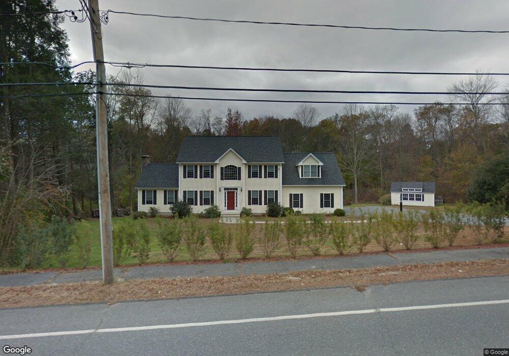
95 N Main St West Boylston, MA 01583
Estimated Value: $768,340 - $921,000
4
Beds
4
Baths
2,800
Sq Ft
$298/Sq Ft
Est. Value
About This Home
This home is located at 95 N Main St, West Boylston, MA 01583 and is currently estimated at $835,085, approximately $298 per square foot. 95 N Main St is a home located in Worcester County with nearby schools including Major Edwards Elementary School and West Boylston Junior/Senior High School.
Ownership History
Date
Name
Owned For
Owner Type
Purchase Details
Closed on
Jun 16, 2006
Sold by
Hadley John
Bought by
Marcoux David P and Ferrera Jennifer L
Current Estimated Value
Home Financials for this Owner
Home Financials are based on the most recent Mortgage that was taken out on this home.
Original Mortgage
$399,900
Outstanding Balance
$235,766
Interest Rate
6.62%
Mortgage Type
Purchase Money Mortgage
Estimated Equity
$599,319
Purchase Details
Closed on
Feb 18, 2005
Sold by
Est Anderson Gerald F and Ohlson Dorothy G
Bought by
Hadley John
Create a Home Valuation Report for This Property
The Home Valuation Report is an in-depth analysis detailing your home's value as well as a comparison with similar homes in the area
Home Values in the Area
Average Home Value in this Area
Purchase History
| Date | Buyer | Sale Price | Title Company |
|---|---|---|---|
| Marcoux David P | $499,900 | -- | |
| Hadley John | $165,000 | -- |
Source: Public Records
Mortgage History
| Date | Status | Borrower | Loan Amount |
|---|---|---|---|
| Open | Marcoux David P | $399,900 |
Source: Public Records
Tax History Compared to Growth
Tax History
| Year | Tax Paid | Tax Assessment Tax Assessment Total Assessment is a certain percentage of the fair market value that is determined by local assessors to be the total taxable value of land and additions on the property. | Land | Improvement |
|---|---|---|---|---|
| 2025 | $98 | $705,300 | $111,200 | $594,100 |
| 2024 | $9,279 | $627,800 | $111,200 | $516,600 |
| 2023 | $8,996 | $577,400 | $109,900 | $467,500 |
| 2022 | $8,472 | $479,200 | $109,900 | $369,300 |
| 2021 | $3,744 | $459,100 | $104,700 | $354,400 |
| 2020 | $7,818 | $420,800 | $104,700 | $316,100 |
| 2019 | $7,649 | $405,800 | $104,700 | $301,100 |
| 2018 | $7,258 | $387,700 | $104,700 | $283,000 |
| 2017 | $7,176 | $381,700 | $104,700 | $277,000 |
| 2016 | $7,077 | $383,600 | $97,500 | $286,100 |
| 2015 | $7,066 | $385,300 | $96,500 | $288,800 |
Source: Public Records
Map
Nearby Homes
- 16 N Main St
- 287 Laurel St
- 20 Winthrop St
- 136 Sterling St Unit A3
- 0 Boutelle Rd
- 61 Boutelle Rd
- 2 Lakeview Ave
- 18 Laurel Ave
- 21 Myrtle Ave
- 223 Worcester Rd
- 0 North St
- Lot 1 Manning St
- 156 Prospect St
- 4 Jewett Rd Unit B
- 4 Jewett Rd Unit A
- 152 Worcester St Unit 8
- 54 Maple St
- 62 Maple St
- 15 N Cove Rd
- 43 Chace Hill Rd
- @ 95 N Main St
- 85 N Main St
- 98 N Main St
- 83 N Main St
- 102 N Main St
- 105 N Main St
- 86 N Main St
- 79 N Main St
- 106 N Main St
- 82 N Main St
- 92 N Main St Unit B224
- 92 N Main St Unit B
- 92 N Main St Unit B212
- 92 N Main St Unit C102
- 92 N Main St Unit A327
- 92 N Main St Unit C208
- 92 N Main St Unit A329
- 92 N Main St Unit B244
- 92 N Main St Unit 2A
- 92 N Main St Unit 3A