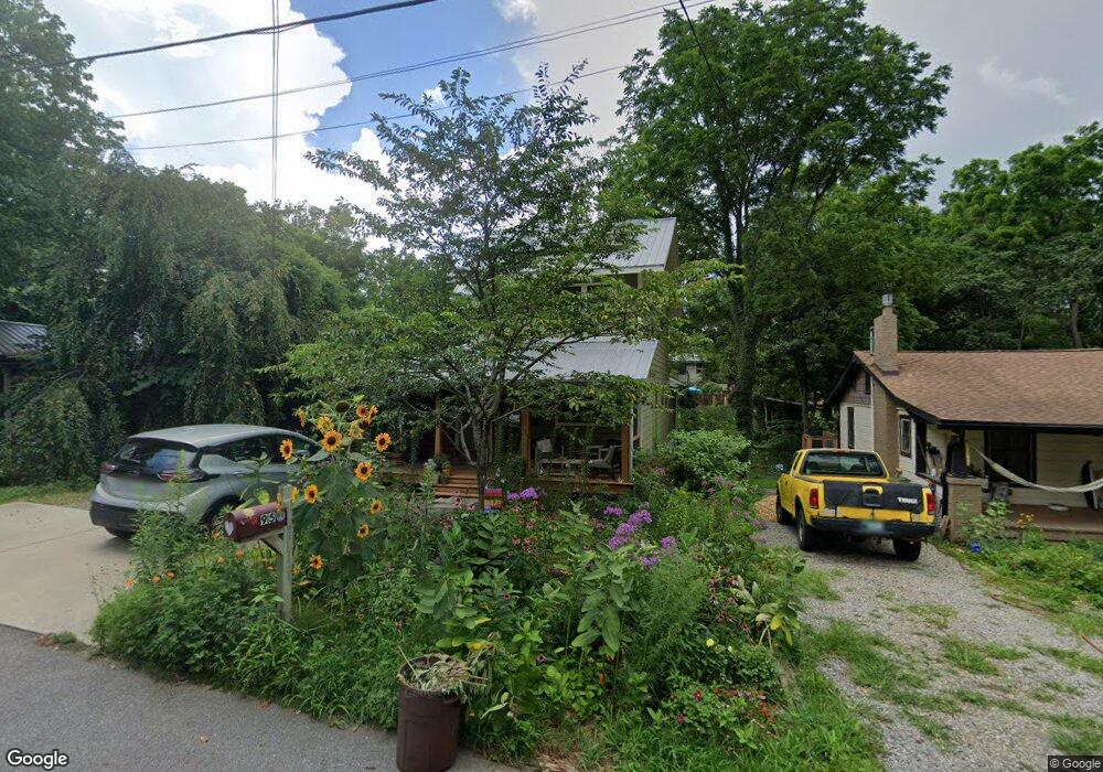
95 Nebraska St Asheville, NC 28806
West Asheville NeighborhoodEstimated Value: $763,952 - $812,000
4
Beds
4
Baths
1,584
Sq Ft
$497/Sq Ft
Est. Value
About This Home
This home is located at 95 Nebraska St, Asheville, NC 28806 and is currently estimated at $786,738, approximately $496 per square foot. 95 Nebraska St is a home with nearby schools including Hall Fletcher Elementary, Isaac Dickson Elementary, and Ira B Jones Elementary.
Ownership History
Date
Name
Owned For
Owner Type
Purchase Details
Closed on
Jun 27, 2014
Sold by
Dansie Kenneth J and Dansie Hannah C
Bought by
Vankat John A and Franke Kara S
Current Estimated Value
Home Financials for this Owner
Home Financials are based on the most recent Mortgage that was taken out on this home.
Original Mortgage
$241,600
Outstanding Balance
$187,220
Interest Rate
4.23%
Mortgage Type
Construction
Estimated Equity
$599,518
Create a Home Valuation Report for This Property
The Home Valuation Report is an in-depth analysis detailing your home's value as well as a comparison with similar homes in the area
Home Values in the Area
Average Home Value in this Area
Purchase History
| Date | Buyer | Sale Price | Title Company |
|---|---|---|---|
| Vankat John A | $52,000 | None Available |
Source: Public Records
Mortgage History
| Date | Status | Borrower | Loan Amount |
|---|---|---|---|
| Open | Vankat John A | $241,600 |
Source: Public Records
Tax History Compared to Growth
Tax History
| Year | Tax Paid | Tax Assessment Tax Assessment Total Assessment is a certain percentage of the fair market value that is determined by local assessors to be the total taxable value of land and additions on the property. | Land | Improvement |
|---|---|---|---|---|
| 2025 | $5,635 | $545,400 | $84,200 | $461,200 |
| 2024 | $5,635 | $545,400 | $84,200 | $461,200 |
| 2023 | $5,635 | $545,400 | $84,200 | $461,200 |
| 2022 | $5,439 | $545,400 | $0 | $0 |
| 2021 | $5,439 | $545,400 | $0 | $0 |
| 2020 | $4,636 | $430,100 | $0 | $0 |
| 2019 | $4,636 | $430,100 | $0 | $0 |
| 2018 | $4,636 | $430,100 | $0 | $0 |
| 2017 | $4,023 | $250,700 | $0 | $0 |
| 2016 | $3,081 | $250,700 | $0 | $0 |
| 2015 | $2,283 | $185,800 | $0 | $0 |
| 2014 | -- | $0 | $0 | $0 |
Source: Public Records
Map
Nearby Homes
- 99 Nevada Ave
- 68 1/2 Nevada Ave
- 75 Nevada Ave
- 91 Virginia Ave
- 153 State St
- 99999 State St
- 141 State St
- 199 Pennsylvania Ave
- 25 Gratitude Dr
- 56 Brevard Rd
- 89 Galax Ave
- 18 Jarrett St
- 17 & 19 Hubbard Ave
- 99999 Stewart St
- 198 Hanover St
- 140 Pennsylvania Ave
- 26 Hanover St
- 54 Louisiana Ave
- 127 Pennsylvania Ave
- 269 Virginia Ave