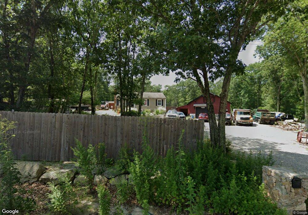
95 Old Cranston Rd Sterling, CT 06377
Estimated Value: $301,000 - $349,000
3
Beds
1
Bath
1,260
Sq Ft
$253/Sq Ft
Est. Value
About This Home
This home is located at 95 Old Cranston Rd, Sterling, CT 06377 and is currently estimated at $318,570, approximately $252 per square foot. 95 Old Cranston Rd is a home located in Windham County with nearby schools including Sterling Community School.
Ownership History
Date
Name
Owned For
Owner Type
Purchase Details
Closed on
Nov 2, 2016
Sold by
Adams Michael W
Bought by
Logan Debra A
Current Estimated Value
Home Financials for this Owner
Home Financials are based on the most recent Mortgage that was taken out on this home.
Original Mortgage
$140,404
Outstanding Balance
$112,933
Interest Rate
3.48%
Mortgage Type
Purchase Money Mortgage
Estimated Equity
$205,637
Purchase Details
Closed on
Sep 14, 2016
Sold by
Baker Sandra L
Bought by
Adams Michael W
Home Financials for this Owner
Home Financials are based on the most recent Mortgage that was taken out on this home.
Original Mortgage
$140,404
Outstanding Balance
$112,933
Interest Rate
3.48%
Mortgage Type
Purchase Money Mortgage
Estimated Equity
$205,637
Purchase Details
Closed on
Apr 21, 1995
Sold by
Berk Assoc
Bought by
Baker Sandra L
Home Financials for this Owner
Home Financials are based on the most recent Mortgage that was taken out on this home.
Original Mortgage
$98,280
Interest Rate
8.75%
Mortgage Type
Unknown
Create a Home Valuation Report for This Property
The Home Valuation Report is an in-depth analysis detailing your home's value as well as a comparison with similar homes in the area
Home Values in the Area
Average Home Value in this Area
Purchase History
| Date | Buyer | Sale Price | Title Company |
|---|---|---|---|
| Logan Debra A | $139,000 | -- | |
| Logan Debra A | $139,000 | -- | |
| Adams Michael W | -- | -- | |
| Adams Michael W | -- | -- | |
| Baker Sandra L | $26,900 | -- | |
| Baker Sandra L | $26,900 | -- |
Source: Public Records
Mortgage History
| Date | Status | Borrower | Loan Amount |
|---|---|---|---|
| Open | Baker Sandra L | $140,404 | |
| Closed | Baker Sandra L | $140,404 | |
| Previous Owner | Baker Sandra L | $98,280 |
Source: Public Records
Tax History Compared to Growth
Tax History
| Year | Tax Paid | Tax Assessment Tax Assessment Total Assessment is a certain percentage of the fair market value that is determined by local assessors to be the total taxable value of land and additions on the property. | Land | Improvement |
|---|---|---|---|---|
| 2025 | $4,052 | $184,200 | $42,600 | $141,600 |
| 2024 | $4,356 | $184,200 | $42,600 | $141,600 |
| 2023 | $4,093 | $184,200 | $42,600 | $141,600 |
| 2022 | $2,782 | $87,100 | $21,930 | $65,170 |
| 2021 | $2,782 | $87,100 | $21,930 | $65,170 |
| 2020 | $2,782 | $87,100 | $21,930 | $65,170 |
| 2019 | $2,782 | $87,100 | $21,930 | $65,170 |
| 2018 | $2,770 | $87,100 | $21,930 | $65,170 |
| 2017 | $2,759 | $86,750 | $28,580 | $58,170 |
| 2016 | $2,741 | $86,750 | $28,580 | $58,170 |
| 2015 | $2,741 | $86,750 | $28,580 | $58,170 |
| 2014 | $2,733 | $86,750 | $28,580 | $58,170 |
Source: Public Records
Map
Nearby Homes
- 581 Sterling Rd
- 1 Johns Cir
- 5 John's Cir Unit Lot 35
- 1 John's Cir Unit Lot 37
- 8 John's Cir Unit Lot 33
- 4 Johns Cir Unit Lot 31
- 7 Johns Cir Unit Lot 34
- 35 River Rd
- 38 Deerfield Dr
- 197 Church St
- 24 River Rd
- 18 Ledge Hill Rd
- 126 Pine Hill Rd
- 367 Pine Hill Rd
- 58 New Rd
- 10 Ralph St
- 532 Lewis Farm Rd
- 0 Rice City Rd
- 92 Lake St
- 181 Snake Meadow Rd
- 77 Old Cranston Rd
- 92 Old Cranston Rd
- 84 Old Cranston Rd
- 87 Old Cranston Rd
- 73 Old Cranston Rd
- 90 Old Cranston Rd
- 81 Old Cranston Rd
- 78 Old Cranston Rd
- 61 Old Cranston Rd
- 110 Old Cranston Rd
- 70 Old Cranston Rd
- 53 Old Cranston Rd
- 58 Old Cranston Rd
- 41 Old Cranston Rd
- 50 Old Cranston Rd
- 42 Old Cranston Rd
- 31 Old Cranston Rd
- 34 Old Cranston Rd
- 21 Old Cranston Rd
- 30 Old Cranston Rd