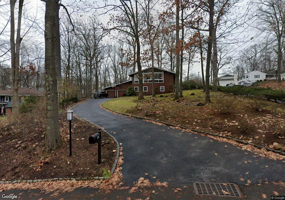
95 Pine Grove Rd Berkeley Heights, NJ 07922
Estimated Value: $1,012,804 - $1,136,000
--
Bed
--
Bath
2,632
Sq Ft
$407/Sq Ft
Est. Value
About This Home
This home is located at 95 Pine Grove Rd, Berkeley Heights, NJ 07922 and is currently estimated at $1,071,951, approximately $407 per square foot. 95 Pine Grove Rd is a home located in Union County with nearby schools including Columbia Middle School and Governor Livingston High School.
Ownership History
Date
Name
Owned For
Owner Type
Purchase Details
Closed on
Aug 25, 2009
Sold by
Maguire Kathleen
Bought by
Roder Glenn H and Roder Sharon M
Current Estimated Value
Home Financials for this Owner
Home Financials are based on the most recent Mortgage that was taken out on this home.
Original Mortgage
$300,000
Outstanding Balance
$195,999
Interest Rate
5.17%
Mortgage Type
New Conventional
Estimated Equity
$875,952
Purchase Details
Closed on
May 17, 1996
Sold by
High Oaks Development Corp
Bought by
Ppak Inc
Purchase Details
Closed on
Feb 1, 1996
Sold by
High Oaks Development Corp
Bought by
Nicholas Development Group Inc
Create a Home Valuation Report for This Property
The Home Valuation Report is an in-depth analysis detailing your home's value as well as a comparison with similar homes in the area
Home Values in the Area
Average Home Value in this Area
Purchase History
| Date | Buyer | Sale Price | Title Company |
|---|---|---|---|
| Roder Glenn H | $505,000 | Chicago Title Insurance Co | |
| Ppak Inc | $135,000 | -- | |
| Nicholas Development Group Inc | $118,000 | -- |
Source: Public Records
Mortgage History
| Date | Status | Borrower | Loan Amount |
|---|---|---|---|
| Open | Roder Glenn H | $300,000 |
Source: Public Records
Tax History Compared to Growth
Tax History
| Year | Tax Paid | Tax Assessment Tax Assessment Total Assessment is a certain percentage of the fair market value that is determined by local assessors to be the total taxable value of land and additions on the property. | Land | Improvement |
|---|---|---|---|---|
| 2025 | $13,684 | $319,200 | $171,400 | $147,800 |
| 2024 | $13,486 | $319,200 | $171,400 | $147,800 |
| 2023 | $13,486 | $319,200 | $171,400 | $147,800 |
| 2022 | $13,403 | $319,200 | $171,400 | $147,800 |
| 2021 | $13,330 | $319,200 | $171,400 | $147,800 |
| 2020 | $13,400 | $319,200 | $171,400 | $147,800 |
| 2019 | $13,333 | $319,200 | $171,400 | $147,800 |
| 2018 | $13,055 | $319,200 | $171,400 | $147,800 |
| 2017 | $12,896 | $319,200 | $171,400 | $147,800 |
| 2016 | $12,669 | $319,200 | $171,400 | $147,800 |
| 2015 | $12,599 | $319,200 | $171,400 | $147,800 |
| 2014 | $12,270 | $319,200 | $171,400 | $147,800 |
Source: Public Records
Map
Nearby Homes
- 5 Berkeley Square Unit 5
- 25 Oechsner Ct
- 45 Wilson Dr
- 78 Spring Ridge Dr
- 28 Peacock Ln Unit 28
- 37 Oak Ridge Rd
- 33 Bristol Ct
- 220 Horseshoe Rd
- 27 Angela Way Unit 727
- 566 Plainfield Ave
- 235 Plainfield Ave
- 3 Cottage Ct Unit 3
- 78 Twin Falls Rd
- 30 Robbins Ave
- 63 Snyder Ave
- 62 Springholm Dr Unit 62
- 46 Snyder Ave
- 217 Lincoln St
- 41 Meadowview Ln
- 43 Kuntz Ave
- 103 Pine Grove Rd
- 2 High Oaks Dr
- 1 High Oaks Dr
- 102 Pine Grove Rd
- 3 High Oaks Dr
- 111 Pine Grove Rd
- 63 Pine Grove Rd
- 95 Sycamore Ave
- 76 Old Cannon Rd
- 100 Pine Grove Rd
- 66 Old Cannon Rd
- 5 High Oaks Dr
- 87 Sycamore Ave
- 74 Pine Grove Rd
- 80 Old Cannon Rd
- 60 Old Cannon Rd
- 83 Sycamore Ave
- 112 Pine Grove Rd
- 116 Pine Grove Rd
- 15 Coachman Ct