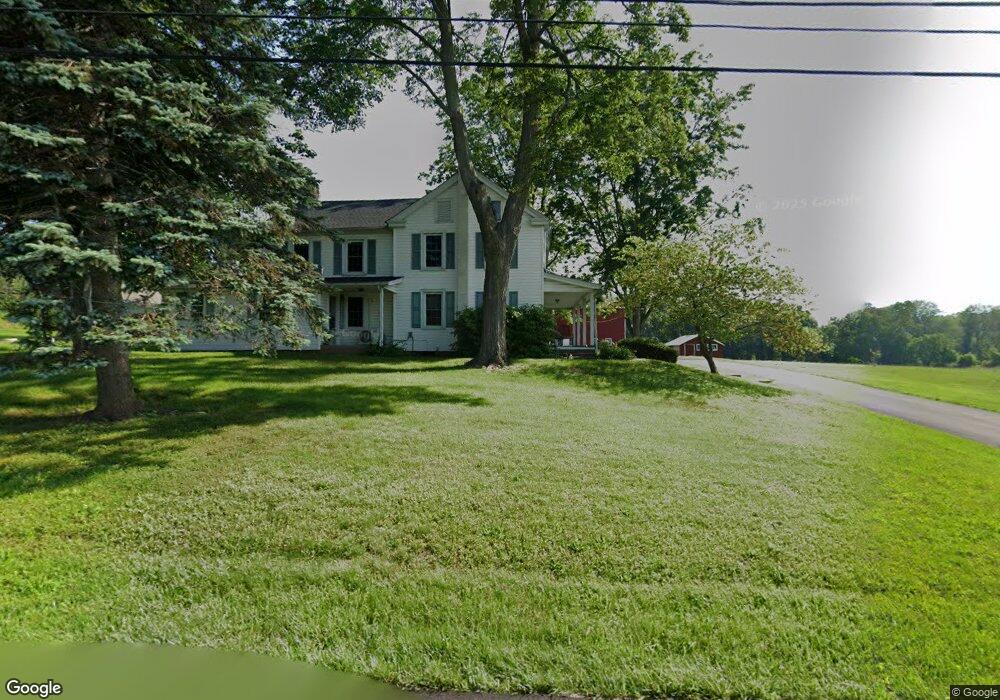
95 Rickert Rd Doylestown, PA 18901
Estimated Value: $982,000 - $1,248,726
9
Beds
8
Baths
6,710
Sq Ft
$165/Sq Ft
Est. Value
About This Home
This home is located at 95 Rickert Rd, Doylestown, PA 18901 and is currently estimated at $1,104,432, approximately $164 per square foot. 95 Rickert Rd is a home located in Bucks County with nearby schools including Doyle El School, Lenape Middle School, and Central Bucks High School-West.
Ownership History
Date
Name
Owned For
Owner Type
Purchase Details
Closed on
Aug 30, 2021
Sold by
Althouse Blanche G
Bought by
Nolt Todd and Nolt Jessica A
Current Estimated Value
Home Financials for this Owner
Home Financials are based on the most recent Mortgage that was taken out on this home.
Original Mortgage
$552,000
Outstanding Balance
$497,072
Interest Rate
2.7%
Mortgage Type
Purchase Money Mortgage
Estimated Equity
$607,360
Purchase Details
Closed on
Apr 28, 1976
Sold by
Althouse Wilmer B
Bought by
Althouse Vernon H and Althouse Blanche G
Create a Home Valuation Report for This Property
The Home Valuation Report is an in-depth analysis detailing your home's value as well as a comparison with similar homes in the area
Home Values in the Area
Average Home Value in this Area
Purchase History
| Date | Buyer | Sale Price | Title Company |
|---|---|---|---|
| Nolt Todd | $690,000 | None Available | |
| Althouse Vernon H | -- | -- |
Source: Public Records
Mortgage History
| Date | Status | Borrower | Loan Amount |
|---|---|---|---|
| Open | Nolt Todd | $552,000 |
Source: Public Records
Tax History
| Year | Tax Paid | Tax Assessment Tax Assessment Total Assessment is a certain percentage of the fair market value that is determined by local assessors to be the total taxable value of land and additions on the property. | Land | Improvement |
|---|---|---|---|---|
| 2025 | $9,901 | $83,200 | $19,090 | $64,110 |
| 2024 | $9,901 | $55,950 | $21,880 | $34,070 |
| 2023 | $9,441 | $55,950 | $21,880 | $34,070 |
| 2022 | $9,336 | $55,950 | $21,880 | $34,070 |
| 2021 | $9,144 | $55,950 | $21,880 | $34,070 |
| 2020 | $9,102 | $55,950 | $21,880 | $34,070 |
| 2019 | $9,004 | $55,950 | $21,880 | $34,070 |
| 2018 | $8,976 | $55,950 | $21,880 | $34,070 |
| 2017 | $8,906 | $55,950 | $21,880 | $34,070 |
| 2016 | $8,850 | $55,950 | $21,880 | $34,070 |
| 2015 | -- | $54,160 | $21,880 | $32,280 |
| 2014 | -- | $54,160 | $21,880 | $32,280 |
Source: Public Records
Map
Nearby Homes
- 3642 Nancy Ward Cir Unit 43
- 3688 Christopher Day Rd
- 4645 Louise Saint Claire Dr
- 3904 Captain Molly Cir Unit 148
- 807 N Broad St
- 3765 William Daves Rd
- 3765 Christopher Day Rd
- 4 Ren Way
- 6 Edison Ln Unit 1
- 117 Cottonwood Ct
- 3799 Jacob Stout Rd Unit 1
- 225 Chestnut Valley Dr
- 4748 Bishop Cir
- 3838 Jacob Stout Rd
- 3910 Cephas Child Rd Unit 6
- 3970 Salome Rd
- 215 N Franklin St
- 121 Conestoga Dr
- 102 Clear Springs Ct
- Lot 6 Henry Ct
- 013-004 Rickert Rd
- 00 Rickert Rd
- 101 Pine Mill Cir
- 95 Pine Mill Cir
- 56 Rickert Rd
- 107 Pine Mill Cir
- 89 Pine Mill Cir
- 83 Pine Mill Cir
- 135 Rickert Rd
- 113 Pine Mill Cir
- 72 Pine Mill Cir
- 77 Pine Mill Cir
- 120 Pine Mill Cir
- 119 Pine Mill Cir
- 66 Pine Mill Cir
- 71 Pine Mill Cir
- 125 Pine Mill Cir
- 147 Rickert Rd
- 126 Pine Mill Cir
- 60 Pine Mill Cir
Your Personal Tour Guide
Ask me questions while you tour the home.