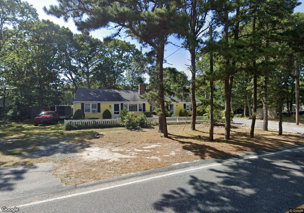
95 S Yarmouth Rd Dennis, MA 02638
Dennis Village NeighborhoodEstimated Value: $616,000 - $724,000
4
Beds
2
Baths
1,612
Sq Ft
$408/Sq Ft
Est. Value
About This Home
This home is located at 95 S Yarmouth Rd, Dennis, MA 02638 and is currently estimated at $657,607, approximately $407 per square foot. 95 S Yarmouth Rd is a home located in Barnstable County with nearby schools including Dennis-Yarmouth Regional High School and St. Pius X. School.
Create a Home Valuation Report for This Property
The Home Valuation Report is an in-depth analysis detailing your home's value as well as a comparison with similar homes in the area
Home Values in the Area
Average Home Value in this Area
Tax History Compared to Growth
Tax History
| Year | Tax Paid | Tax Assessment Tax Assessment Total Assessment is a certain percentage of the fair market value that is determined by local assessors to be the total taxable value of land and additions on the property. | Land | Improvement |
|---|---|---|---|---|
| 2025 | $2,453 | $566,500 | $218,400 | $348,100 |
| 2024 | $2,273 | $517,700 | $210,000 | $307,700 |
| 2023 | $2,061 | $441,300 | $161,600 | $279,700 |
| 2022 | $2,001 | $357,400 | $145,500 | $211,900 |
| 2021 | $2,199 | $364,700 | $142,700 | $222,000 |
| 2020 | $2,231 | $365,700 | $155,700 | $210,000 |
| 2019 | $2,253 | $365,100 | $190,800 | $174,300 |
| 2018 | $1,804 | $284,600 | $145,300 | $139,300 |
| 2017 | $1,715 | $278,900 | $145,300 | $133,600 |
| 2016 | $1,646 | $252,100 | $145,300 | $106,800 |
| 2015 | $1,613 | $252,100 | $145,300 | $106,800 |
| 2014 | $1,447 | $227,900 | $121,100 | $106,800 |
Source: Public Records
Map
Nearby Homes
- 59 Route 6a Unit 29-4
- 268 Main St
- 6 Nimble Hill Dr
- 6 Match Point
- 13 Covey Dr
- 20 Trophy Ln
- 15 Follins Pond Rd
- 17 Nottingham Dr
- 6 Thomas Ct
- 64 Kates Path
- 15 Signal Hill Dr
- 42 John Hall Cartway Unit 42
- 19 John Halls Cartpath Village Unit E
- 4 Ebb Rd
- 19 John Hall Cartway Unit E
- 228 Kates Path
- 35 Crown Grant Dr
- 17 Kates Path Unit A
- 11 Uncle Stanleys Way
- 0 S Yarmouth Rd
- 66 Captain Prestons Rd
- 98 S Yarmouth Rd
- 103 S Yarmouth Rd
- 87 S Yarmouth Rd
- 94 S Yarmouth Rd
- 74 Captain Prestons Rd
- 79 Capt Preston's Rd
- 58 Captain Prestons Rd
- 90 S Yarmouth Rd
- 90 S Yarmouth Rd Unit 2
- 74 Captain Preston
- 104 S Yarmouth Rd
- 47 Flax St
- 47 Flax St Unit 2
- 47 Flax St Unit A-B
- 51 Flax St
- 73 Captain Prestons Rd
- 103 S Sou Yarmouth
- 65 Captain Prestons Rd