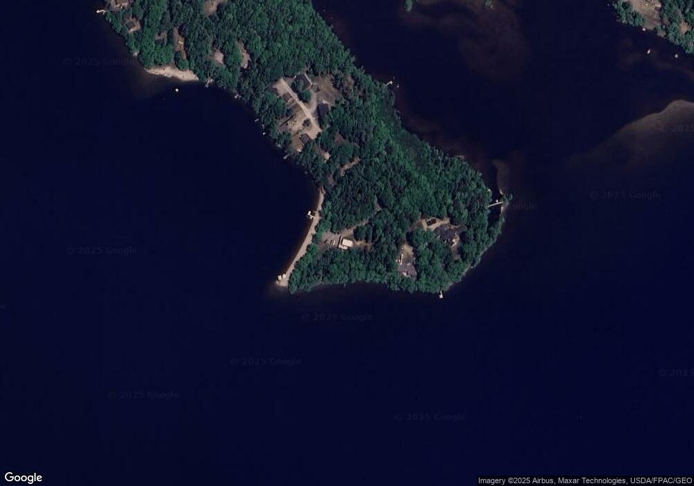
95 Sandy Point Way Ellsworth, ME 04605
Estimated Value: $521,000 - $762,000
2
Beds
2
Baths
1,288
Sq Ft
$495/Sq Ft
Est. Value
About This Home
This home is located at 95 Sandy Point Way, Ellsworth, ME 04605 and is currently estimated at $637,429, approximately $494 per square foot. 95 Sandy Point Way is a home with nearby schools including Sumner Memorial High School.
Ownership History
Date
Name
Owned For
Owner Type
Purchase Details
Closed on
Nov 26, 2018
Sold by
Smith Michelle Q and Smith Michelle Q
Bought by
Smith Ft
Current Estimated Value
Purchase Details
Closed on
Jul 31, 2013
Sold by
Stanley Kathryn L and Quinn Kathryn L
Bought by
Smith Carl S and Smith Michelle L
Home Financials for this Owner
Home Financials are based on the most recent Mortgage that was taken out on this home.
Original Mortgage
$220,000
Outstanding Balance
$160,690
Interest Rate
3.95%
Mortgage Type
New Conventional
Estimated Equity
$476,739
Create a Home Valuation Report for This Property
The Home Valuation Report is an in-depth analysis detailing your home's value as well as a comparison with similar homes in the area
Home Values in the Area
Average Home Value in this Area
Purchase History
| Date | Buyer | Sale Price | Title Company |
|---|---|---|---|
| Smith Ft | -- | -- | |
| Smith Carl S | -- | -- | |
| Smith Carl S | -- | -- | |
| Smith Carl S | -- | -- | |
| Smith Carl S | -- | -- | |
| Smith Ft | -- | -- | |
| Smith Carl S | -- | -- |
Source: Public Records
Mortgage History
| Date | Status | Borrower | Loan Amount |
|---|---|---|---|
| Open | Smith Carl S | $220,000 | |
| Closed | Smith Carl S | $0 |
Source: Public Records
Tax History Compared to Growth
Tax History
| Year | Tax Paid | Tax Assessment Tax Assessment Total Assessment is a certain percentage of the fair market value that is determined by local assessors to be the total taxable value of land and additions on the property. | Land | Improvement |
|---|---|---|---|---|
| 2024 | $8,804 | $504,500 | $265,625 | $238,875 |
| 2023 | $7,858 | $454,200 | $255,000 | $199,200 |
| 2022 | $7,131 | $454,200 | $255,000 | $199,200 |
| 2021 | $6,565 | $364,100 | $212,500 | $151,600 |
| 2020 | $6,806 | $362,600 | $212,500 | $150,100 |
| 2019 | $6,821 | $362,600 | $212,500 | $150,100 |
| 2018 | $6,614 | $362,600 | $212,500 | $150,100 |
| 2017 | $6,491 | $361,200 | $212,500 | $148,700 |
| 2016 | $6,232 | $352,500 | $203,800 | $148,700 |
| 2015 | $6,239 | $352,500 | $203,800 | $148,700 |
| 2014 | $5,799 | $352,500 | $203,800 | $148,700 |
| 2012 | $5,446 | $352,500 | $203,800 | $148,700 |
Source: Public Records
Map
Nearby Homes
- 235 Kotagiri Way
- 627 Green Lake Rd
- 20 Upper Boggy Brook Rd
- 394 Green Lake Rd
- Lot 6 Keefe Way
- 1400 Bangor Rd
- 0 Branch Pond Rd
- 00 Green Lake Rd
- M6, L3 Beech Hill Pond Rd
- Lot 5 Foggy Ridge Way
- Lot 9 Foggy Ridge Way
- 18 Tamarac Rd
- 52 Shore Path
- 161 Black Island Way
- 1802 Bangor Rd
- Lot 24 Grand View Dr
- 459 W West Shore Rd
- 0 Nevells Way
- 461 W Shore Rd
- 309 Gary Moore Rd
- 99 Sandy Point Way
- 81 Sandy Point Way
- 100 Sandy Point Way
- 77 Sandy Point Way
- 98 Sandy Point Way
- 75 Sandy Point Way
- 69 Sandy Point Way
- 66 Sandy Point Way
- 63-75 Sandy Point Way
- 63 Sandy Point Way Unit 2
- 63 Sandy Point Way Unit 1
- 63 Sandy Point Way
- 57 Sandy Point Way
- 0 Sandy Point Way
- 47 Sandy Point Way
- 43 Sandy Point Way
- 11 Sailor Way
- LOT 38 Sandy Point Rd
- LOT 38 Sandy Point
- 37 Sandy Point Way
