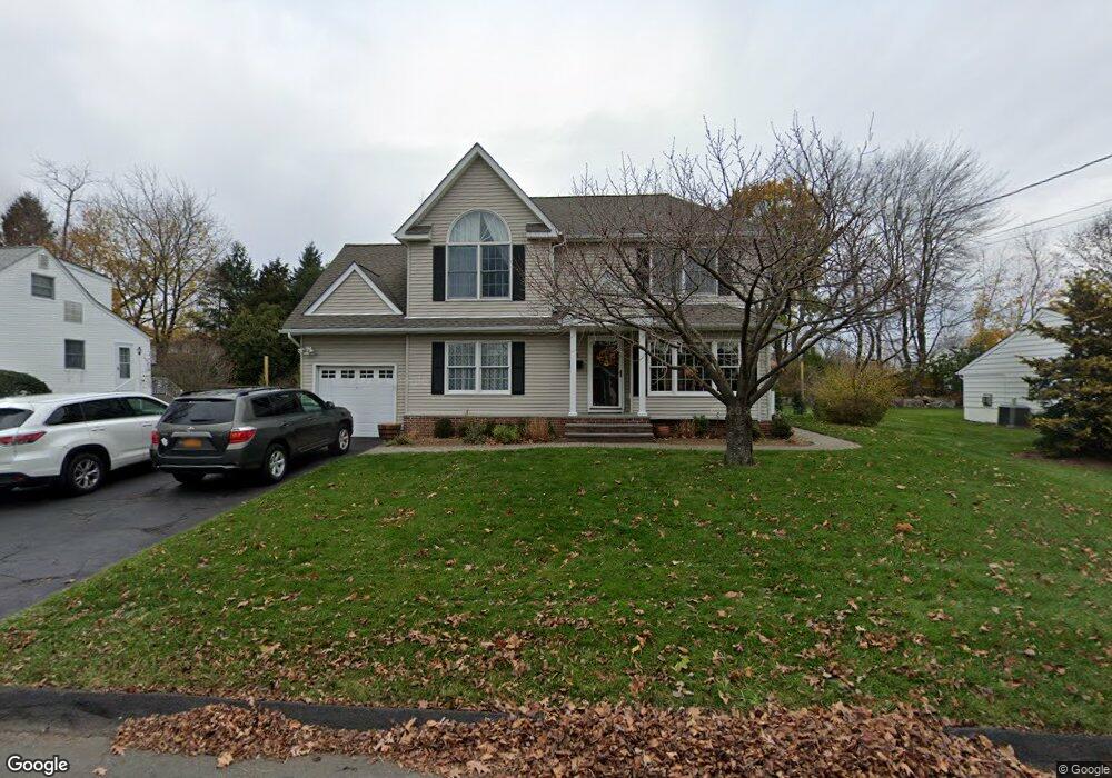
95 Secor Blvd Pearl River, NY 10965
Estimated Value: $714,000 - $754,000
4
Beds
2
Baths
2,117
Sq Ft
$344/Sq Ft
Est. Value
About This Home
This home is located at 95 Secor Blvd, Pearl River, NY 10965 and is currently estimated at $727,929, approximately $343 per square foot. 95 Secor Blvd is a home located in Rockland County with nearby schools including Pearl River High School and St Margaret School.
Ownership History
Date
Name
Owned For
Owner Type
Purchase Details
Closed on
Dec 15, 2015
Sold by
Macdonald James O and Macdonald Cathleen F
Bought by
Macdonald Cathleen F
Current Estimated Value
Purchase Details
Closed on
Apr 17, 2000
Sold by
Macdonald James O
Bought by
Macdonald James O and Macdonald Cathleen F
Home Financials for this Owner
Home Financials are based on the most recent Mortgage that was taken out on this home.
Original Mortgage
$207,200
Interest Rate
8.26%
Create a Home Valuation Report for This Property
The Home Valuation Report is an in-depth analysis detailing your home's value as well as a comparison with similar homes in the area
Home Values in the Area
Average Home Value in this Area
Purchase History
| Date | Buyer | Sale Price | Title Company |
|---|---|---|---|
| Macdonald Cathleen F | -- | Madison Title Agency Llc | |
| Macdonald James O | -- | Fidelity National Title Ins | |
| Macdonald James O | $259,000 | Fidelity National Title Ins |
Source: Public Records
Mortgage History
| Date | Status | Borrower | Loan Amount |
|---|---|---|---|
| Previous Owner | Macdonald James O | $207,200 |
Source: Public Records
Tax History Compared to Growth
Tax History
| Year | Tax Paid | Tax Assessment Tax Assessment Total Assessment is a certain percentage of the fair market value that is determined by local assessors to be the total taxable value of land and additions on the property. | Land | Improvement |
|---|---|---|---|---|
| 2024 | $14,340 | $181,400 | $39,200 | $142,200 |
| 2023 | $14,340 | $181,400 | $39,200 | $142,200 |
| 2022 | $4,532 | $181,400 | $39,200 | $142,200 |
| 2021 | $12,149 | $181,400 | $39,200 | $142,200 |
| 2020 | $11,494 | $181,400 | $39,200 | $142,200 |
| 2019 | $4,212 | $181,400 | $39,200 | $142,200 |
| 2018 | $10,877 | $181,400 | $39,200 | $142,200 |
| 2017 | $10,497 | $181,400 | $39,200 | $142,200 |
| 2016 | $10,167 | $181,400 | $39,200 | $142,200 |
| 2015 | -- | $181,400 | $39,200 | $142,200 |
| 2014 | -- | $181,400 | $39,200 | $142,200 |
Source: Public Records
Map
Nearby Homes
- 110 Orchid Dr
- 4 Brown Dr
- 452 Somerset Dr Unit F
- 432 Somerset Dr Unit M
- 854 E Crooked Hill Rd Unit 854
- 165 Forest Ave
- 87 Pinto Rd
- 46 Cara Dr
- 250 Blauvelt Rd
- 14 Staubitz Ave
- 137 Blauvelt Rd
- 352 Holt Dr
- 20 E Palisades Ave
- 26 E George Ave
- 73 Bogert Ave
- 15 Pacific Ave
- 84 Highview Ave
- 12 Lilac Ct
- 86 Braunsdorf Rd
- 99 E Washington Ave