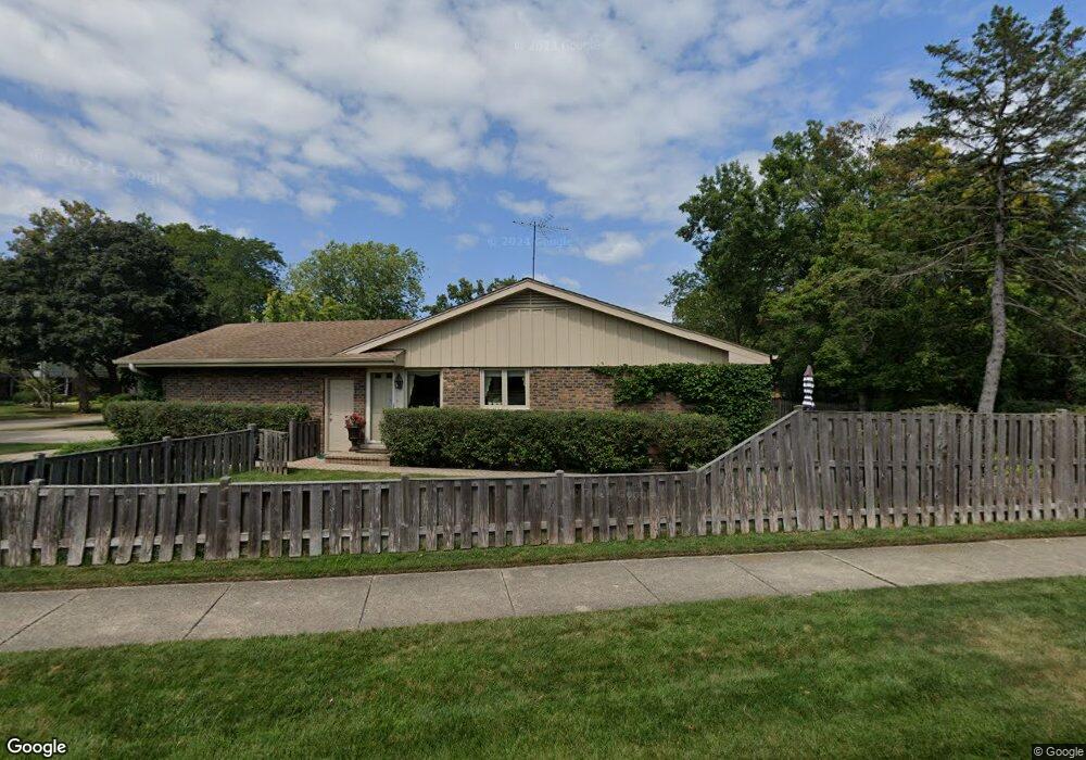
95 Sequoia Ln Deerfield, IL 60015
Briarwood NeighborhoodEstimated Value: $694,409 - $793,000
4
Beds
2
Baths
2,045
Sq Ft
$363/Sq Ft
Est. Value
About This Home
This home is located at 95 Sequoia Ln, Deerfield, IL 60015 and is currently estimated at $742,352, approximately $363 per square foot. 95 Sequoia Ln is a home located in Lake County with nearby schools including Kipling Elementary School, Alan B Shepard Middle School, and Deerfield High School.
Ownership History
Date
Name
Owned For
Owner Type
Purchase Details
Closed on
Oct 29, 2003
Sold by
Levy Mark H and Levy Susan May
Bought by
North Star Trust Co and Trust #03-6608
Current Estimated Value
Purchase Details
Closed on
Apr 28, 1995
Sold by
Nbd Bank
Bought by
Levy Mark H and Levy Susan May
Home Financials for this Owner
Home Financials are based on the most recent Mortgage that was taken out on this home.
Original Mortgage
$250,000
Interest Rate
8.39%
Create a Home Valuation Report for This Property
The Home Valuation Report is an in-depth analysis detailing your home's value as well as a comparison with similar homes in the area
Home Values in the Area
Average Home Value in this Area
Purchase History
| Date | Buyer | Sale Price | Title Company |
|---|---|---|---|
| North Star Trust Co | -- | -- | |
| Levy Mark H | $325,000 | Chicago Title Insurance Co |
Source: Public Records
Mortgage History
| Date | Status | Borrower | Loan Amount |
|---|---|---|---|
| Previous Owner | Levy Mark H | $250,000 |
Source: Public Records
Tax History
| Year | Tax Paid | Tax Assessment Tax Assessment Total Assessment is a certain percentage of the fair market value that is determined by local assessors to be the total taxable value of land and additions on the property. | Land | Improvement |
|---|---|---|---|---|
| 2024 | $14,413 | $167,802 | $65,583 | $102,219 |
| 2023 | $16,119 | $161,039 | $62,940 | $98,099 |
| 2022 | $16,119 | $176,030 | $67,605 | $108,425 |
| 2021 | $15,206 | $169,716 | $65,180 | $104,536 |
| 2020 | $14,625 | $170,073 | $65,317 | $104,756 |
| 2019 | $14,290 | $169,784 | $65,206 | $104,578 |
| 2018 | $14,030 | $173,532 | $69,112 | $104,420 |
| 2017 | $13,918 | $172,979 | $68,892 | $104,087 |
| 2016 | $13,534 | $166,438 | $66,287 | $100,151 |
| 2015 | $13,247 | $156,382 | $62,282 | $94,100 |
| 2014 | $14,258 | $165,552 | $62,726 | $102,826 |
| 2012 | $13,910 | $164,092 | $62,173 | $101,919 |
Source: Public Records
Map
Nearby Homes
- 520 Standish Dr
- 215 Waukegan Rd
- 707 Brierhill Rd
- 370 Briar Ln
- 326 Briar Ln
- 1921 Beechnut Rd
- 453 Longfellow Ave
- 757 Kipling Place
- 50 Red Oak Ln
- 2140 Beechnut Rd
- 435 Kingston Terrace
- 990 Heather Rd
- 521 Deerfield Rd
- 1744 Walnut Cir
- 971 Windsor Rd
- 621 Ridge Rd
- 645 Ridge Rd
- 2065 Walnut Cir
- 501 Kelburn Rd
- 309 Ridge Rd
- 85 Sequoia Ln
- 70 Shenandoah Rd
- 75 Sequoia Ln
- 85 Shenandoah Rd
- 90 Sequoia Ln Unit 4
- 75 Shenandoah Rd
- 95 Shenandoah Rd
- 80 Sequoia Ln
- 100 Sequoia Ln
- 65 Shenandoah Rd
- 370 Shenandoah Ct
- 65 Sequoia Ln
- 105 Sequoia Ln
- 410 Standish Dr
- 55 Shenandoah Rd
- 380 Shenandoah Ct
- 110 Sequoia Ln Unit 4
- 58 W Saint Andrews Ln
- 44 W Saint Andrews Ln
- 72 W Saint Andrews Ln
Your Personal Tour Guide
Ask me questions while you tour the home.