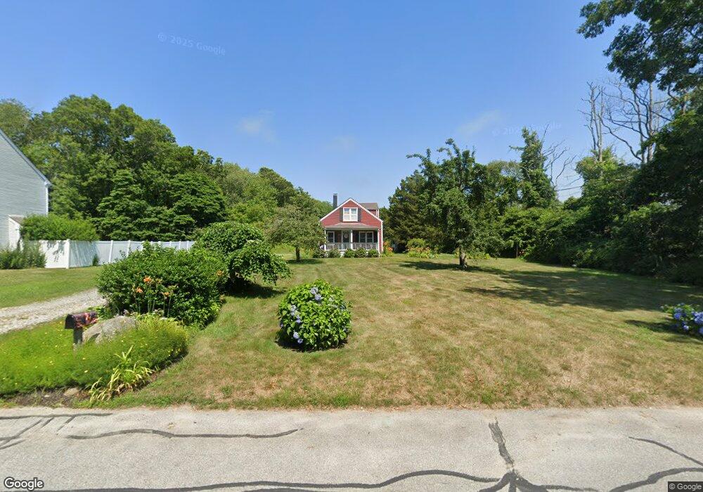
95 Shaw Rd Fairhaven, MA 02719
East Fairhaven NeighborhoodEstimated Value: $360,000 - $417,000
3
Beds
1
Bath
672
Sq Ft
$575/Sq Ft
Est. Value
About This Home
This home is located at 95 Shaw Rd, Fairhaven, MA 02719 and is currently estimated at $386,413, approximately $575 per square foot. 95 Shaw Rd is a home located in Bristol County with nearby schools including Fairhaven High School and St. Joseph School.
Ownership History
Date
Name
Owned For
Owner Type
Purchase Details
Closed on
Jul 25, 2024
Sold by
Almeida Marie A
Bought by
Almeida Marie A
Current Estimated Value
Purchase Details
Closed on
Dec 29, 2010
Sold by
Depina Ilda
Bought by
Almeida Marie A
Home Financials for this Owner
Home Financials are based on the most recent Mortgage that was taken out on this home.
Original Mortgage
$87,200
Interest Rate
4.37%
Mortgage Type
Purchase Money Mortgage
Purchase Details
Closed on
Jan 15, 2008
Sold by
Depina Ilda and Depina Lewis E
Bought by
Depina Ilda and Depina Lewis E
Create a Home Valuation Report for This Property
The Home Valuation Report is an in-depth analysis detailing your home's value as well as a comparison with similar homes in the area
Home Values in the Area
Average Home Value in this Area
Purchase History
| Date | Buyer | Sale Price | Title Company |
|---|---|---|---|
| Almeida Marie A | -- | None Available | |
| Almeida Marie A | -- | None Available | |
| Almeida Marie A | -- | -- | |
| Depina Ilda | -- | -- | |
| Almeida Marie A | -- | -- | |
| Depina Ilda | -- | -- |
Source: Public Records
Mortgage History
| Date | Status | Borrower | Loan Amount |
|---|---|---|---|
| Previous Owner | Depina Ilda | $104,000 | |
| Previous Owner | Depina Ilda | $87,200 |
Source: Public Records
Tax History
| Year | Tax Paid | Tax Assessment Tax Assessment Total Assessment is a certain percentage of the fair market value that is determined by local assessors to be the total taxable value of land and additions on the property. | Land | Improvement |
|---|---|---|---|---|
| 2025 | $7 | $306,700 | $182,000 | $124,700 |
| 2024 | $2,772 | $300,300 | $182,000 | $118,300 |
| 2023 | $2,686 | $269,900 | $159,800 | $110,100 |
| 2022 | $2,599 | $254,300 | $148,700 | $105,600 |
| 2021 | $2,476 | $219,300 | $134,800 | $84,500 |
| 2020 | $2,425 | $219,300 | $134,800 | $84,500 |
| 2019 | $2,217 | $190,000 | $112,300 | $77,700 |
| 2018 | $496 | $180,200 | $107,100 | $73,100 |
| 2017 | $2,059 | $171,000 | $107,100 | $63,900 |
| 2016 | $2,013 | $165,300 | $107,100 | $58,200 |
| 2015 | $1,993 | $164,000 | $107,100 | $56,900 |
Source: Public Records
Map
Nearby Homes
- 3 Earle St
- 421 Huttleston Ave
- 0 Whalers Way
- 28 Brant Beach Ave
- 0 Marina Dr Unit 72497908
- 0 Marina Dr Unit 72497877
- 41 Starboard Way
- 3.5 Golf St
- 190 Sconticut Neck Rd
- 33 Narragansett Blvd
- 1 Harvard St
- 15 Bayview Ave
- 27 Bayview Ave
- 0 Harbor Acres Ln - Lot B
- 58 Bayview Ave
- 9 Hitching Post Rd
- 15 Hitching Post Rd
- 21 Hitching Post Rd
- 35 North St
- 13 Park Place