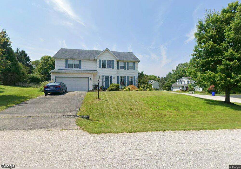
95 Smokebox Cir Stewartstown, PA 17363
Estimated Value: $420,000 - $485,000
4
Beds
3
Baths
2,648
Sq Ft
$170/Sq Ft
Est. Value
About This Home
This home is located at 95 Smokebox Cir, Stewartstown, PA 17363 and is currently estimated at $449,904, approximately $169 per square foot. 95 Smokebox Cir is a home located in York County with nearby schools including South Eastern Intermediate School, South Eastern Middle School, and Kennard-Dale High School.
Ownership History
Date
Name
Owned For
Owner Type
Purchase Details
Closed on
Jul 10, 2000
Sold by
Mortgage Guaranty Insurance Corp
Bought by
Gering Gregory J and Gering Michelle B
Current Estimated Value
Home Financials for this Owner
Home Financials are based on the most recent Mortgage that was taken out on this home.
Original Mortgage
$164,900
Interest Rate
8.28%
Purchase Details
Closed on
Nov 5, 1999
Sold by
Federal Home Loan Mortgage Corporation
Bought by
Mortgage Guaranty Insurance Corp
Purchase Details
Closed on
Aug 16, 1999
Sold by
Feyerherm Ronald C and Feyerherm Tammy L
Bought by
Federal Home Loan Mortgage Corporation
Create a Home Valuation Report for This Property
The Home Valuation Report is an in-depth analysis detailing your home's value as well as a comparison with similar homes in the area
Home Values in the Area
Average Home Value in this Area
Purchase History
| Date | Buyer | Sale Price | Title Company |
|---|---|---|---|
| Gering Gregory J | $170,000 | -- | |
| Mortgage Guaranty Insurance Corp | $171,010 | -- | |
| Federal Home Loan Mortgage Corporation | $125,000 | -- |
Source: Public Records
Mortgage History
| Date | Status | Borrower | Loan Amount |
|---|---|---|---|
| Previous Owner | Gering Gregory J | $164,900 |
Source: Public Records
Tax History Compared to Growth
Tax History
| Year | Tax Paid | Tax Assessment Tax Assessment Total Assessment is a certain percentage of the fair market value that is determined by local assessors to be the total taxable value of land and additions on the property. | Land | Improvement |
|---|---|---|---|---|
| 2025 | $7,260 | $247,260 | $53,770 | $193,490 |
| 2024 | $7,260 | $247,260 | $53,770 | $193,490 |
| 2023 | $7,260 | $247,260 | $53,770 | $193,490 |
| 2022 | $7,260 | $247,260 | $53,770 | $193,490 |
| 2021 | $7,012 | $247,260 | $53,770 | $193,490 |
| 2020 | $7,012 | $247,260 | $53,770 | $193,490 |
| 2019 | $6,988 | $247,260 | $53,770 | $193,490 |
| 2018 | $6,988 | $247,260 | $53,770 | $193,490 |
| 2017 | $6,988 | $247,260 | $53,770 | $193,490 |
| 2016 | $0 | $247,260 | $53,770 | $193,490 |
| 2015 | -- | $247,260 | $53,770 | $193,490 |
| 2014 | -- | $247,260 | $53,770 | $193,490 |
Source: Public Records
Map
Nearby Homes
- 94 Piston Ct
- 82 Piston Ct
- 18007 Dave Anne Cir
- 18010 Dave Anne Cir
- 2 S Main St
- 9 W Pennsylvania Ave
- 17 Charles Ave
- 18183 Piedmont Rd
- 13 Baneberry St
- 10 Black Oak Ct
- 150 Patterson Dr Unit 47
- 103 Hershey Cir
- 180 Patterson Dr Unit 50
- 231 Cool Spring Ln
- 4341 Forbes Dr
- 4303 Forbes Dr
- 8287 Pleasant Valley Rd
- 0 Five Forks Rd Unit PAYK2095070
- 0 Five Forks Rd Unit PAYK2095050
- 7923 Hickory Rd