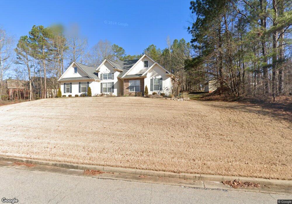
95 Stonewall Dr Covington, GA 30016
Estimated Value: $254,824 - $302,000
Studio
2
Baths
1,419
Sq Ft
$199/Sq Ft
Est. Value
About This Home
This home is located at 95 Stonewall Dr, Covington, GA 30016 and is currently estimated at $281,956, approximately $198 per square foot. 95 Stonewall Dr is a home located in Newton County with nearby schools including Livingston Elementary School, Liberty Middle School, and Alcovy High School.
Ownership History
Date
Name
Owned For
Owner Type
Purchase Details
Closed on
Mar 26, 1999
Sold by
Lance Unlimited Llc
Bought by
Thomas Latroll S
Current Estimated Value
Home Financials for this Owner
Home Financials are based on the most recent Mortgage that was taken out on this home.
Original Mortgage
$112,900
Outstanding Balance
$26,322
Interest Rate
6.82%
Mortgage Type
FHA
Estimated Equity
$255,634
Purchase Details
Closed on
Mar 25, 1998
Sold by
Harvey Aubrey W
Bought by
Lance Unlimited Llc
Home Financials for this Owner
Home Financials are based on the most recent Mortgage that was taken out on this home.
Original Mortgage
$81,750
Interest Rate
6.95%
Mortgage Type
New Conventional
Create a Home Valuation Report for This Property
The Home Valuation Report is an in-depth analysis detailing your home's value as well as a comparison with similar homes in the area
Home Values in the Area
Average Home Value in this Area
Purchase History
| Date | Buyer | Sale Price | Title Company |
|---|---|---|---|
| Thomas Latroll S | $113,900 | -- | |
| Lance Unlimited Llc | $16,900 | -- |
Source: Public Records
Mortgage History
| Date | Status | Borrower | Loan Amount |
|---|---|---|---|
| Open | Thomas Latroll S | $112,900 | |
| Previous Owner | Lance Unlimited Llc | $81,750 |
Source: Public Records
Tax History
| Year | Tax Paid | Tax Assessment Tax Assessment Total Assessment is a certain percentage of the fair market value that is determined by local assessors to be the total taxable value of land and additions on the property. | Land | Improvement |
|---|---|---|---|---|
| 2025 | $2,511 | $101,280 | $18,800 | $82,480 |
| 2024 | $2,536 | $100,240 | $18,800 | $81,440 |
| 2023 | $2,750 | $101,720 | $11,200 | $90,520 |
| 2022 | $2,028 | $75,120 | $11,200 | $63,920 |
| 2021 | $1,865 | $62,240 | $11,200 | $51,040 |
| 2020 | $1,809 | $54,520 | $9,200 | $45,320 |
| 2019 | $1,824 | $54,200 | $9,200 | $45,000 |
| 2018 | $1,788 | $52,800 | $9,200 | $43,600 |
| 2017 | $1,571 | $46,480 | $9,200 | $37,280 |
| 2016 | $1,406 | $41,680 | $5,200 | $36,480 |
| 2015 | $1,415 | $42,000 | $5,200 | $36,800 |
| 2014 | $1,300 | $38,720 | $0 | $0 |
Source: Public Records
Map
Nearby Homes
- 25 Castlehill Ct
- 70 Blackberry Ln
- 40 Belmont Cir Unit 2
- 75 Cannonade Ct
- 195 Cedar Rd
- 60 Muirfield Dr
- 230 Belmont Trail
- 15 Glen Echo Dr
- 50 Glen Echo Dr
- 585 Cowan Rd
- 66 Ellis Trail
- 179 Ellis Trail
- 205 Woodcrest Dr
- 130 Lakefront Dr
- 335 Glen Echo Dr
- 120 Woodcrest Dr
- 115 Branchwood Dr
- 10 Oaklake Ct
- 10 Barberry Cir
- 70 Countryside Ln
- 85 Stonewall Dr
- 180 Huntington St
- 20 Livingston Way
- 10 Livingston Way
- 15 Summerwood Ln
- 110 Stonewall Dr
- 80 Stonewall Dr
- 170 Huntington St
- 170 Huntington St Unit 149
- 30 Livingston Way
- 120 Stonewall Dr
- 70 Stonewall Dr Unit 134
- 70 Stonewall Dr
- 195 Huntington St
- 25 Summerwood Ln
- 160 Huntington St
- 20 Summerwood Ln
- 60 Stonewall Dr
- 230 Huntington St Unit /233
- 230 Huntington St
Your Personal Tour Guide
Ask me questions while you tour the home.