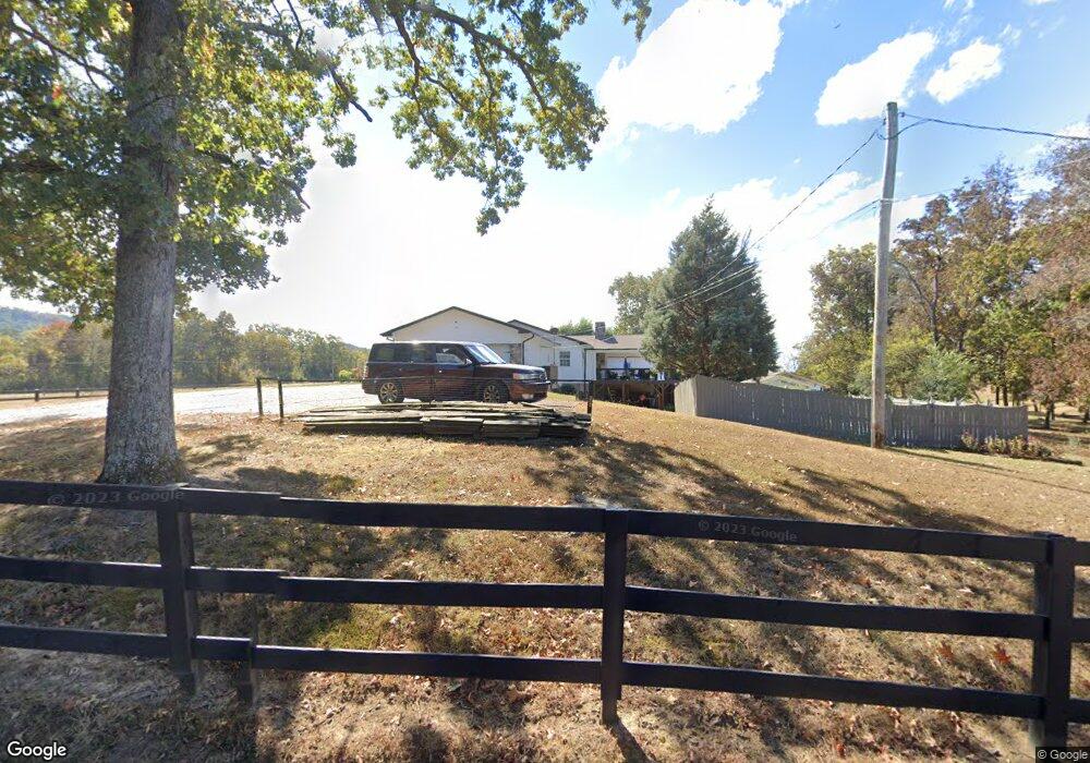
95 Swanson Rd Ringgold, GA 30736
Estimated Value: $551,284 - $667,000
5
Beds
5
Baths
3,326
Sq Ft
$186/Sq Ft
Est. Value
About This Home
This home is located at 95 Swanson Rd, Ringgold, GA 30736 and is currently estimated at $618,571, approximately $185 per square foot. 95 Swanson Rd is a home located in Catoosa County with nearby schools including Graysville Elementary School, Ringgold Middle School, and Ringgold High School.
Ownership History
Date
Name
Owned For
Owner Type
Purchase Details
Closed on
Jan 13, 2026
Sold by
Ives Steven
Bought by
Ives Steven & Theresa Revocable Living T and Theresa & Steven Ives Revocable Living T
Current Estimated Value
Purchase Details
Closed on
Sep 15, 2020
Sold by
Allison Craig P
Bought by
Ives Steven L and Ives Theresa C
Home Financials for this Owner
Home Financials are based on the most recent Mortgage that was taken out on this home.
Original Mortgage
$362,900
Interest Rate
2.9%
Mortgage Type
New Conventional
Purchase Details
Closed on
Mar 5, 2004
Bought by
Allison Craig P
Create a Home Valuation Report for This Property
The Home Valuation Report is an in-depth analysis detailing your home's value as well as a comparison with similar homes in the area
Home Values in the Area
Average Home Value in this Area
Purchase History
| Date | Buyer | Sale Price | Title Company |
|---|---|---|---|
| Ives Steven & Theresa Revocable Living T | -- | -- | |
| Ives Steven L | $382,000 | -- | |
| Allison Craig P | $150,000 | -- |
Source: Public Records
Mortgage History
| Date | Status | Borrower | Loan Amount |
|---|---|---|---|
| Previous Owner | Ives Steven L | $362,900 |
Source: Public Records
Tax History
| Year | Tax Paid | Tax Assessment Tax Assessment Total Assessment is a certain percentage of the fair market value that is determined by local assessors to be the total taxable value of land and additions on the property. | Land | Improvement |
|---|---|---|---|---|
| 2025 | $4,242 | $223,411 | $15,665 | $207,746 |
| 2024 | $4,431 | $207,767 | $8,555 | $199,212 |
| 2023 | $3,510 | $156,771 | $7,439 | $149,332 |
| 2022 | $2,658 | $118,745 | $7,085 | $111,660 |
| 2021 | $2,485 | $118,745 | $7,085 | $111,660 |
| 2020 | $1,920 | $82,980 | $6,748 | $76,232 |
| 2019 | $1,894 | $82,980 | $6,748 | $76,232 |
| 2018 | $2,050 | $82,980 | $6,748 | $76,232 |
| 2017 | $2,020 | $83,744 | $6,748 | $76,996 |
| 2016 | $1,954 | $77,183 | $6,134 | $71,049 |
| 2015 | -- | $77,183 | $6,134 | $71,049 |
| 2014 | -- | $78,989 | $7,940 | $71,049 |
| 2013 | -- | $78,989 | $7,940 | $71,049 |
Source: Public Records
Map
Nearby Homes
- 0 Swanson Rd Unit 1517125
- 643 Cardinal Rd
- 195 Mallard Hill
- 35 S Links Dr
- 312 Autumn Trail
- 59 Briarwood Dr
- 28 N Links Dr
- 2119 Ooltewah Ringgold Rd
- 467 Wisley Way
- 464 Blue Jay Pkwy
- 19 Laura Ln
- 1926 Windstone Dr
- 2049 Saunders Rd
- 106 Woodpecker Place
- 0 Blue Jay Pkwy Unit 10577001
- 0 Saunders Rd Unit 1527205
- 1768 Windstone Dr
- 9235 Shay Cove
- 2311 Saunders Rd
- 267 Quail Run Ln
- 1215 Ooltewah Ringgold Rd
- 1183 Ooltewah Ringgold Rd
- 0 Swanson Rd Unit RTC2918462
- 0 Swanson Rd Unit RTC2945385
- 0 Swanson Rd Unit RTC2945386
- 0 Swanson Rd Unit RTC2945355
- 0 Swanson Rd Unit 1508732
- 0 Swanson Rd Unit RTC2797620
- 0 Swanson Rd Unit RTC2797618
- 0 Swanson Rd Unit RTC2797619
- 0 Swanson Rd Unit RTC2771042
- 0 Swanson Rd Unit 955199
- 0 Swanson Rd Unit RTC2536026
- 0 Swanson Rd Unit 1501686
- 0 Swanson Rd Unit RTC2720189
- 0 Swanson Rd Unit 1387737
- 0 Swanson Rd Unit RTC2589890
- 0 Swanson Rd Unit 1374224
- 0 Swanson Rd Unit RTC2530455
- 0 Swanson Rd Unit 1330431
Your Personal Tour Guide
Ask me questions while you tour the home.