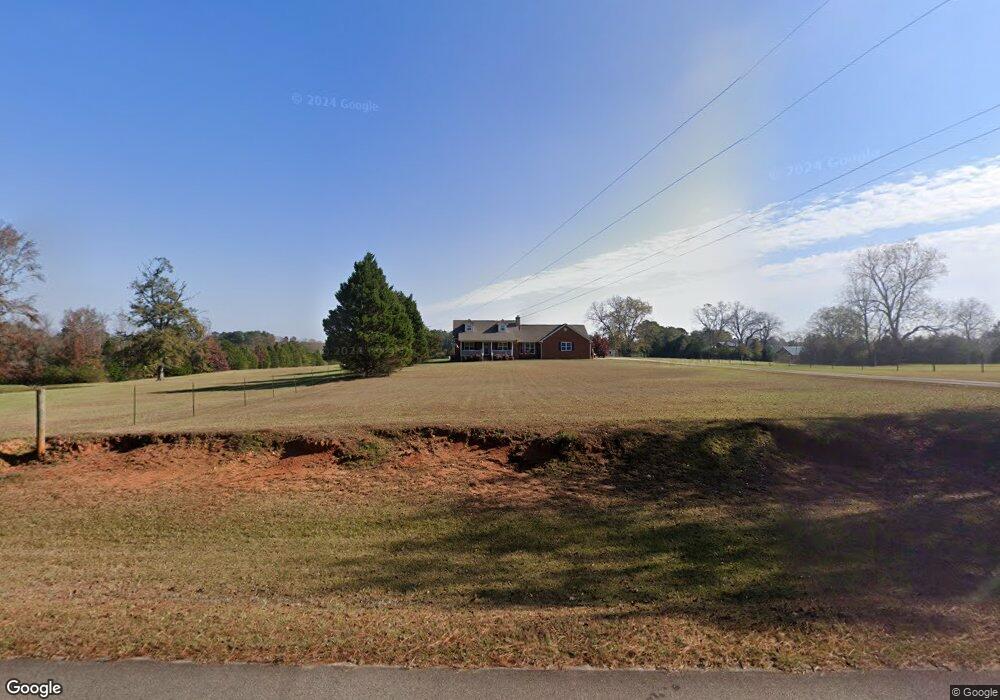
95 Waldroup Rd West Point, GA 31833
Estimated Value: $246,000 - $411,755
3
Beds
3
Baths
2,145
Sq Ft
$160/Sq Ft
Est. Value
About This Home
This home is located at 95 Waldroup Rd, West Point, GA 31833 and is currently estimated at $342,585, approximately $159 per square foot. 95 Waldroup Rd is a home located in Troup County with nearby schools including West Point Elementary School, Long Cane Elementary School, and Whitesville Road Elementary School.
Ownership History
Date
Name
Owned For
Owner Type
Purchase Details
Closed on
Jul 24, 2002
Sold by
Roger Irwin
Bought by
Gilley Kenneth W and Gilley Deborah D
Current Estimated Value
Purchase Details
Closed on
Jul 19, 2000
Sold by
Belinda Steve A and Belinda Hethcox
Bought by
Roger Irwin
Purchase Details
Closed on
Jun 17, 1994
Sold by
Regina B Waldroup
Bought by
Belinda Steve A and Belinda Hethcox
Purchase Details
Closed on
Mar 10, 1994
Bought by
Regina B Waldroup
Purchase Details
Closed on
Mar 12, 1990
Sold by
Odessa Waldroup
Create a Home Valuation Report for This Property
The Home Valuation Report is an in-depth analysis detailing your home's value as well as a comparison with similar homes in the area
Home Values in the Area
Average Home Value in this Area
Purchase History
| Date | Buyer | Sale Price | Title Company |
|---|---|---|---|
| Gilley Kenneth W | $220,000 | -- | |
| Roger Irwin | $196,900 | -- | |
| Belinda Steve A | $44,000 | -- | |
| Regina B Waldroup | -- | -- | |
| -- | -- | -- |
Source: Public Records
Tax History
| Year | Tax Paid | Tax Assessment Tax Assessment Total Assessment is a certain percentage of the fair market value that is determined by local assessors to be the total taxable value of land and additions on the property. | Land | Improvement |
|---|---|---|---|---|
| 2025 | $3,326 | $128,120 | $26,120 | $102,000 |
| 2024 | $3,119 | $116,360 | $26,120 | $90,240 |
| 2023 | $2,533 | $112,760 | $26,120 | $86,640 |
| 2022 | $2,948 | $107,600 | $26,120 | $81,480 |
| 2021 | $2,932 | $99,200 | $21,880 | $77,320 |
| 2020 | $2,932 | $99,200 | $21,880 | $77,320 |
| 2019 | $2,870 | $97,160 | $21,880 | $75,280 |
| 2018 | $2,724 | $90,320 | $21,880 | $68,440 |
| 2017 | $2,664 | $90,320 | $21,880 | $68,440 |
Source: Public Records
Map
Nearby Homes
- 215 Harris Walk
- 211 Harris Walk
- 223 Harris Walk
- 209 Harris Walk
- 225 Harris Walk
- 221 Harris Walk
- 145 Jarrell Hogg Rd
- 101 Garden Walk
- 101 Garden Walk Unit 85
- 107 Amhurst Dr
- 4172 Bartley Rd
- 648 Warner Rd
- 0 Warner Rd Unit 10686116
- 143 W Drummond Rd
- 151 W Drummond Rd
- 157 W Drummond Rd
- 137 W Drummond Rd
- 131 W Drummond Rd
- 1688 Bartley Rd
- 0 Johns Rd Unit 10615130
- 107 Waldroup Rd
- 56 Waldroup Rd
- 8 Waldroup Rd
- 462 Baughs Cross Rd
- 413 Baughs Cross Rd
- 385 Baughs Cross Rd
- 422 Baughs Cross Rd
- 357 Baughs Cross Rd
- 633 Baughs Cross Rd
- 333 Baughs Cross Rd
- 403 Gray Hill Rd
- 577 Baughs Cross Rd
- 389 Gray Hill Rd
- 289 Baughs Cross Rd
- 375 Gray Hill Rd
- 304 Baughs Cross Rd
- 292 Baughs Cross Rd
- 361 Gray Hill Rd
- 282 Baughs Cross Rd
- 347 Gray Hill Rd
Your Personal Tour Guide
Ask me questions while you tour the home.