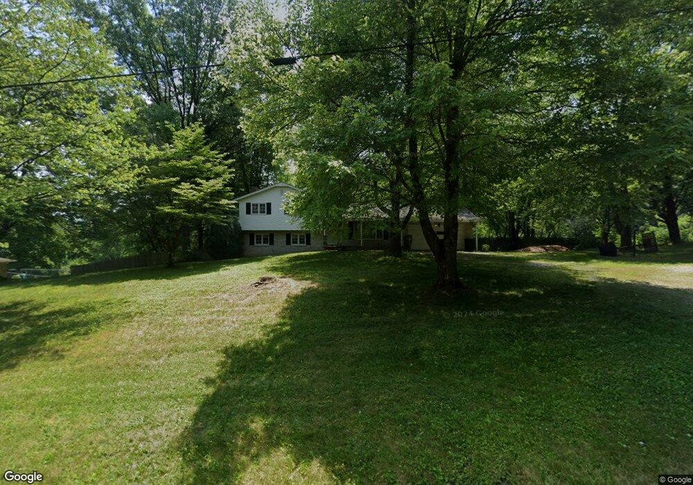
950 53rd St SW Canton, OH 44706
Estimated Value: $267,000 - $370,000
3
Beds
2
Baths
1,772
Sq Ft
$175/Sq Ft
Est. Value
About This Home
This home is located at 950 53rd St SW, Canton, OH 44706 and is currently estimated at $309,603, approximately $174 per square foot. 950 53rd St SW is a home located in Stark County with nearby schools including Faircrest Memorial Elementary School and Canton South High School.
Ownership History
Date
Name
Owned For
Owner Type
Purchase Details
Closed on
Jun 28, 2018
Sold by
Stover Larry M and Stover Debra A
Bought by
Stover Larry M and Stover Debra A
Current Estimated Value
Home Financials for this Owner
Home Financials are based on the most recent Mortgage that was taken out on this home.
Original Mortgage
$118,000
Interest Rate
4.6%
Mortgage Type
New Conventional
Create a Home Valuation Report for This Property
The Home Valuation Report is an in-depth analysis detailing your home's value as well as a comparison with similar homes in the area
Home Values in the Area
Average Home Value in this Area
Purchase History
| Date | Buyer | Sale Price | Title Company |
|---|---|---|---|
| Stover Larry M | -- | None Available |
Source: Public Records
Mortgage History
| Date | Status | Borrower | Loan Amount |
|---|---|---|---|
| Closed | Stover Larry M | $118,000 |
Source: Public Records
Tax History Compared to Growth
Tax History
| Year | Tax Paid | Tax Assessment Tax Assessment Total Assessment is a certain percentage of the fair market value that is determined by local assessors to be the total taxable value of land and additions on the property. | Land | Improvement |
|---|---|---|---|---|
| 2025 | -- | $93,940 | $10,010 | $83,930 |
| 2024 | -- | $93,940 | $10,010 | $83,930 |
| 2023 | $2,585 | $66,500 | $9,730 | $56,770 |
| 2022 | $2,413 | $66,500 | $9,730 | $56,770 |
| 2021 | $2,423 | $66,500 | $9,730 | $56,770 |
| 2020 | $2,270 | $56,220 | $8,230 | $47,990 |
| 2019 | $2,304 | $56,220 | $8,230 | $47,990 |
| 2018 | $2,285 | $56,220 | $8,230 | $47,990 |
| 2017 | $2,718 | $53,310 | $7,670 | $45,640 |
| 2016 | $2,461 | $48,200 | $7,670 | $40,530 |
| 2015 | $2,464 | $48,200 | $7,670 | $40,530 |
| 2014 | $284 | $41,970 | $6,690 | $35,280 |
| 2013 | $1,006 | $36,720 | $6,690 | $30,030 |
Source: Public Records
Map
Nearby Homes
- 900 53rd St SW
- 5226 Ashmont Ave SW
- 5434 Briggle Ave SW
- 340 53rd St SW
- 4314 Millport Ave SW
- 2020 Wildlife Dr SW
- 5327 Dunfred Cir SE
- 1376 Melscheimer Rd SW
- 5333 Dunfred Cir SE
- 4624 Ridge Ave SE
- 4017 Treeline Dr SW
- 2802 Rexdale St SW
- 4805 Harvest Cir SE
- 223 Faircrest St SW
- 5985 Dueber Ave SW
- 5346 Shaker Valley Cir SE
- 3939 Cleveland Ave SW
- 3725 Diane Ave SW
- 2749 Deer Pass Dr SW
- 3673 Highview Ave SW
- 942 53rd St SW
- 954 53rd St SW
- 955 53rd St SW
- 902 53rd St SW
- 1015 53rd St SW
- 921 53rd St SW
- 0 53rd St SW Unit 4461292
- 0 53rd St SW Unit 4091358
- 0 53rd St SW
- 813 53rd St SW
- 825 Fohl Rd SW
- 5247 Birchmont Ave SW
- 5233 Birchmont Ave SW
- 5225 Birchmont Ave SW
- 1210 53rd St SW
- 1210 53rd St SW
- 5203 Birchmont Ave SW
- 5207 Birchmont Ave SW
- 800 Fohl Rd SW
- 5227 Birchmont Ave SW