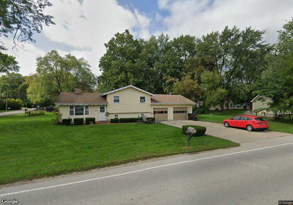
950 Algonquin Rd Fox River Grove, IL 60021
North Barrington Hills NeighborhoodEstimated Value: $291,411 - $322,000
3
Beds
2
Baths
1,031
Sq Ft
$299/Sq Ft
Est. Value
About This Home
This home is located at 950 Algonquin Rd, Fox River Grove, IL 60021 and is currently estimated at $308,603, approximately $299 per square foot. 950 Algonquin Rd is a home located in McHenry County with nearby schools including Algonquin Road Elementary School, Fox River Grove Middle School, and Cary-Grove High School.
Ownership History
Date
Name
Owned For
Owner Type
Purchase Details
Closed on
May 30, 2002
Sold by
Henry Bart L
Bought by
Dean Arthur J and Dean Carmen R
Current Estimated Value
Home Financials for this Owner
Home Financials are based on the most recent Mortgage that was taken out on this home.
Original Mortgage
$142,400
Outstanding Balance
$61,018
Interest Rate
7%
Estimated Equity
$247,585
Purchase Details
Closed on
Feb 4, 1998
Sold by
Henry Lisa Ann Chevrette
Bought by
Henry Bart Lynn
Home Financials for this Owner
Home Financials are based on the most recent Mortgage that was taken out on this home.
Original Mortgage
$102,900
Interest Rate
7.26%
Create a Home Valuation Report for This Property
The Home Valuation Report is an in-depth analysis detailing your home's value as well as a comparison with similar homes in the area
Home Values in the Area
Average Home Value in this Area
Purchase History
| Date | Buyer | Sale Price | Title Company |
|---|---|---|---|
| Dean Arthur J | $178,000 | -- | |
| Henry Bart Lynn | -- | -- |
Source: Public Records
Mortgage History
| Date | Status | Borrower | Loan Amount |
|---|---|---|---|
| Open | Dean Arthur J | $142,400 | |
| Previous Owner | Henry Bart Lynn | $102,900 | |
| Closed | Dean Arthur J | $17,800 |
Source: Public Records
Tax History
| Year | Tax Paid | Tax Assessment Tax Assessment Total Assessment is a certain percentage of the fair market value that is determined by local assessors to be the total taxable value of land and additions on the property. | Land | Improvement |
|---|---|---|---|---|
| 2024 | $6,705 | $83,243 | $16,287 | $66,956 |
| 2023 | $6,454 | $74,451 | $14,567 | $59,884 |
| 2022 | $6,628 | $75,021 | $11,523 | $63,498 |
| 2021 | $6,181 | $69,891 | $10,735 | $59,156 |
| 2020 | $6,036 | $67,417 | $10,355 | $57,062 |
| 2019 | $5,805 | $64,526 | $9,911 | $54,615 |
| 2018 | $5,696 | $59,609 | $9,156 | $50,453 |
| 2017 | $5,527 | $56,156 | $8,626 | $47,530 |
| 2016 | $5,403 | $52,669 | $8,090 | $44,579 |
| 2013 | -- | $49,134 | $7,548 | $41,586 |
Source: Public Records
Map
Nearby Homes
- 208 S River Rd
- 1104 Hillcrest Ave
- 113 Gladys Ave
- 210 Foxmoor Rd
- 2016 Grove Ln
- 2101 Riverview Ave
- 422 Lincoln Ave Unit A
- Lot 1 Asbury Ave
- LOT 2 Asbury Ave
- 1 Rock Ridge Rd
- 9814 River Bluff Ln
- 5 Jacqueline Ln
- 12 Rock Ridge Rd
- 726 Barberry Trail
- 321 Cold Spring St
- 341 Cold Spring St
- 331 Cold Spring St
- 371 Cold Spring St
- 16 Ascot Ln
- 128 E Main St
- 1002 Bloner Pkwy
- 1004 Bloner Pkwy
- 1001 Pine St
- 1003 Pine St
- 1001 Algonquin Rd
- 1009 Pine St
- 1003 Bloner Pkwy
- 1005 Pine St
- 1005 Bloner Pkwy
- 1012 Bloner Pkwy
- 1000 Algonquin Rd
- 1004 Pine St
- 1000 Pine St
- 1007 Pine St
- 1006 Pine St
- 1002 Crescent Pkwy
- 1008 Pine St
- 1018 Bloner Pkwy
- 1006 Crescent Pkwy
- 1004 Crescent Pkwy
Your Personal Tour Guide
Ask me questions while you tour the home.