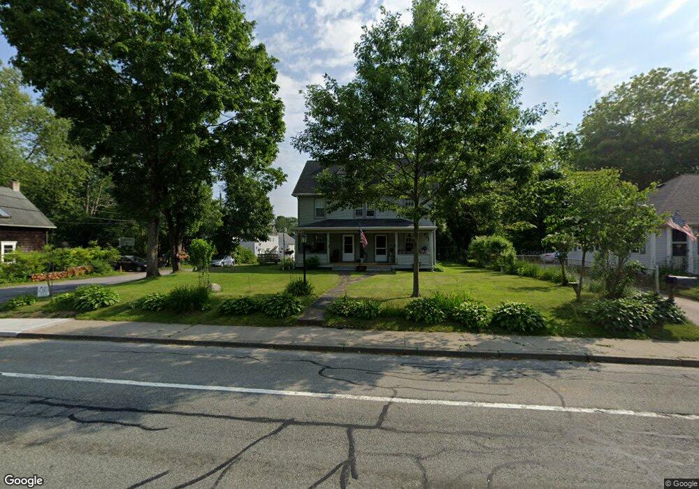
950 Kingstown Rd Wakefield, RI 02879
Estimated Value: $542,000 - $682,000
9
Beds
3
Baths
2,869
Sq Ft
$219/Sq Ft
Est. Value
About This Home
This home is located at 950 Kingstown Rd, Wakefield, RI 02879 and is currently estimated at $629,641, approximately $219 per square foot. 950 Kingstown Rd is a home located in Washington County with nearby schools including South Kingstown High School, Monsignor Matthew Clarke Catholic Regional School, and Bradley School-South.
Ownership History
Date
Name
Owned For
Owner Type
Purchase Details
Closed on
Aug 25, 2008
Sold by
Hunt Margery C Est
Bought by
Hunt Sara J
Current Estimated Value
Home Financials for this Owner
Home Financials are based on the most recent Mortgage that was taken out on this home.
Original Mortgage
$78,000
Interest Rate
6.69%
Create a Home Valuation Report for This Property
The Home Valuation Report is an in-depth analysis detailing your home's value as well as a comparison with similar homes in the area
Home Values in the Area
Average Home Value in this Area
Purchase History
| Date | Buyer | Sale Price | Title Company |
|---|---|---|---|
| Hunt Sara J | $212,500 | -- |
Source: Public Records
Mortgage History
| Date | Status | Borrower | Loan Amount |
|---|---|---|---|
| Open | Hunt Sara J | $173,000 | |
| Closed | Hunt Sara J | $78,000 | |
| Closed | Hunt Sara J | $170,000 | |
| Previous Owner | Hunt Sara J | $84,800 |
Source: Public Records
Tax History
| Year | Tax Paid | Tax Assessment Tax Assessment Total Assessment is a certain percentage of the fair market value that is determined by local assessors to be the total taxable value of land and additions on the property. | Land | Improvement |
|---|---|---|---|---|
| 2025 | $4,139 | $463,000 | $153,800 | $309,200 |
| 2024 | $4,514 | $408,500 | $118,200 | $290,300 |
| 2023 | $4,514 | $408,500 | $118,200 | $290,300 |
| 2022 | $4,473 | $408,500 | $118,200 | $290,300 |
| 2021 | $4,263 | $295,000 | $75,800 | $219,200 |
| 2020 | $4,263 | $295,000 | $75,800 | $219,200 |
| 2019 | $4,263 | $295,000 | $75,800 | $219,200 |
| 2018 | $3,677 | $234,500 | $64,900 | $169,600 |
| 2017 | $3,590 | $234,500 | $64,900 | $169,600 |
| 2016 | $3,539 | $234,500 | $64,900 | $169,600 |
| 2015 | $3,702 | $238,500 | $68,900 | $169,600 |
| 2014 | $3,692 | $238,500 | $68,900 | $169,600 |
Source: Public Records
Map
Nearby Homes
- 15 Jessica Ln
- 131 Columbia St
- 301 Church St Unit 103
- 48 Stone Bridge Dr
- 37 Columbia St
- 20 Cleveland St
- 45 Cherry Ln Unit C
- 39 Hazard Ave
- 57 Rocky Brook Way
- 143 Summit Ave
- 35 Abbey Rd
- 23 Rockland Dr
- 66 Christopher St
- 260 Sweet Allen Farm Rd Unit 3
- 1808 Kingstown Rd
- 44 Vespia Ln
- 56 Vespia Ln
- 39 Secluded Dr
- 13 Prospect Ave
- 56 Wanda St
- 960 Kingstown Rd
- 17 Amos St
- 940 Kingstown Rd
- 16 Amos St
- 968 Kingstown Rd
- 953 Kingstown Rd
- 981 Kingstown Rd Unit A
- 981 Kingstown Rd Unit B
- 25 Amos St
- 943 Kingstown Rd
- 932 Kingstown Rd
- 961 Kingstown Rd
- 978 Kingstown Rd
- 28 Amos St
- 969 Kingstown Rd
- 30 Amos St
- 924 Kingstown Rd
- 33 Amos St
- 931 Kingstown Rd
- 984 Kingstown Rd
Your Personal Tour Guide
Ask me questions while you tour the home.