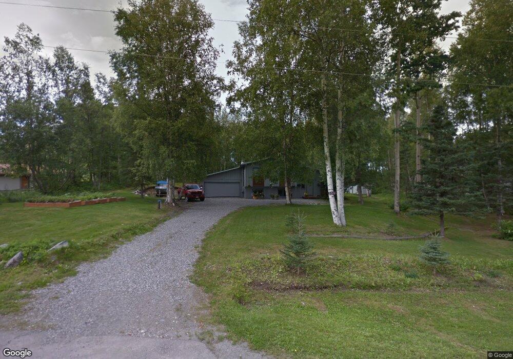
950 N Balsam Cir Wasilla, AK 99654
Estimated Value: $282,000 - $370,755
3
Beds
2
Baths
1,672
Sq Ft
$190/Sq Ft
Est. Value
About This Home
This home is located at 950 N Balsam Cir, Wasilla, AK 99654 and is currently estimated at $317,939, approximately $190 per square foot. 950 N Balsam Cir is a home located in Matanuska-Susitna Borough with nearby schools including Tanaina Elementary School, Wasilla Middle School, and Wasilla High School.
Ownership History
Date
Name
Owned For
Owner Type
Purchase Details
Closed on
Nov 5, 2009
Sold by
Meshkin Lawrence D and Meshkin Marie L
Bought by
Robbins Priscilla
Current Estimated Value
Home Financials for this Owner
Home Financials are based on the most recent Mortgage that was taken out on this home.
Original Mortgage
$145,520
Outstanding Balance
$95,116
Interest Rate
5.02%
Mortgage Type
New Conventional
Estimated Equity
$222,823
Purchase Details
Closed on
Mar 5, 2004
Sold by
Meshkin Lawrence D and Holley Marie L
Bought by
Meshkin Lawrence D and Meshkin Marie Holley
Create a Home Valuation Report for This Property
The Home Valuation Report is an in-depth analysis detailing your home's value as well as a comparison with similar homes in the area
Home Values in the Area
Average Home Value in this Area
Purchase History
| Date | Buyer | Sale Price | Title Company |
|---|---|---|---|
| Robbins Priscilla | -- | Mat Su Title Ins Agency Inc | |
| Meshkin Lawrence D | -- | -- |
Source: Public Records
Mortgage History
| Date | Status | Borrower | Loan Amount |
|---|---|---|---|
| Open | Robbins Priscilla | $145,520 |
Source: Public Records
Tax History Compared to Growth
Tax History
| Year | Tax Paid | Tax Assessment Tax Assessment Total Assessment is a certain percentage of the fair market value that is determined by local assessors to be the total taxable value of land and additions on the property. | Land | Improvement |
|---|---|---|---|---|
| 2025 | $96 | $296,500 | $40,000 | $256,500 |
| 2024 | $96 | $279,700 | $40,000 | $239,700 |
| 2023 | $62 | $270,000 | $40,000 | $230,000 |
| 2022 | $317 | $247,200 | $40,000 | $207,200 |
| 2021 | $17 | $219,400 | $40,000 | $179,400 |
| 2020 | $0 | $207,300 | $40,000 | $167,300 |
| 2019 | $0 | $198,300 | $40,000 | $158,300 |
| 2018 | $0 | $197,200 | $40,000 | $157,200 |
| 2017 | $0 | $190,200 | $40,000 | $150,200 |
| 2016 | $0 | $190,600 | $40,000 | $150,600 |
| 2015 | $2,087 | $180,800 | $32,000 | $148,800 |
| 2014 | $2,087 | $175,400 | $32,000 | $143,400 |
Source: Public Records
Map
Nearby Homes
- 844 W Winter Ave
- 412 W Ashbrook Dr
- 382 W Ashbrook Dr
- 365 W Crestwood Ave
- 1148 W Dr
- 590 W Spruce Ave
- 121 E Herning Ave
- L13A Selina Ln
- 500 W Roy Rd
- 465 W Roy Rd
- 1785 N Lana Cir
- 205 W Jensen Cir
- 1401 W Nicola Ave
- 1906 W Cashatt Ave
- 3669 S Alvaro Dr
- 15151 W Crest Place
- 3637 S Alvaro Dr
- 2165 N Gwene Ln
- L6 B2 Bella Ridge Subdivision
- L5 Sassy Lot 5 B2
- 1000 N Balsam Cir
- 900 N Balsam Cir
- 673 W Holiday Dr
- 901 Balsam Cir
- 850 N Balsam Cir
- 1050 N Balsam Cir
- 951 N Balsam Cir
- 955 N Pinion Dr
- 681 W Holiday Dr
- 665 W Holiday Dr
- 655 W Holiday Dr
- 1100 N Balsam Cir
- 701 W Holiday Dr
- 950 N Pinion Dr
- L19 B8 W Lone Cub
- 1001 N Pinion Dr
- 645 W Holiday Dr
- 1050 N Pinion Dr
- 1035 N Pinion Dr
- 1101 Snowflake Cir