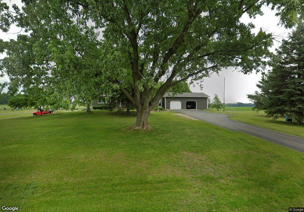
950 N Patterson Rd Wayland, MI 49348
Estimated Value: $311,000 - $460,000
4
Beds
3
Baths
1,389
Sq Ft
$276/Sq Ft
Est. Value
About This Home
This home is located at 950 N Patterson Rd, Wayland, MI 49348 and is currently estimated at $382,985, approximately $275 per square foot. 950 N Patterson Rd is a home located in Barry County with nearby schools including McFall Elementary School, Page Elementary School, and Lee Elementary School.
Ownership History
Date
Name
Owned For
Owner Type
Purchase Details
Closed on
Oct 22, 2015
Sold by
Thompson Barbara A and Christensen Barbara A
Bought by
Christensen Barbara A and Christensen John M
Current Estimated Value
Home Financials for this Owner
Home Financials are based on the most recent Mortgage that was taken out on this home.
Original Mortgage
$140,000
Outstanding Balance
$56,635
Interest Rate
3.82%
Mortgage Type
New Conventional
Estimated Equity
$326,350
Purchase Details
Closed on
Jun 17, 2008
Sold by
Thompson Frank W
Bought by
Thompson Barbara A
Home Financials for this Owner
Home Financials are based on the most recent Mortgage that was taken out on this home.
Original Mortgage
$127,000
Interest Rate
6.04%
Mortgage Type
New Conventional
Purchase Details
Closed on
Mar 12, 1999
Bought by
Thompson Barbara A
Create a Home Valuation Report for This Property
The Home Valuation Report is an in-depth analysis detailing your home's value as well as a comparison with similar homes in the area
Home Values in the Area
Average Home Value in this Area
Purchase History
| Date | Buyer | Sale Price | Title Company |
|---|---|---|---|
| Christensen Barbara A | -- | Hbi Title Services | |
| Christensen Barbara A | -- | Hbi Title Services Inc | |
| Thompson Barbara A | -- | Michigan Bankers Title | |
| Thompson Barbara A | $124,500 | -- |
Source: Public Records
Mortgage History
| Date | Status | Borrower | Loan Amount |
|---|---|---|---|
| Open | Christensen Barbara A | $140,000 | |
| Closed | Thompson Barbara A | $127,000 |
Source: Public Records
Tax History Compared to Growth
Tax History
| Year | Tax Paid | Tax Assessment Tax Assessment Total Assessment is a certain percentage of the fair market value that is determined by local assessors to be the total taxable value of land and additions on the property. | Land | Improvement |
|---|---|---|---|---|
| 2025 | $2,727 | $149,600 | $0 | $0 |
| 2024 | $2,727 | $134,800 | $0 | $0 |
| 2023 | $2,530 | $100,700 | $0 | $0 |
| 2022 | $2,530 | $100,700 | $0 | $0 |
| 2021 | $2,530 | $92,200 | $0 | $0 |
| 2020 | $2,454 | $84,500 | $0 | $0 |
| 2019 | $2,454 | $84,300 | $0 | $0 |
| 2018 | $2,333 | $76,500 | $14,200 | $62,300 |
| 2017 | $2,333 | $76,500 | $0 | $0 |
| 2016 | -- | $70,800 | $0 | $0 |
| 2015 | -- | $72,500 | $0 | $0 |
| 2014 | -- | $72,500 | $0 | $0 |
Source: Public Records
Map
Nearby Homes
- 12720 S Grey Ct
- 1164 E Bernie Ct
- 12811 Charles Dr
- 12857 Michael Dr Unit 49
- 1391 Shadowridge Dr
- 11753 Rosemary Ln
- 11751 Rosemary Ln
- 2615 Harwood Lake Rd
- 12031 Sandstone Dr
- 11401 Davis Rd
- 12169 Pine Meadows Dr
- Lot 7 Reflection Pond Dr
- 1823 Starr View Ln Unit 11
- 1736 Parker Dr
- 1875 Edwin Dr
- 1980 Parker Dr
- 11065 W M 179 Hwy
- 4007 2nd St
- 12712 Sunrise Ct
- 2724 Pasture Ln
- 900 N Patterson Rd
- 3388 Patterson Rd
- 3404 N Patterson Rd
- 1050 N Patterson Rd
- 1000 N Patterson Rd
- 12701 S Bernie Ct
- 650 N Patterson Rd
- 600 N Patterson Rd
- 1338 Shadowridge Dr
- 12850 Bowens Mill Rd
- 15 133rd Ave
- 1392 Shadow Ridge Dr
- 12750 Bowens Mill Rd
- 12908 Robert Ln
- 12955 Bowens Mill Rd
- 3298 Patterson Rd
- 1498 N Patterson Rd
- 12760 Bowens Mill Rd
- 12855 Bowens Mill Rd
- 51 133rd Ave