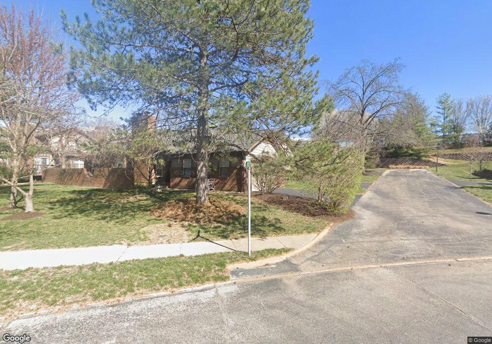
950 N Spoede Rd Unit 950 Saint Louis, MO 63146
Estimated Value: $263,052 - $323,000
2
Beds
3
Baths
1,405
Sq Ft
$199/Sq Ft
Est. Value
About This Home
This home is located at 950 N Spoede Rd Unit 950, Saint Louis, MO 63146 and is currently estimated at $279,513, approximately $198 per square foot. 950 N Spoede Rd Unit 950 is a home located in St. Louis County with nearby schools including Spoede Elementary School, Ladue 5th Grade Center, and Ladue Middle.
Ownership History
Date
Name
Owned For
Owner Type
Purchase Details
Closed on
Aug 12, 2008
Sold by
Costigan Edward J
Bought by
Bulger Mary
Current Estimated Value
Purchase Details
Closed on
Nov 16, 2001
Sold by
Teske Ann Engelhardt
Bought by
Jordan Elizabeth C
Purchase Details
Closed on
Oct 10, 1998
Sold by
Engelhardt Dorcas and Eades Patricia Louise
Bought by
Engelhardt Dorcas
Create a Home Valuation Report for This Property
The Home Valuation Report is an in-depth analysis detailing your home's value as well as a comparison with similar homes in the area
Home Values in the Area
Average Home Value in this Area
Purchase History
| Date | Buyer | Sale Price | Title Company |
|---|---|---|---|
| Bulger Mary | $229,500 | None Available | |
| Jordan Elizabeth C | $215,000 | -- | |
| Engelhardt Dorcas | $94,789 | -- |
Source: Public Records
Tax History Compared to Growth
Tax History
| Year | Tax Paid | Tax Assessment Tax Assessment Total Assessment is a certain percentage of the fair market value that is determined by local assessors to be the total taxable value of land and additions on the property. | Land | Improvement |
|---|---|---|---|---|
| 2025 | $2,778 | $47,770 | $12,810 | $34,960 |
| 2024 | $2,778 | $39,900 | $8,020 | $31,880 |
| 2023 | $2,775 | $39,900 | $8,020 | $31,880 |
| 2022 | $2,593 | $35,870 | $8,020 | $27,850 |
| 2021 | $2,573 | $35,870 | $8,020 | $27,850 |
| 2020 | $2,606 | $35,880 | $8,820 | $27,060 |
| 2019 | $2,586 | $35,880 | $8,820 | $27,060 |
| 2018 | $2,499 | $32,010 | $3,740 | $28,270 |
| 2017 | $2,495 | $32,010 | $3,740 | $28,270 |
| 2016 | $2,805 | $35,130 | $5,870 | $29,260 |
| 2015 | $2,624 | $35,130 | $5,870 | $29,260 |
| 2014 | $2,846 | $37,050 | $7,110 | $29,940 |
Source: Public Records
Map
Nearby Homes
- 970 N Spoede Rd Unit 24
- 1033 Wilton Royal Dr Unit 210
- 1033 Wilton Royal Dr Unit 107
- 1033 Wilton Royal Dr Unit 204
- 1054 Willow Brook Dr
- 832 Larkin Ave
- 10469 Briarbend Dr Unit 3
- 18 Sona Ln
- 1060 Port Diane Dr
- 866 Deaver Ln
- 817 Larkin Ave
- 50 Willow Brook Dr
- 10401 Briarbend Dr Unit 2
- 10 Spoede Woods Dr
- 10360 Forest Brook Ln Unit G
- 10352 Forest Brook Ln Unit H
- 10344 Forest Brook Ln Unit C
- 10340 Corbeil Dr Unit 86
- 10387 Forest Brook Ln
- 2 Wedgewood Ln
- 936 N Spoede Rd Unit 936
- 946 N Spoede Rd Unit 948
- 942 N Spoede Rd
- 10808 Charlton Way
- 10802 Charlton Way
- 10810 Charlton Way
- 10806 Charlton Way
- 10804 Charlton Way
- 932 N Spoede Rd
- 928 N Spoede Rd
- 924 N Spoede Rd
- 1002 Wilton Royal Dr
- 1004 Wilton Royal Dr
- 1004 Wilton Royal Dr Unit 2
- 954 N Spoede Rd Unit 4
- 10817 Charlton Way
- 951 N Spoede Rd Unit 1
- 10813 Charlton Way
- 10805 Charlton Way
- 10809 Charlton Way