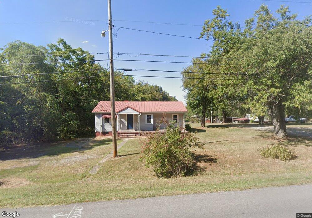
950 State Route 120 Marion, KY 42064
Estimated Value: $74,197 - $151,000
2
Beds
1
Bath
1,038
Sq Ft
$104/Sq Ft
Est. Value
About This Home
This home is located at 950 State Route 120, Marion, KY 42064 and is currently estimated at $107,799, approximately $103 per square foot. 950 State Route 120 is a home located in Crittenden County with nearby schools including Crittenden County Elementary School, Crittenden County Middle School, and Pathway Academy High School.
Ownership History
Date
Name
Owned For
Owner Type
Purchase Details
Closed on
Feb 21, 2013
Sold by
Farmers Bank And Trust Co
Bought by
Smith Billy Aaron and Smith Kasie Renee
Current Estimated Value
Home Financials for this Owner
Home Financials are based on the most recent Mortgage that was taken out on this home.
Original Mortgage
$16,800
Interest Rate
3.43%
Mortgage Type
Future Advance Clause Open End Mortgage
Create a Home Valuation Report for This Property
The Home Valuation Report is an in-depth analysis detailing your home's value as well as a comparison with similar homes in the area
Home Values in the Area
Average Home Value in this Area
Purchase History
| Date | Buyer | Sale Price | Title Company |
|---|---|---|---|
| Smith Billy Aaron | $21,000 | None Available |
Source: Public Records
Mortgage History
| Date | Status | Borrower | Loan Amount |
|---|---|---|---|
| Closed | Smith Billy Aaron | $16,800 |
Source: Public Records
Tax History Compared to Growth
Tax History
| Year | Tax Paid | Tax Assessment Tax Assessment Total Assessment is a certain percentage of the fair market value that is determined by local assessors to be the total taxable value of land and additions on the property. | Land | Improvement |
|---|---|---|---|---|
| 2024 | $174 | $12,500 | $3,000 | $9,500 |
| 2023 | $175 | $12,500 | $3,000 | $9,500 |
| 2022 | $171 | $12,500 | $3,000 | $9,500 |
| 2021 | $172 | $12,500 | $3,000 | $9,500 |
| 2020 | $241 | $25,000 | $3,000 | $22,000 |
| 2019 | $241 | $25,000 | $0 | $0 |
| 2018 | $207 | $21,000 | $3,000 | $18,000 |
| 2017 | $206 | $0 | $0 | $0 |
| 2016 | $201 | $21,000 | $0 | $0 |
| 2015 | -- | $21,000 | $0 | $0 |
| 2014 | -- | $21,000 | $0 | $0 |
| 2013 | -- | $31,000 | $0 | $0 |
Source: Public Records
Map
Nearby Homes
- 251 Guess Dr
- 251 Guess Dr Unit (Crittenden Co. KY 0
- 127 Hawk Ln Unit 2
- 123 Hawk Ln Unit 121 Hawk Lane
- 920 State Route 506
- 700 E Depot St
- 511 E Bellville St
- 301 Adam St Unit (Crittenden Co. KY 2
- 300 Spar Mill Rd Unit (Crittenden Co. KY 8
- 414 Moore St
- 308 W Bellville St
- 60 Nichols Ave
- 316 W Carlisle St
- 220 Shady Ln
- 0 Fords Ferry Rd Unit (Parcel 2 - 17 AC)
- 125 S Yandell St
- 408 W Bellville St
- 2003 Sr 506
- 714 Crittenden Dr
- 121 E Cruse Ln
- 984 State Route 120
- 985 Kentucky 120
- 1000 State Route 120
- 1055 State Route 120
- 1000 Kentucky 120
- 1076 State Route 120
- 1075 State Route 120
- 611 Old Shady Grove Rd
- 631 Old Shady Grove Rd
- 621 Old Shady Grove Rd
- 520 Old Shady Grove Rd
- 204 Club Dr
- 200 Country Dr
- 1095 State Route 120
- 830 E Bellville St
- 512 Old Shady Grove Rd
- 821 E Bellville St
- 1102 State Route 120
- 211 Country Dr
- 513 Old Shady Grove Rd