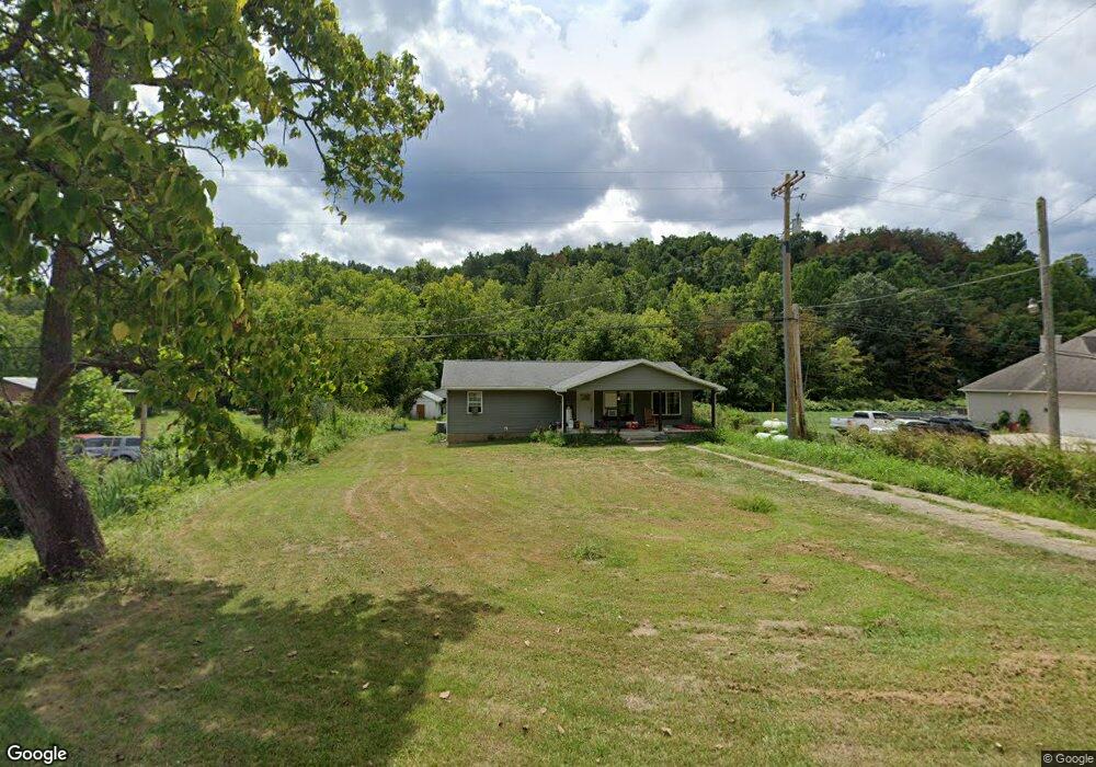
9504 State Route 243 South Point, OH 45680
Estimated Value: $126,000 - $157,000
3
Beds
2
Baths
2,016
Sq Ft
$70/Sq Ft
Est. Value
About This Home
This home is located at 9504 State Route 243, South Point, OH 45680 and is currently estimated at $141,500, approximately $70 per square foot. 9504 State Route 243 is a home located in Lawrence County with nearby schools including Dawson-Bryant Elementary School, Dawson-Bryant Middle School, and Dawson-Bryant High School.
Ownership History
Date
Name
Owned For
Owner Type
Purchase Details
Closed on
Apr 6, 2021
Sold by
Russell Katherine Sue and Russell Justin Ray
Bought by
Baldridge Brittany N and Justice Kelsey A
Current Estimated Value
Home Financials for this Owner
Home Financials are based on the most recent Mortgage that was taken out on this home.
Original Mortgage
$180,000
Outstanding Balance
$162,518
Interest Rate
3%
Mortgage Type
VA
Estimated Equity
-$21,018
Purchase Details
Closed on
Jan 3, 2018
Sold by
Willis Patricia and Willis Patricia Elaine
Bought by
Russell Justin Ray and Russell Katherine Sue
Home Financials for this Owner
Home Financials are based on the most recent Mortgage that was taken out on this home.
Original Mortgage
$147,250
Interest Rate
3.75%
Mortgage Type
Adjustable Rate Mortgage/ARM
Purchase Details
Closed on
Jan 1, 1987
Bought by
Willis John E and Patricia Elaine
Create a Home Valuation Report for This Property
The Home Valuation Report is an in-depth analysis detailing your home's value as well as a comparison with similar homes in the area
Home Values in the Area
Average Home Value in this Area
Purchase History
| Date | Buyer | Sale Price | Title Company |
|---|---|---|---|
| Baldridge Brittany N | $30,000 | Bestitle Title Agency | |
| Russell Justin Ray | $80,000 | None Available | |
| Willis John E | -- | -- |
Source: Public Records
Mortgage History
| Date | Status | Borrower | Loan Amount |
|---|---|---|---|
| Open | Baldridge Brittany N | $180,000 | |
| Previous Owner | Russell Justin Ray | $147,250 |
Source: Public Records
Tax History Compared to Growth
Tax History
| Year | Tax Paid | Tax Assessment Tax Assessment Total Assessment is a certain percentage of the fair market value that is determined by local assessors to be the total taxable value of land and additions on the property. | Land | Improvement |
|---|---|---|---|---|
| 2024 | -- | $100 | $100 | -- |
| 2023 | $3 | $100 | $100 | $0 |
| 2022 | $3 | $100 | $100 | $0 |
| 2021 | $3 | $90 | $90 | $0 |
| 2020 | $520 | $17,540 | $2,600 | $14,940 |
| 2019 | $518 | $17,540 | $2,600 | $14,940 |
| 2018 | $514 | $17,180 | $2,540 | $14,640 |
| 2017 | $633 | $31,820 | $2,540 | $29,280 |
| 2016 | $606 | $30,890 | $1,610 | $29,280 |
| 2015 | $676 | $32,600 | $1,620 | $30,980 |
| 2014 | $667 | $32,600 | $1,620 | $30,980 |
| 2013 | $666 | $32,600 | $1,620 | $30,980 |
Source: Public Records
Map
Nearby Homes
- 9040 Ohio 243
- 66 County Road 30
- 3493 County Road 31
- 6881 State Route 243
- 3171 County Road 31
- 1122 Township Road 266
- 1122 Township Road 266
- 66 Township Road 1523
- 25 Township Road 1524
- 3569 County Road 6
- 71 Private Dr
- 4404 County Road 15
- 6757 County Road 15
- 6897 County Road 15
- 1334 McKinney Creek-Hesson Hollow Rd N
- 1334 Township Road 214th N
- 859 County Road 53
- 885 County Road 53
- 00 Township Road 219 N
- 181 Private Road 3954
- 9504 Ohio 243
- 9526 State Route 243
- 9466 State Route 243
- 9526 Ohio 243
- 8829 State Route 243
- 9712 State Route 243
- 9301 State Route 243
- 9317 State Route 243
- 9287 State Route 243
- 9772 State Route 243
- 9247 State Route 243
- 4113 County Road 55
- 4091 County Road 55
- 203 Private Road 1653 Unit 17
- 9164 State Route 243
- 195 Private Road 1478 Unit 250
- 4036 County Road 55
- 9916 State Route 243
- 9097 State Route 243
- 4014 County Road 55