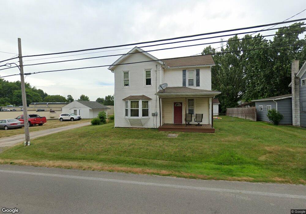
9505 Edison St NE Alliance, OH 44601
Estimated Value: $125,000 - $268,000
3
Beds
2
Baths
1,708
Sq Ft
$105/Sq Ft
Est. Value
About This Home
This home is located at 9505 Edison St NE, Alliance, OH 44601 and is currently estimated at $178,862, approximately $104 per square foot. 9505 Edison St NE is a home located in Stark County with nearby schools including Marlington High School.
Ownership History
Date
Name
Owned For
Owner Type
Purchase Details
Closed on
Jul 23, 2018
Sold by
Brison Richard K
Bought by
Stevens Richard L
Current Estimated Value
Home Financials for this Owner
Home Financials are based on the most recent Mortgage that was taken out on this home.
Original Mortgage
$61,367
Outstanding Balance
$53,184
Interest Rate
4.5%
Mortgage Type
FHA
Estimated Equity
$125,678
Purchase Details
Closed on
Jul 14, 2009
Sold by
Hoover Michael P
Bought by
Federal National Mortgage Association
Purchase Details
Closed on
Nov 21, 2003
Sold by
Household Realty Corp
Bought by
Hoover Michael P and Noble Cathy J
Home Financials for this Owner
Home Financials are based on the most recent Mortgage that was taken out on this home.
Original Mortgage
$69,000
Interest Rate
6.1%
Mortgage Type
Purchase Money Mortgage
Purchase Details
Closed on
Aug 19, 2003
Sold by
Sparren Roger D
Bought by
Household Realty Corp
Purchase Details
Closed on
Oct 27, 1993
Create a Home Valuation Report for This Property
The Home Valuation Report is an in-depth analysis detailing your home's value as well as a comparison with similar homes in the area
Purchase History
| Date | Buyer | Sale Price | Title Company |
|---|---|---|---|
| Stevens Richard L | $62,500 | None Available | |
| Federal National Mortgage Association | $44,000 | None Available | |
| Hoover Michael P | $69,000 | -- | |
| Household Realty Corp | $50,000 | -- | |
| -- | -- | -- |
Source: Public Records
Mortgage History
| Date | Status | Borrower | Loan Amount |
|---|---|---|---|
| Open | Stevens Richard L | $61,367 | |
| Previous Owner | Hoover Michael P | $69,000 |
Source: Public Records
Tax History
| Year | Tax Paid | Tax Assessment Tax Assessment Total Assessment is a certain percentage of the fair market value that is determined by local assessors to be the total taxable value of land and additions on the property. | Land | Improvement |
|---|---|---|---|---|
| 2025 | -- | $42,280 | $9,730 | $32,550 |
| 2024 | -- | $42,280 | $9,730 | $32,550 |
| 2023 | $1,136 | $30,910 | $7,420 | $23,490 |
| 2022 | $1,140 | $30,910 | $7,420 | $23,490 |
| 2021 | $1,144 | $30,910 | $7,420 | $23,490 |
| 2020 | $1,048 | $25,940 | $6,230 | $19,710 |
| 2019 | $1,040 | $26,080 | $6,370 | $19,710 |
Source: Public Records
Map
Nearby Homes
- 9478 Edison St NE
- 8736 Lynn Park St NE
- 13390 Ravenna Ave NE
- 14170 Ravenna Ave NE
- 10131 Columbus Rd NE
- 0 New Milford Rd Unit 5119787
- 6920 Nimishillen Church St
- 10770 Dot Ave NE
- 10684 Dot Ave NE
- 0 Greenbower St NE Unit 5188782
- 10645 Wilma Ave NE
- 13004 Edison St NE
- 5615 Laubert Rd
- 13109 Edison St NE
- 635 Industry Rd
- 642 Horning Rd
- 724 New Milford Rd
- 10366 Immel St NE
- 10366 Immel Ave NE
- 14244 Atwater Ave NE
- 9487 Edison St NE
- 9529 Edison St NE
- 0 Edison Unit 3333288
- 0 Edison Unit 1187536
- 12403 Beechlawn Ave NE
- 9500 Edison St NE
- 9496 Foxvale St NE
- 9500 Easton St
- 12429 Beechlawn Ave NE
- 9499 Foxvale St NE
- 9527 Saint Peters Church Rd NE
- 9408 Easton St
- 9560 Edison St NE
- 12441 Beechlawn Ave NE
- 9576 Edison St NE
- 12308 Beechlawn Ave NE
- 9555 Saint Peters Church Rd NE
- 12403 Marlboro Ave NE
- 9408 Edison St NE
- 12387 Marlboro Ave NE
Your Personal Tour Guide
Ask me questions while you tour the home.