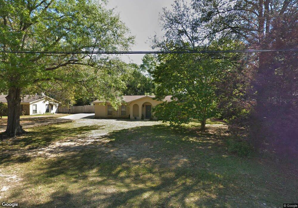
951 Abilene Dr E Mobile, AL 36695
Baker NeighborhoodEstimated Value: $203,000 - $212,000
Studio
2
Baths
1,457
Sq Ft
$143/Sq Ft
Est. Value
About This Home
This home is located at 951 Abilene Dr E, Mobile, AL 36695 and is currently estimated at $208,164, approximately $142 per square foot. 951 Abilene Dr E is a home located in Mobile County with nearby schools including Elsie Collier Elementary School, Bernice J Causey Middle School, and Baker High School.
Ownership History
Date
Name
Owned For
Owner Type
Purchase Details
Closed on
Mar 19, 2004
Sold by
Flowers Sherry E
Bought by
Montazer Beverly A
Current Estimated Value
Purchase Details
Closed on
Jun 20, 2002
Sold by
Montazer Beverly A and Flowers Sherry E
Bought by
Montazer Beverly A and Flowers Sherry E
Purchase Details
Closed on
Sep 28, 2001
Sold by
Easley Joan P
Bought by
Montazer Beverly A
Home Financials for this Owner
Home Financials are based on the most recent Mortgage that was taken out on this home.
Original Mortgage
$60,000
Interest Rate
6.89%
Create a Home Valuation Report for This Property
The Home Valuation Report is an in-depth analysis detailing your home's value as well as a comparison with similar homes in the area
Home Values in the Area
Average Home Value in this Area
Purchase History
| Date | Buyer | Sale Price | Title Company |
|---|---|---|---|
| Montazer Beverly A | -- | -- | |
| Montazer Beverly A | -- | -- | |
| Montazer Beverly A | -- | -- |
Source: Public Records
Mortgage History
| Date | Status | Borrower | Loan Amount |
|---|---|---|---|
| Previous Owner | Montazer Beverly A | $60,000 |
Source: Public Records
Tax History
| Year | Tax Paid | Tax Assessment Tax Assessment Total Assessment is a certain percentage of the fair market value that is determined by local assessors to be the total taxable value of land and additions on the property. | Land | Improvement |
|---|---|---|---|---|
| 2025 | -- | $18,770 | $3,000 | $15,770 |
| 2024 | -- | $17,620 | $3,000 | $14,620 |
| 2023 | $0 | $14,800 | $3,300 | $11,500 |
| 2022 | $0 | $13,650 | $3,000 | $10,650 |
| 2021 | $0 | $13,330 | $2,600 | $10,730 |
| 2020 | $0 | $13,440 | $2,600 | $10,840 |
| 2019 | $0 | $13,170 | $2,940 | $10,230 |
| 2018 | $0 | $13,300 | $0 | $0 |
| 2017 | $0 | $12,560 | $0 | $0 |
| 2016 | -- | $12,780 | $0 | $0 |
| 2013 | $517 | $12,260 | $0 | $0 |
Source: Public Records
Map
Nearby Homes
- 11905 Airport Blvd
- 11905 Airport Blvd Unit 3
- 801 Copperfield Dr E
- 821 Copperfield Dr W
- 775 Hale Rd
- 8880 Ohara Dr
- 835 Royal Woods Dr E
- 750 Hale Rd
- 860 Trailwood Dr E
- 0 Airport Blvd Unit 7368583
- 0 Airport Blvd Unit 7741478
- 0 Airport Blvd Unit 7368582
- 9630 Oak Forrest Dr Unit 2
- 9613 Oak Forrest Place
- 9650 Oak Forrest Dr
- 0 New Neck Rd Unit 387066
- 1030 Hamilton Bridges Dr E
- 9751 Pine Knoll Rd
- 944 Parliament Ct
- 0 Three Dean Way Unit 7712046
- 921 Abilene Dr E
- 961 Abilene Dr E
- 971 Abilene Dr E
- 911 Abilene Dr E
- 930 Abilene Dr E
- 950 Abilene Dr E
- 918 Abilene Dr E
- 920 Abilene Dr E
- 981 Abilene Dr E
- 901 Abilene Dr E
- 913 Abilene Dr E
- 960 Abilene Dr E
- 910 Abilene Dr E
- 970 Abilene Dr E
- 1001 Abilene Dr E
- 891 Abilene Dr E
- 900 Abilene Dr E
- 9261 Abilene Ct
- 9271 Abilene Ct
- 9270 Abilene Ct
Your Personal Tour Guide
Ask me questions while you tour the home.