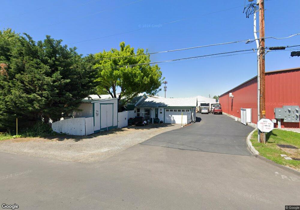
951 Lawnsdale Rd Medford, OR 97504
Northwest Medford NeighborhoodEstimated Value: $418,000 - $689,759
--
Bed
1
Bath
5,472
Sq Ft
$108/Sq Ft
Est. Value
About This Home
This home is located at 951 Lawnsdale Rd, Medford, OR 97504 and is currently estimated at $589,586, approximately $107 per square foot. 951 Lawnsdale Rd is a home located in Jackson County with nearby schools including Wilson Elementary School, Hedrick Middle School, and North Medford High School.
Ownership History
Date
Name
Owned For
Owner Type
Purchase Details
Closed on
Apr 13, 2006
Sold by
Whalen Steve and Whalen Karen
Bought by
Whalen Raymond S and Whalen Karen I
Current Estimated Value
Purchase Details
Closed on
Nov 24, 2003
Sold by
Whalen Steve and Whalen Karen
Bought by
City Of Medford
Purchase Details
Closed on
Sep 13, 1999
Sold by
Magro A Louis Trustee and Gladys M
Bought by
Whalen Steve and Whalen Karen
Home Financials for this Owner
Home Financials are based on the most recent Mortgage that was taken out on this home.
Original Mortgage
$75,000
Interest Rate
7.89%
Mortgage Type
Seller Take Back
Create a Home Valuation Report for This Property
The Home Valuation Report is an in-depth analysis detailing your home's value as well as a comparison with similar homes in the area
Home Values in the Area
Average Home Value in this Area
Purchase History
| Date | Buyer | Sale Price | Title Company |
|---|---|---|---|
| Whalen Raymond S | -- | None Available | |
| City Of Medford | -- | -- | |
| Whalen Steve | $78,000 | Jackson County Title |
Source: Public Records
Mortgage History
| Date | Status | Borrower | Loan Amount |
|---|---|---|---|
| Previous Owner | Whalen Steve | $75,000 |
Source: Public Records
Tax History Compared to Growth
Tax History
| Year | Tax Paid | Tax Assessment Tax Assessment Total Assessment is a certain percentage of the fair market value that is determined by local assessors to be the total taxable value of land and additions on the property. | Land | Improvement |
|---|---|---|---|---|
| 2025 | $9,368 | $645,930 | $171,300 | $474,630 |
| 2024 | $9,368 | $627,120 | $166,310 | $460,810 |
| 2023 | $9,081 | $608,860 | $161,470 | $447,390 |
| 2022 | $8,859 | $608,860 | $161,470 | $447,390 |
| 2021 | $8,630 | $591,130 | $156,770 | $434,360 |
| 2020 | $8,300 | $557,210 | $147,770 | $409,440 |
| 2019 | $8,267 | $542,210 | $143,800 | $398,410 |
| 2018 | $8,055 | $515,960 | $136,830 | $379,130 |
| 2017 | $7,821 | $515,960 | $136,830 | $379,130 |
| 2016 | $7,926 | $496,210 | $131,590 | $364,620 |
| 2015 | $7,727 | $501,040 | $176,830 | $324,210 |
| 2014 | $7,590 | $472,290 | $166,680 | $305,610 |
Source: Public Records
Map
Nearby Homes
- 811 O'Hare Pkwy
- 246 Reanna Way
- 529 Black Bear Dr
- 2772 Merriman Rd
- 450 Midway Rd Unit 16
- 450 Midway Rd Unit 5
- 1580 Delta Waters Rd
- 2621 Merriman Rd Unit 3000
- 3119 Merriman Rd
- 2587 Merriman Rd Unit 3200
- 2573 Merriman Rd Unit 3300
- 2605 Merriman Rd Unit 3101
- 2252 Table Rock Rd Unit 128
- 2252 Table Rock Rd Unit 97
- 2252 Table Rock Rd Unit SPC 102
- 2252 Table Rock Rd Unit SPC 228
- 2252 Table Rock Rd Unit SPC 100
- 2252 Table Rock Rd Unit SPC 232
- 460 Federal Way
- 2336 Table Rock Rd
- 925 Lawnsdale Rd
- 950 Gilman Rd
- 907 Lawnsdale Rd
- 924 Gilman Rd
- 952 Lawnsdale Rd
- 3265 Biddle Rd
- 924 Lawnsdale Rd
- 966 Gilman Rd
- 895 Lawnsdale Rd
- 908 Lawnsdale Rd
- 3263 Biddle Rd Unit A
- 3263 Biddle Rd Unit B
- 3263 Biddle Rd
- 3261 Biddle Rd
- 908 Gilman Rd
- 886 Gilman Rd
- 898 Lawnsdale Rd
- 875 Lawnsdale Rd
- 0 Lawnsdale
- 884 Gilman Rd