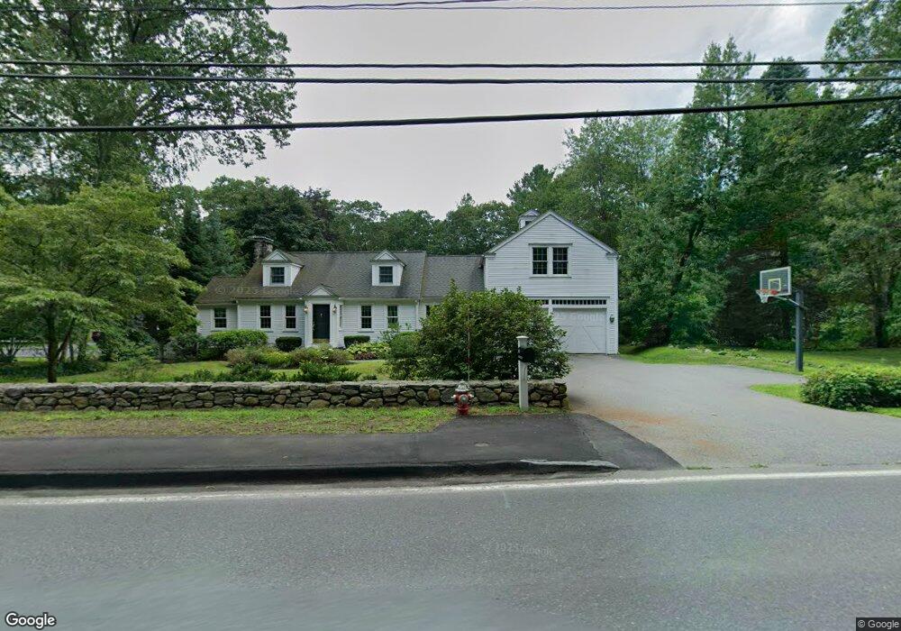
951 Lowell Rd Concord, MA 01742
Estimated Value: $1,780,000 - $2,419,109
4
Beds
5
Baths
4,478
Sq Ft
$474/Sq Ft
Est. Value
About This Home
This home is located at 951 Lowell Rd, Concord, MA 01742 and is currently estimated at $2,122,027, approximately $473 per square foot. 951 Lowell Rd is a home located in Middlesex County with nearby schools including Thoreau Elementary School, Concord Middle School, and Concord Carlisle High School.
Ownership History
Date
Name
Owned For
Owner Type
Purchase Details
Closed on
Aug 31, 2010
Sold by
Sonnen Cora V
Bought by
Cora V Sonnen Ret and Sonnen Cora V
Current Estimated Value
Purchase Details
Closed on
Feb 12, 2001
Sold by
Waldeck Patricia A
Bought by
Sonnen Cora
Home Financials for this Owner
Home Financials are based on the most recent Mortgage that was taken out on this home.
Original Mortgage
$275,000
Interest Rate
7.13%
Mortgage Type
Purchase Money Mortgage
Purchase Details
Closed on
May 26, 1995
Sold by
Neale Timothy A and Neale Cathleen S
Bought by
Waldeck Patricia A
Purchase Details
Closed on
Jul 6, 1990
Sold by
Trodeau Thomas
Bought by
Neale Timothy A
Create a Home Valuation Report for This Property
The Home Valuation Report is an in-depth analysis detailing your home's value as well as a comparison with similar homes in the area
Home Values in the Area
Average Home Value in this Area
Purchase History
| Date | Buyer | Sale Price | Title Company |
|---|---|---|---|
| Cora V Sonnen Ret | -- | -- | |
| Sonnen Cora | $622,000 | -- | |
| Waldeck Patricia A | $338,000 | -- | |
| Neale Timothy A | $321,000 | -- |
Source: Public Records
Mortgage History
| Date | Status | Borrower | Loan Amount |
|---|---|---|---|
| Previous Owner | Neale Timothy A | $275,000 | |
| Previous Owner | Neale Timothy A | $199,000 | |
| Previous Owner | Neale Timothy A | $200,000 |
Source: Public Records
Tax History Compared to Growth
Tax History
| Year | Tax Paid | Tax Assessment Tax Assessment Total Assessment is a certain percentage of the fair market value that is determined by local assessors to be the total taxable value of land and additions on the property. | Land | Improvement |
|---|---|---|---|---|
| 2025 | $285 | $2,149,800 | $514,300 | $1,635,500 |
| 2024 | $28,227 | $2,149,800 | $514,300 | $1,635,500 |
| 2023 | $23,403 | $1,805,800 | $467,600 | $1,338,200 |
| 2022 | $22,479 | $1,523,000 | $374,000 | $1,149,000 |
| 2021 | $22,564 | $1,532,900 | $374,000 | $1,158,900 |
| 2020 | $21,634 | $1,520,300 | $374,000 | $1,146,300 |
| 2019 | $20,960 | $1,477,100 | $344,900 | $1,132,200 |
| 2018 | $19,720 | $1,380,000 | $345,800 | $1,034,200 |
| 2017 | $18,961 | $1,347,600 | $354,000 | $993,600 |
| 2016 | $18,238 | $1,310,200 | $337,500 | $972,700 |
| 2015 | $17,129 | $1,198,700 | $312,600 | $886,100 |
Source: Public Records
Map
Nearby Homes
- 987 Lowell Rd
- 495 Hugh Cargill Rd
- 76 Red Coat Ln
- 295 Musterfield Rd
- 244 Musterfield Rd
- 19 Whippoorwill Ln
- 343 Nashawtuc Rd
- 29 Willard Common
- 49 Willard Common
- 104 Channing Rd
- 488 Elm St
- 775 Monument St
- 79-81 Assabet Ave
- 855 Barretts Mill Rd
- 168 Nashawtuc Rd
- 249 Pope Rd
- 247 Pope Rd
- 106 Elm St
- 138 Baker Ave
- 46 Wood St
- 943 Lowell Rd
- 956 Lowell Rd
- 925 Lowell Rd
- 963 Lowell Rd
- 909 Lowell Rd
- 904 Lowell Rd
- 887 Lowell Rd
- 994 Lowell Rd
- 1007 Lowell Rd
- 934 Lowell Rd
- 73 Hugh Cargill Rd
- 962 Lowell Rd
- 55 Hugh Cargill Rd
- 1014 Lowell Rd
- 125 Hugh Cargill Rd
- 1048 Lowell Rd
- 857 Lowell Rd
- 88 Hugh Cargill Rd
- 88 Hugh Cargill Rd Unit 88
- 58 Hugh Cargill Rd