Estimated Value: $724,000 - $850,000
6
Beds
4
Baths
3,412
Sq Ft
$230/Sq Ft
Est. Value
About This Home
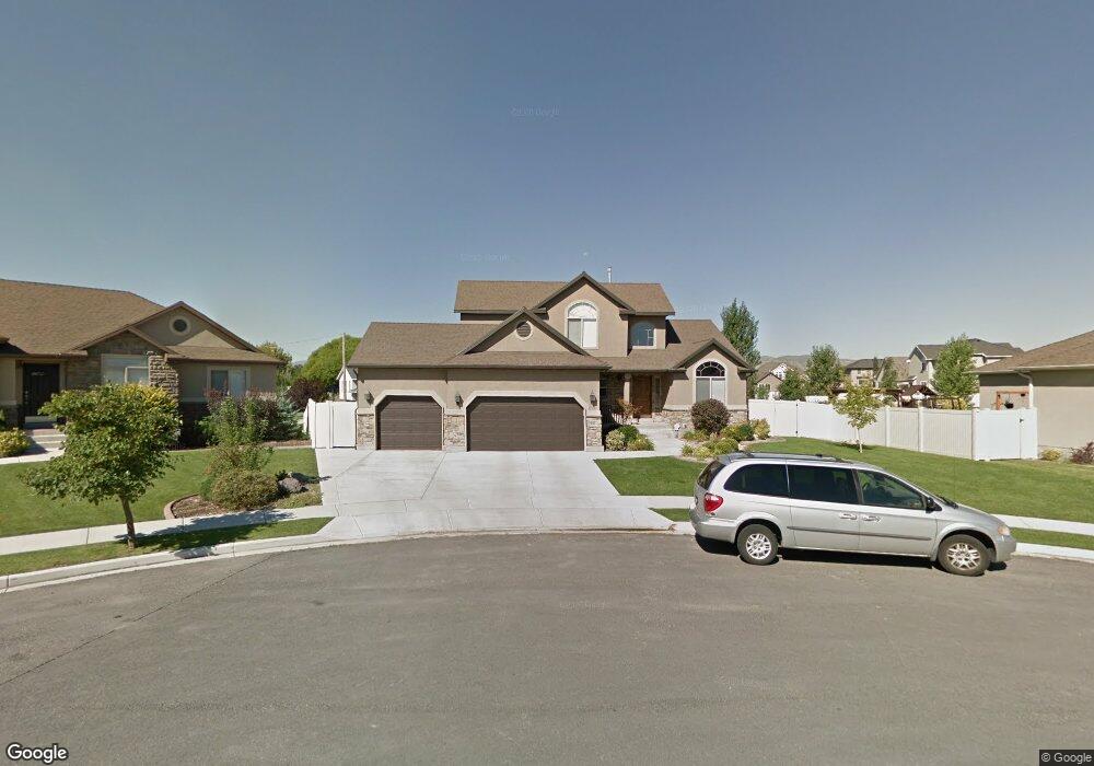
This home is located at 951 N 1750 W, Lehi, UT 84043 and is currently estimated at $784,481, approximately $229 per square foot. 951 N 1750 W is a home located in Utah County with nearby schools including North Point Elementary School, Willowcreek Middle School, and Lehi High School.
Ownership History
Date
Name
Owned For
Owner Type
Purchase Details
Closed on
Mar 1, 2016
Sold by
Adams Chris J and Adams Tiffany M
Bought by
Nelson Cory D and Nelson Andrea
Current Estimated Value
Home Financials for this Owner
Home Financials are based on the most recent Mortgage that was taken out on this home.
Original Mortgage
$356,250
Outstanding Balance
$283,461
Interest Rate
3.81%
Mortgage Type
New Conventional
Estimated Equity
$501,020
Purchase Details
Closed on
Mar 27, 2014
Sold by
Mangum Jacob K and Mangum Lindsey M
Bought by
Adams Chris J and Adams Tiffany M
Home Financials for this Owner
Home Financials are based on the most recent Mortgage that was taken out on this home.
Original Mortgage
$354,350
Interest Rate
4.25%
Mortgage Type
New Conventional
Create a Home Valuation Report for This Property
The Home Valuation Report is an in-depth analysis detailing your home's value as well as a comparison with similar homes in the area
Home Values in the Area
Average Home Value in this Area
Purchase History
| Date | Buyer | Sale Price | Title Company |
|---|---|---|---|
| Nelson Cory D | -- | Meridian Title Company | |
| Adams Chris J | -- | Cornerstone Title Ins A |
Source: Public Records
Mortgage History
| Date | Status | Borrower | Loan Amount |
|---|---|---|---|
| Open | Nelson Cory D | $356,250 | |
| Previous Owner | Adams Chris J | $354,350 |
Source: Public Records
Tax History Compared to Growth
Tax History
| Year | Tax Paid | Tax Assessment Tax Assessment Total Assessment is a certain percentage of the fair market value that is determined by local assessors to be the total taxable value of land and additions on the property. | Land | Improvement |
|---|---|---|---|---|
| 2025 | $2,873 | $384,450 | $269,200 | $429,800 |
| 2024 | $2,873 | $336,215 | $0 | $0 |
| 2023 | $2,621 | $333,080 | $0 | $0 |
| 2022 | $2,915 | $359,095 | $0 | $0 |
| 2021 | $2,603 | $484,700 | $155,800 | $328,900 |
| 2020 | $2,454 | $451,700 | $144,300 | $307,400 |
| 2019 | $2,230 | $426,700 | $144,300 | $282,400 |
| 2018 | $2,202 | $398,400 | $123,700 | $274,700 |
| 2017 | $2,066 | $198,715 | $0 | $0 |
| 2016 | $2,165 | $193,215 | $0 | $0 |
| 2015 | $2,164 | $183,315 | $0 | $0 |
| 2014 | $1,862 | $156,805 | $0 | $0 |
Source: Public Records
Map
Nearby Homes
- 1127 N 1500 W
- 1032 Titan Dr
- 1132 Titan Dr
- 1659 W Boxwood Dr Unit 109
- 1627 W Boxwood Dr Unit 110
- 1542 N 1900 W
- 1332 W 1500 N
- 1302 N 2450 W
- 2512 W 610 N Unit 99
- 1094 W 1425 N
- 373 N Willow Haven Ave
- 1301 N 900 W Unit 12
- Accord Plan at Riverwalk
- Interlude Plan at Riverwalk
- Trio Plan at Riverwalk
- Fortissimo Plan at Riverwalk
- Ballad Plan at Riverwalk
- Tenor Plan at Riverwalk
- Madrigal Plan at Riverwalk
- Timpani Plan at Riverwalk
- 963 N 1750 W
- 939 N 1750 W
- 1810 W 900 N
- 958 N 1750 W
- 928 N 1750 W
- 979 N 1750 W
- 1787 W Colony Pointe Dr
- 952 N 1750 W
- 964 N 1750 W
- 940 N 1750 W
- 1803 W Colony Pointe Dr
- 1816 W 900 N Unit 17
- 976 N 1750 W
- 1817 W Colony Pointe Dr
- 1832 W 900 N Unit 3
- 1832 W 900 N
- 978 N 1850 W Unit 302
- 978 N 1850 W
- 1008 N 1800 W
- 1811 W 900 N